MyTopo
Wynoochee Lake Washington US Topo Map
Couldn't load pickup availability
Also explore the Wynoochee Lake Forest Service Topo of this same quad for updated USFS data
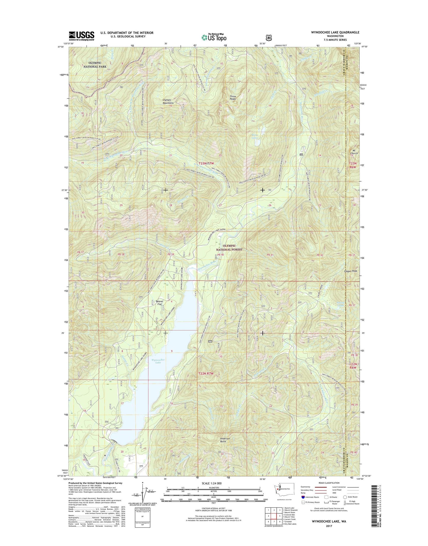
2023 topographic map quadrangle Wynoochee Lake in the state of Washington. Scale: 1:24000. Based on the newly updated USGS 7.5' US Topo map series, this map is in the following counties: Grays Harbor, Mason. The map contains contour data, water features, and other items you are used to seeing on USGS maps, but also has updated roads and other features. This is the next generation of topographic maps. Printed on high-quality waterproof paper with UV fade-resistant inks.
Quads adjacent to this one:
West: Colonel Bob
Northwest: Bunch Lake
North: Mount Hoquiam
Northeast: Mount Olson
East: Mount Tebo
Southeast: Dry Bed Lakes
South: Grisdale
Southwest: Larsen Creek
This map covers the same area as the classic USGS quad with code o47123d5.
Contains the following named places: Anderson Butte, Anderson Butte Lookout, Beaver Flat, Clark Creek, Coho Campground, Copper Creek, Eleanor Creek, Klone Lakes, North Fork West Branch Wynoochee River, Pederson Creek, Satsop Lakes, Scatter Creek, Schafer Creek, Schofield Creek, Sixteen Creek, Three Peaks, Trout Creek, West Branch Wynoochee River, Wynoochee Dam, Wynoochee Dam Visitor Center, Wynoochee Falls Campground, Wynoochee Lake, Wynoochee Shelter