MyTopo
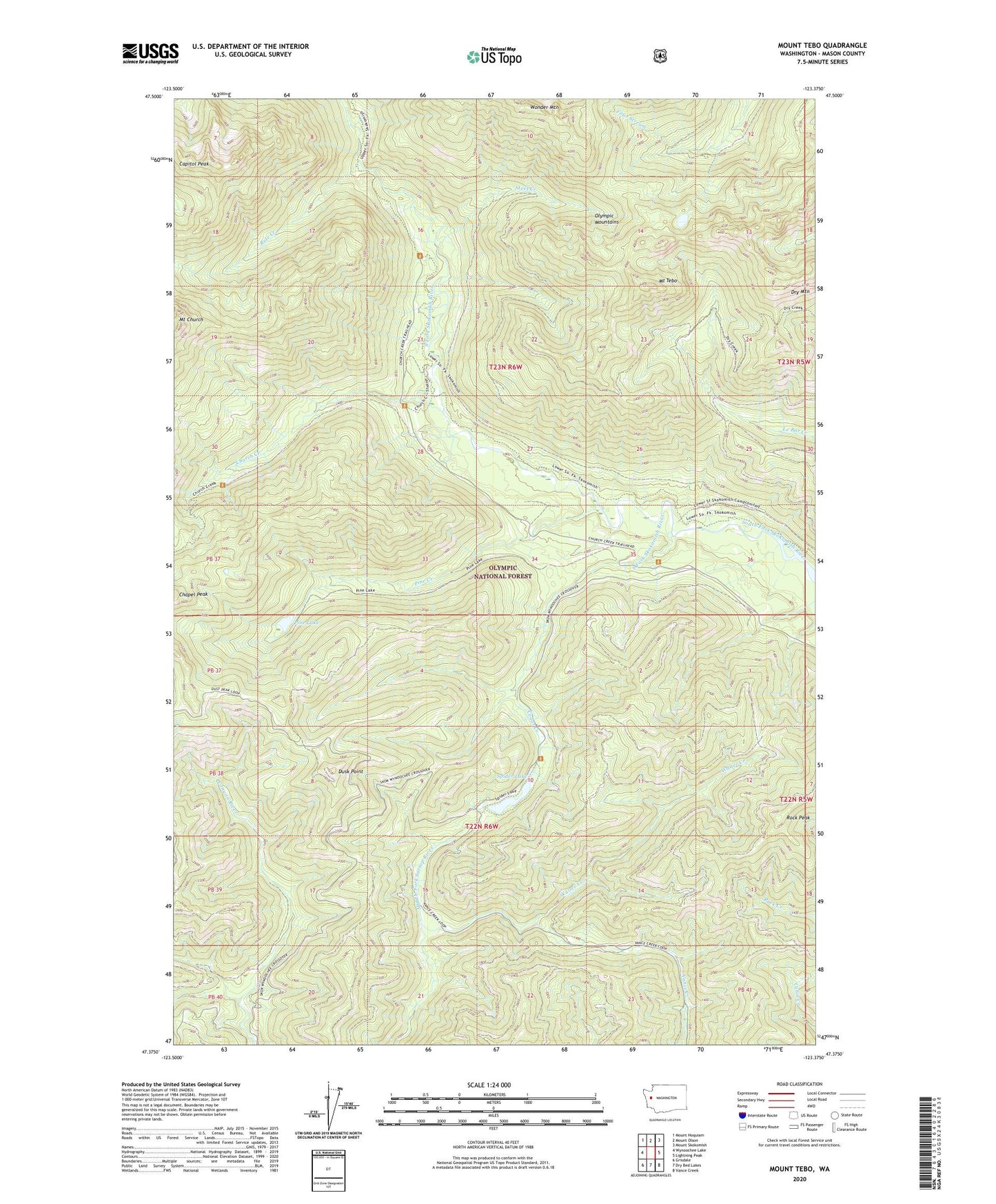
Mount Tebo Washington US Topo Map
Couldn't load pickup availability
Also explore the Mount Tebo Forest Service Topo of this same quad for updated USFS data
2023 topographic map quadrangle Mount Tebo in the state of Washington. Scale: 1:24000. Based on the newly updated USGS 7.5' US Topo map series, this map is in the following counties: Mason. The map contains contour data, water features, and other items you are used to seeing on USGS maps, but also has updated roads and other features. This is the next generation of topographic maps. Printed on high-quality waterproof paper with UV fade-resistant inks.
Quads adjacent to this one:
West: Wynoochee Lake
Northwest: Mount Hoquiam
North: Mount Olson
Northeast: Mount Skokomish
East: Lightning Peak
Southeast: Vance Creek
South: Dry Bed Lakes
Southwest: Grisdale
This map covers the same area as the classic USGS quad with code o47123d4.
Contains the following named places: Camp Comfort Shelter, Camp Harps Shelter, Canyon River Shelter, Capitol Peak, Cedar Creek, Chapel Peak, Church Creek, Church Creek Shelter, Dry Mountain, Dusk Point, Mount Church, Mount Tebo, Neby Shelter, Olympic National Forest, Pine Creek, Pine Lake, Rock Peak, Rule Creek, Spider Lake, Spider Lake Shelter, Steel Creek, Walter Creek, Wonder Mountain, ZIP Code: 98548