MyTopo
Selah Washington US Topo Map
Couldn't load pickup availability
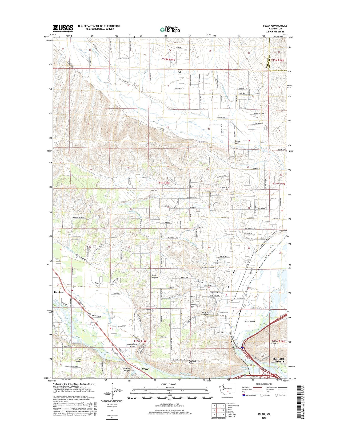
2023 topographic map quadrangle Selah in the state of Washington. Scale: 1:24000. Based on the newly updated USGS 7.5' US Topo map series, this map is in the following counties: Yakima, Kittitas. The map contains contour data, water features, and other items you are used to seeing on USGS maps, but also has updated roads and other features. This is the next generation of topographic maps. Printed on high-quality waterproof paper with UV fade-resistant inks.
Quads adjacent to this one:
West: Naches
Northwest: Wenas Lake
North: The Cottonwoods
Northeast: Wymer
East: Pomona
Southeast: Yakima East
South: Yakima West
Southwest: Wiley City
This map covers the same area as the classic USGS quad with code o46120f5.
Contains the following named places: Berglund Lake, Brace, Buckskin Slough, Carlon Park, City of Selah, Cottonwood Creek, Cowiche Canyon, Cowiche Creek, Crusher Canyon, Dry Creek, Elks Golf and Country Club, Gleed, Gleed Census Designated Place, Gleed Ditch, Indian Painted Rocks State Park, Iowa Flat, John Campbell Elementary School, KUTI-AM (Selah), KYXE-AM (Selah), Legion Park, Lookout Point, Lower Naches Community Park, Lower Naches Grange, Lower Naches Valley, Naches River, Naches Valley Primary School, Number 1 Lateral, Number 2 Lateral, Palm Park, Pleasant Hill, Pulse Alternative School, Ramblers Park, Robert S Lince Intermediate School, Rotary Lake, Selah, Selah Fire Department, Selah Heights, Selah High School, Selah Middle School, Selah Police Department, Selah Post Office, Selah Valley, Spring Creek, Sunset School, Twin Bridges, Viking Village Shopping Center, Wenas Mammoth Mountain, Wenas Valley, Wenas Valley Grange, Wixon Park, Yakima County Fire District 2 Selah Fire Department Station 4, Yakima County Fire District 6 Station 1, Yakima County Fire District 6 Station 2, Yakima Valley School