MyTopo
Beckwith West Virginia US Topo Map
Couldn't load pickup availability
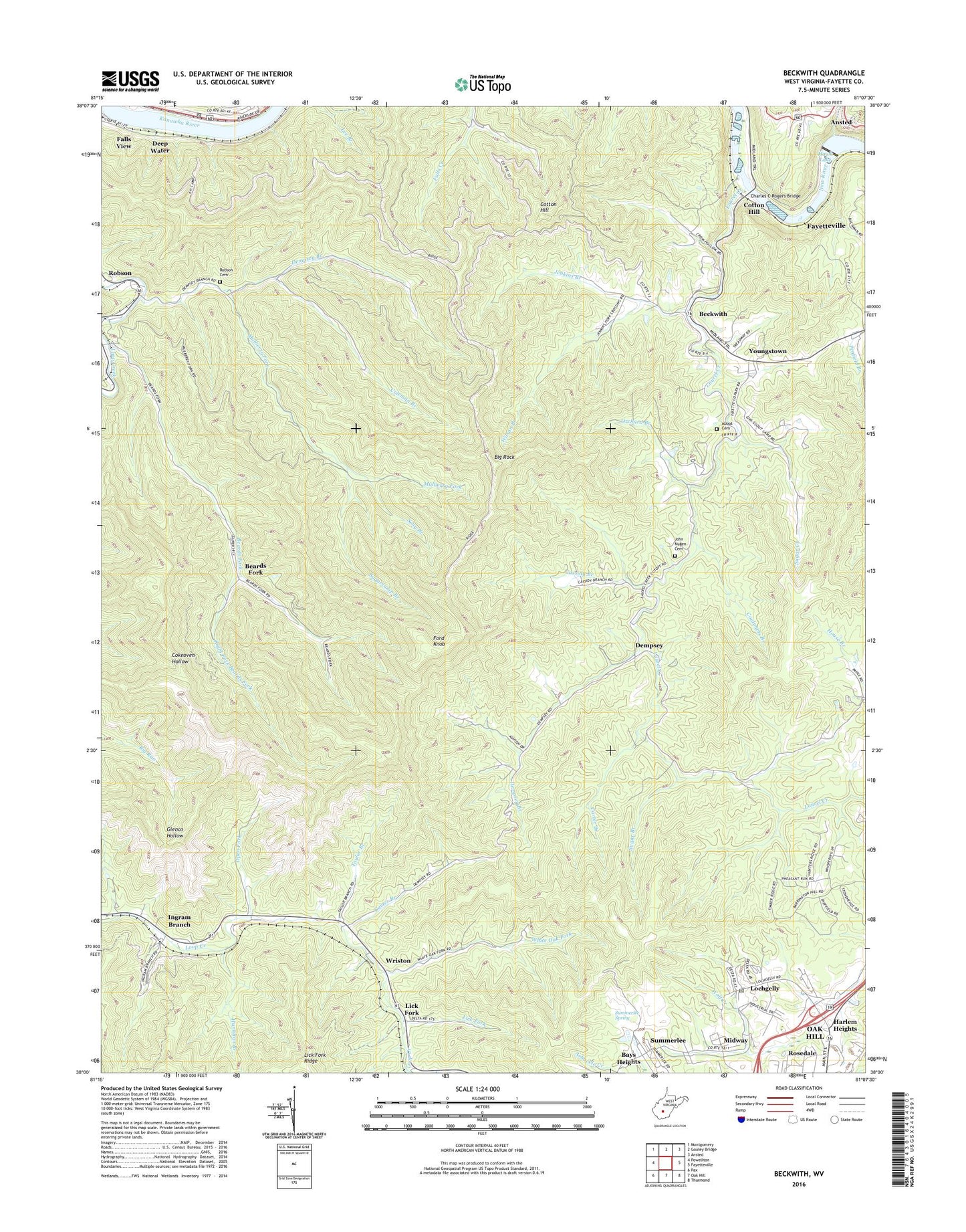
2019 topographic map quadrangle Beckwith in the state of West Virginia. Scale: 1:24000. Based on the newly updated USGS 7.5' US Topo map series, this map is in the following counties: Fayette. The map contains contour data, water features, and other items you are used to seeing on USGS maps, but also has updated roads and other features. This is the next generation of topographic maps. Printed on high-quality waterproof paper with UV fade-resistant inks.
Quads adjacent to this one:
West: Powellton
Northwest: Montgomery
North: Gauley Bridge
Northeast: Ansted
East: Fayetteville
Southeast: Thurmond
South: Oak Hill
Southwest: Pax
Contains the following named places: Beards Fork, Beards Fork Census Designated Place, Beards Fork Elementary School, Beckwith, Beckwith School, Bethel Baptist Church, Big Rock, Camp Beckwith 4-H Camp, Carter Branch, Cassidy Branch, Charles C Rogers Bridge, Charlton Heights, Charlton Heights Post Office, Coalmans Branch, Coleman Branch, Cotton Hill, Dempsey, Dempsey Branch, Doggett Missionary Baptist Church, Fairview School, Fayette Square Shooping Center, Ford Knob, Gauley Junction Dam, General Ambulance Service Station 5, Hamilton, Hamilton Branch, Hawk Lake, Hillcrest Church, Huddleston - Abbot Cemetery, Ingram Branch, Jenkins Branch, John Nugen Cemetery, Laurel Creek, Lick Fork, Lochgelly, Lochgelly Census Designated Place, Lochgelly Post Office, Loop Creek Church, Midway, Mulberry Fork, Oakville School, Open Fork, Orchard Branch, Paddy Branch, Right Fork Beards Fork, Robson, Robson Cemetery, Seng Branch, Skyline Shopping Center, Sugar Branch, Sugar Creek, Sugarcamp Branch, Summerlee, Summerlee Gifted Center, Summerlee Spring, Taylor Branch, Turkey Creek, Valley District, White Oak Fork, Wilson Branch, Wriston, Youngstown, ZIP Codes: 25115, 25173