MyTopo
Thurmond West Virginia US Topo Map
Couldn't load pickup availability
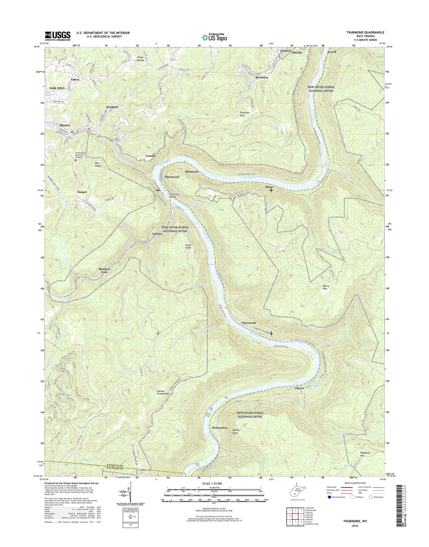
2023 topographic map quadrangle Thurmond in the state of West Virginia. Scale: 1:24000. Based on the newly updated USGS 7.5' US Topo map series, this map is in the following counties: Fayette, Raleigh. The map contains contour data, water features, and other items you are used to seeing on USGS maps, but also has updated roads and other features. This is the next generation of topographic maps. Printed on high-quality waterproof paper with UV fade-resistant inks.
Quads adjacent to this one:
West: Oak Hill
Northwest: Beckwith
North: Fayetteville
Northeast: Winona
East: Danese
Southeast: Meadow Creek
South: Prince
Southwest: Beckley
This map covers the same area as the classic USGS quad with code o37081h1.
Contains the following named places: Alaska, Arbuckle Creek, Barren Branch, Beury, Beury Mountain, Big Stoney Creek, Bobby Gardner Spring, Bowlin, Brooklyn, Buffalo Creek, Calvin Church, Camp Creek, Cedar Branch, Cedar Branch Dam, Chestnut Flat, City of Oak Hill, Claremont, Coal Run, Coal Run Number One Dam, Coal Run Number Two Dam, Concho, Cunard, Cunard Census Designated Place, Dimmock, Dowdy Bluff, Dowdy Creek, Dunloup Creek, East Sewell, Ephraim Creek, Ephram, Erskine, Excelsior School, Finlow, Fire Creek, Garden Ground Mountain, Garden Ground School, Gentry Church, Gethsemane Memorial Gardens, Hamilton Branch, Highland Mountain, Little Rock Church, Little Stony Creek, McKendree, McKendreee Public Hunting and Fishing Area, Meadow Fork, Miles School, Minden, Minden Census Designated Place, Minden Post Office, Mollys Creek, Newlyn, Pennbrook, Plateau District, Red Ash, Rocklick, Rocklick Creek, Rush Run, Salem, Salem Church, Sanger, Sewell, Silo Rapids, Slater Creek, Stone Cliff, Surprise Rapids, Swell Knob, Thayer, Thurmond, Thurmond Bridge, Town of Thurmond, Turley Branch, ZIP Codes: 25864, 25879, 25901, 25936