MyTopo
Bentree West Virginia US Topo Map
Couldn't load pickup availability
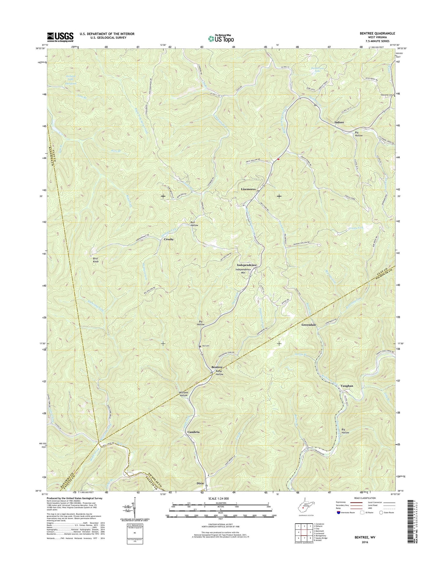
2023 topographic map quadrangle Bentree in the state of West Virginia. Scale: 1:24000. Based on the newly updated USGS 7.5' US Topo map series, this map is in the following counties: Clay, Nicholas, Kanawha, Fayette. The map contains contour data, water features, and other items you are used to seeing on USGS maps, but also has updated roads and other features. This is the next generation of topographic maps. Printed on high-quality waterproof paper with UV fade-resistant inks.
Quads adjacent to this one:
West: Mammoth
Northwest: Clendenin
North: Elkhurst
Northeast: Clay
East: Lockwood
Southeast: Ansted
South: Gauley Bridge
Southwest: Montgomery
This map covers the same area as the classic USGS quad with code o38081c2.
Contains the following named places: Adonijah, Adonijah Fork, Backus Branch, Bearpen Fork, Bells Creek Church, Bentree, Bentree Post Office, Big Hollow, Bird Knob, Brown School, Bull Hollow, Cambria, Crosby, Crosby School, Deerpond, Dixie, Dixie Census Designated Place, Dixie Elementary School, Dixie Post Office, Eberbaugh Station, Grassy Fork, Greendale, Henderson Dam, Henderson Lake, Hubbard Fork, Hughes Fork, Ida Cemetery, Ida Missionary Baptist Church, Independence, Independence Mountain, Indore, Indore Baptist Church, Indore Chapel, Indore Post Office, Kuns Branch, Laurel Fork, Laurel Fork Missionary Baptist Church, Lick Branch, Lilly Branch, Lilly Number 11 School, Lizemore Church of the Nazarene, Lizemore Elementary School, Lizemores, Lizemores Church, Lizemores Post Office, Lizemores Volunteer Fire Department, Open Fork, Orchard Lake, Pack Fork, Ramp Hollow, Right Fork Sycamore Creek, Road Fork, Rockcamp Fork, Sangamore Fork, Smith Branch, Spring Branch, Tent Branch, Union Carbide H F Club Lake Number One Dam, Union Carbide Lake Number Two Dam, Vaughan, Williams Hollow, ZIP Codes: 25111, 25125, 26656