
MyTopo
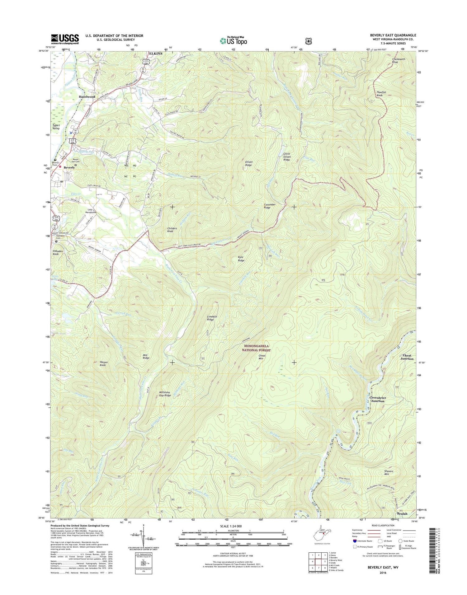
Beverly East West Virginia US Topo Map
Couldn't load pickup availability
2019 topographic map quadrangle Beverly East in the state of West Virginia. Scale: 1:24000. Based on the newly updated USGS 7.5' US Topo map series, this map is in the following counties: Randolph. The map contains contour data, water features, and other items you are used to seeing on USGS maps, but also has updated roads and other features. This is the next generation of topographic maps. Printed on high-quality waterproof paper with UV fade-resistant inks.
Quads adjacent to this one:
West: Beverly West
Northwest: Junior
North: Elkins
Northeast: Bowden
East: Glady
Southeast: Sinks of Gandy
South: Wildell
Southwest: Mill Creek
Contains the following named places: Abundant Life Christian Academy, Beaver Creek, Beulah, Beverly Cemetery, Beverly District, Beverly Elementary School, Beverly Post Office, Beverly Volunteer Fire Department, Camp Pioneer, Carrick Run, Cheat Junction, Chenoweth Knob, Childers Knob, Cucumber Ridge, Deer Lick, Dodson Run, Elk River Junction, Elkhorn School, Elks Golf Course, Elliott Ridge, Fall Run, Files Run, Greenbrier Junction, Harper Knob, Hawflat Knob, Hazelwood, Hazelwood School, High Falls, Hill Run, Hoe Lick Run, Imboden Knob, Kings Run, Knights Branch, Kyle Ridge, Lazy J Aerodrome, Left Fork Files Creek, Limekiln Ridge, Limekiln Run, Little Elliott Ridge, Middle Ridge, Millstone Gap Ridge, Millstone Run, Millstone School, Mount Carmel Church, Mount Iser Cemetery, Mount Vernon Church, Mount Vernon School, Panther Run, Pleasant View School, Red Roaring Run, Red Run, Right Fork Files Creek, Rose Run, Scott Lake Dam, Sherwan Lake Dam, Stalnaker Cemetery, Town of Beverly, Valley Bend District, WDNE-FM (Elkins), West Virginia State Police Troop 3 - Headquarters, Wolfpen Run, ZIP Code: 26253


