MyTopo
Blackbird Knob West Virginia US Topo Map
Couldn't load pickup availability
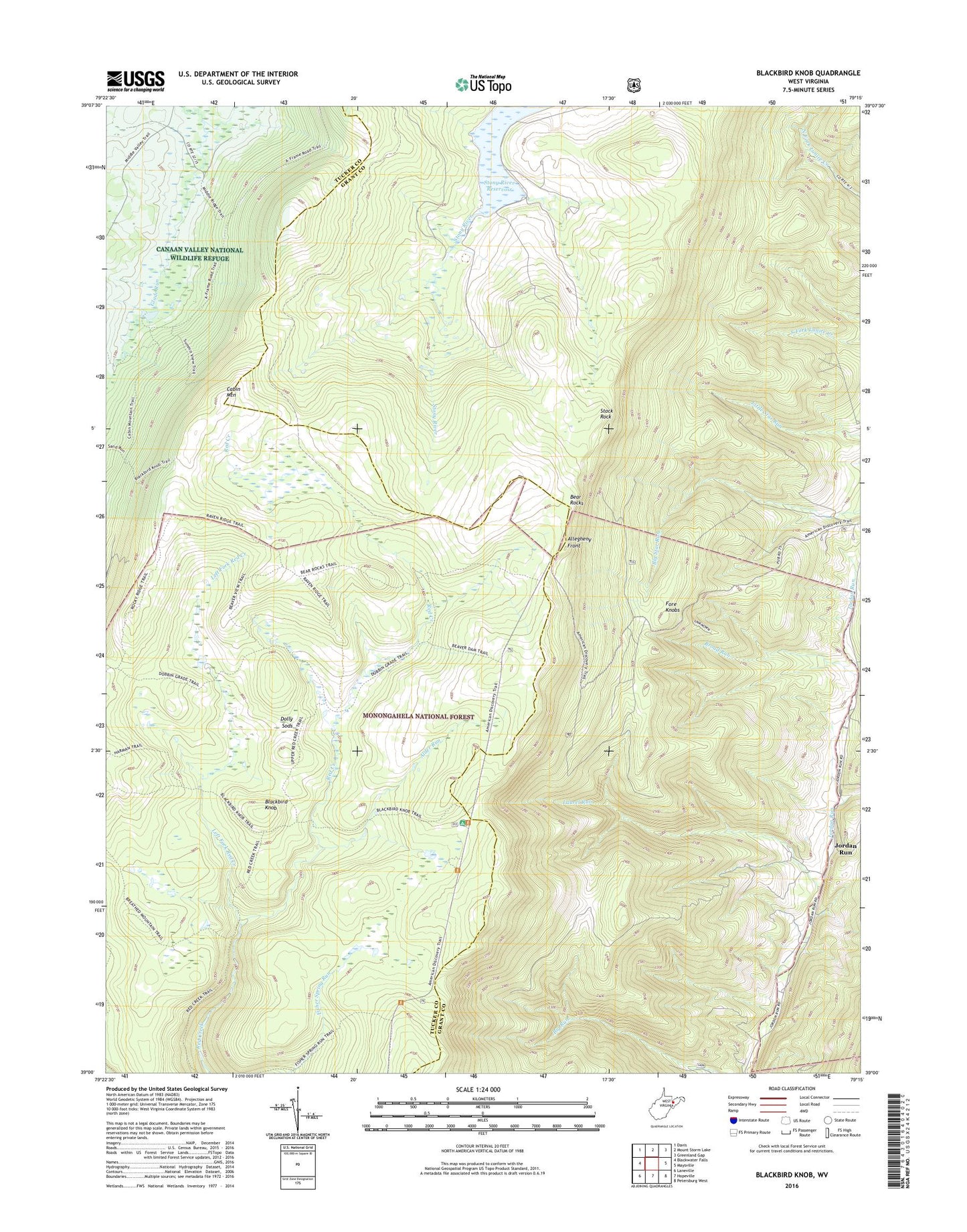
2019 topographic map quadrangle Blackbird Knob in the state of West Virginia. Scale: 1:24000. Based on the newly updated USGS 7.5' US Topo map series, this map is in the following counties: Grant, Tucker. The map contains contour data, water features, and other items you are used to seeing on USGS maps, but also has updated roads and other features. This is the next generation of topographic maps. Printed on high-quality waterproof paper with UV fade-resistant inks.
Quads adjacent to this one:
West: Blackwater Falls
Northwest: Davis
North: Mount Storm Lake
Northeast: Greenland Gap
East: Maysville
Southeast: Petersburg West
South: Hopeville
Southwest: Laneville
Contains the following named places: Alder Run, Bear Rocks, Blackbird Knob, Blackbird Knob Trail, Breathed Mountain Trail, Broad Run, Camp 88, Dolly Sods, Dolly Sods Wilderness, Jordan Run, Laurel Run, Left Fork Red Creek, Red Creek Campground, Rohrbaugh School, Stack Rock