MyTopo
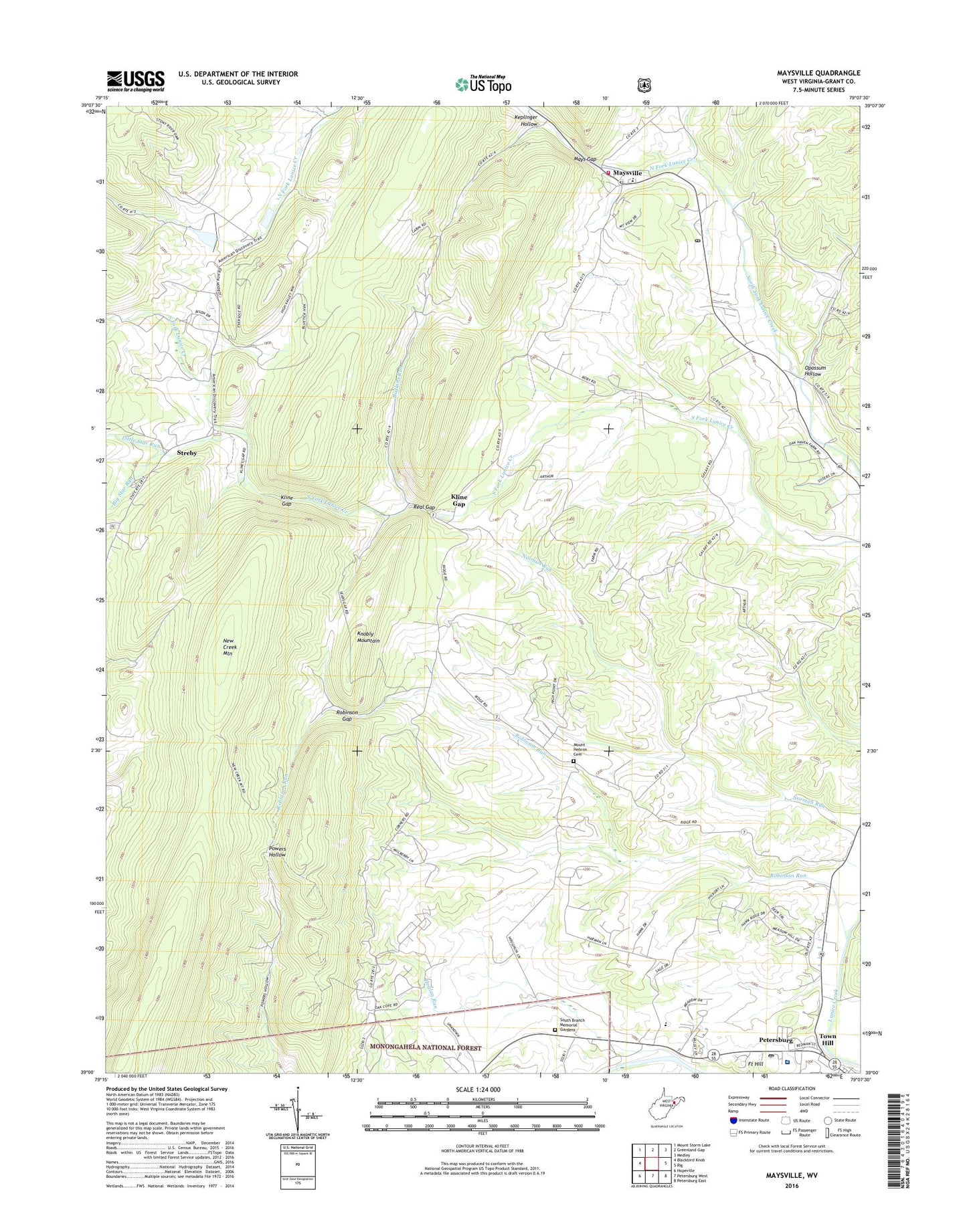
Maysville West Virginia US Topo Map
Couldn't load pickup availability
Also explore the Maysville Forest Service Topo of this same quad for updated USFS data
2023 topographic map quadrangle Maysville in the state of West Virginia. Scale: 1:24000. Based on the newly updated USGS 7.5' US Topo map series, this map is in the following counties: Grant. The map contains contour data, water features, and other items you are used to seeing on USGS maps, but also has updated roads and other features. This is the next generation of topographic maps. Printed on high-quality waterproof paper with UV fade-resistant inks.
Quads adjacent to this one:
West: Blackbird Knob
Northwest: Mount Storm Lake
North: Greenland Gap
Northeast: Medley
East: Rig
Southeast: Petersburg East
South: Petersburg West
Southwest: Hopeville
This map covers the same area as the classic USGS quad with code o39079a2.
Contains the following named places: Big Star Run, Bodkins Run, Eureka School, Fort Hill, Fort Mullegan, Gospel Tabernacle, Grant County, Grant Memorial Hospital, Harmony Church, Hoglan Run, Johnsonville School, Keplinger Hollow, Kline Gap, Kline Gap School, Little Star Run, Lunice Creek Structure Number Nine Dam, Mays Gap, Maysville, Maysville Elementary School, Maysville Post Office, Maysville Volunteer Fire Department, Mount Hebron Cemetery, Mount Hebron Church, Mountain Top School, Opossum Hollow, Patomac District Ranger Station, Petersburg Post Office, Quantico School, Real Gap, Robinson Gap, Robinson Run, Scott School, South Branch Memorial Gardens, Streby, Town Hill, ZIP Code: 26833