MyTopo
Bruceton Mills West Virginia US Topo Map
Couldn't load pickup availability
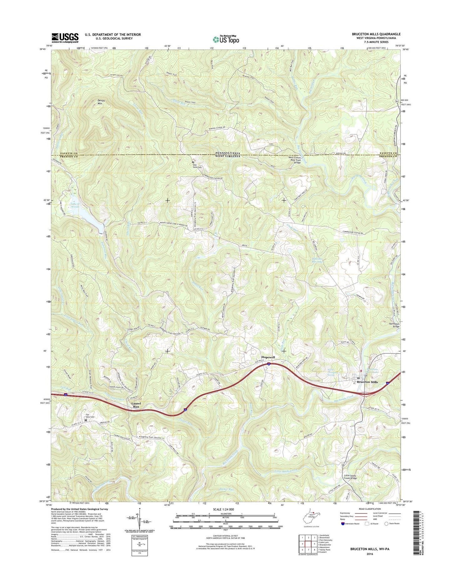
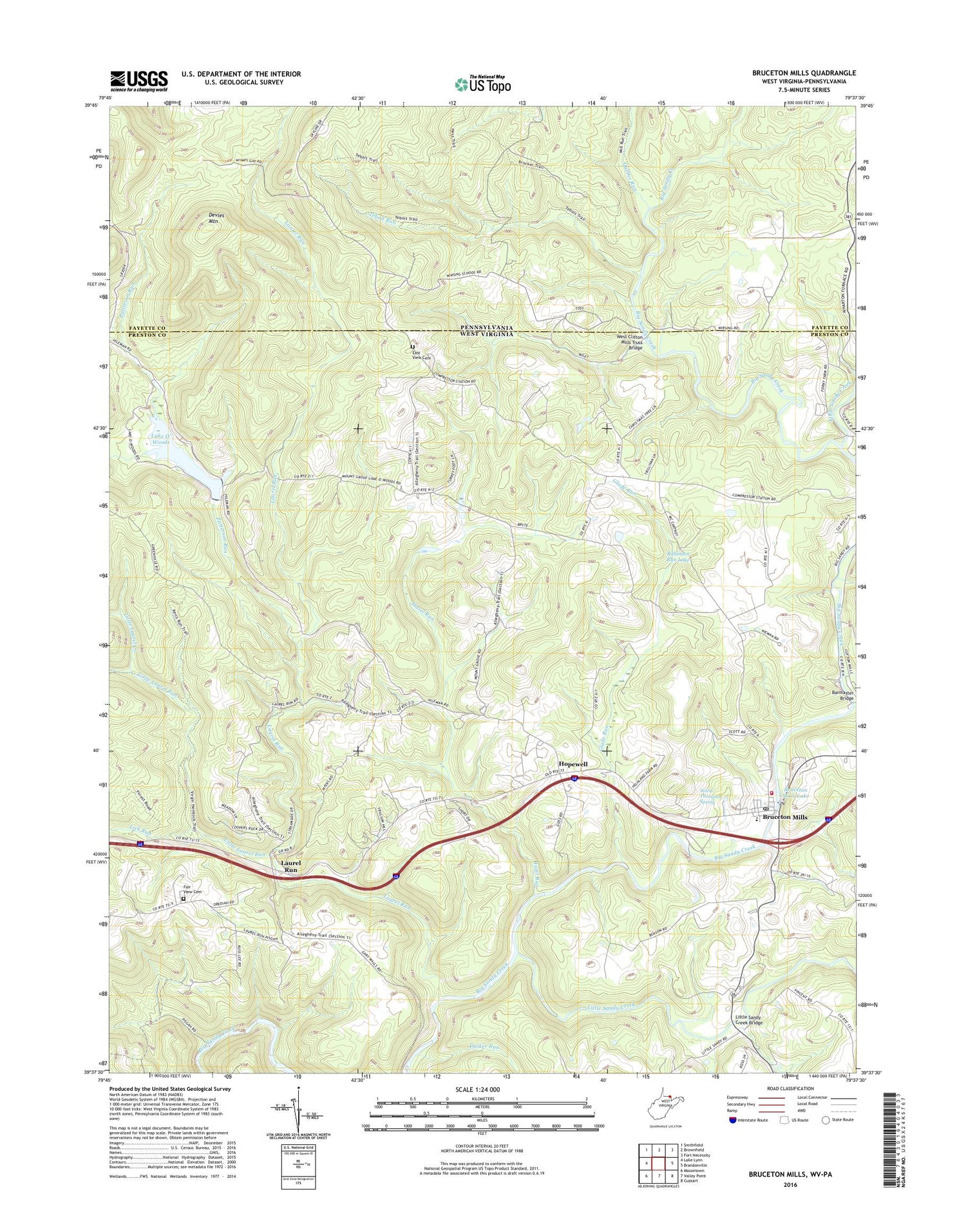
2019 topographic map quadrangle Bruceton Mills in the states of West Virginia, Pennsylvania. Scale: 1:24000. Based on the newly updated USGS 7.5' US Topo map series, this map is in the following counties: Preston, Fayette. The map contains contour data, water features, and other items you are used to seeing on USGS maps, but also has updated roads and other features. This is the next generation of topographic maps. Printed on high-quality waterproof paper with UV fade-resistant inks.
Quads adjacent to this one:
Northwest: Smithfield
North: Brownfield
Northeast: Fort Necessity
East: Brandonville
Southeast: Cuzzart
South: Valley Point
Southwest: Masontown
Contains the following named places: Barmaster Bridge, Bruceton Community Ambulance Service 3, Bruceton Junior High School, Bruceton Mills, Bruceton Mills - Brandonville Volunteer Fire Department, Bruceton Mills Dam, Bruceton Mills Elementary School, Bruceton Mills Lake, Bruceton Mills Post Office, Bruceton School, Bruceton United Methodist Church, Devies Mountain, East View Cemetery, East View Church, Fair View Cemetery, Florence, Glade Run, Greenville School, Guthrie School, Hazel Run, Hopewell, Hopewell Church, Lake O' Woods, Lake O'Woods Recreation Club Dam, Laurel Church, Laurel Run, Lick Run, Little Laurel Creek, Little Laurel Run, Little Sandy, Little Sandy Creek, Little Sandy Creek Bridge, Little Sandy Nazarene Church, Mountain Grove Church of the Brethren, Mountain Grove School, Parker Run, Patterson Run, Petitte Number One Refuse Impoundment Dam, Quebec Run, Robinson Run Lake, Saint Peters Church, Tebolt Run, Town of Brandonville, Town of Bruceton Mills, Valley School, Ward Thompson Spring, Webster Run, West Clifton Mills Truss Bridge, White School, Wirsing, Wirsing School, Wymps Gap, Wymps Gap School, ZIP Code: 26525