MyTopo
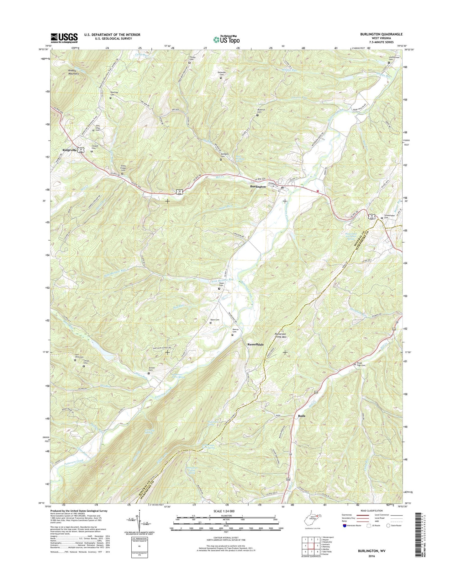
Burlington West Virginia US Topo Map
Couldn't load pickup availability
2019 topographic map quadrangle Burlington in the state of West Virginia. Scale: 1:24000. Based on the newly updated USGS 7.5' US Topo map series, this map is in the following counties: Mineral, Hampshire. The map contains contour data, water features, and other items you are used to seeing on USGS maps, but also has updated roads and other features. This is the next generation of topographic maps. Printed on high-quality waterproof paper with UV fade-resistant inks.
Quads adjacent to this one:
West: Antioch
North: Keyser
Northeast: Headsville
East: Romney
Southeast: Sector
South: Old Fields
Southwest: Medley
Contains the following named places: Anderson Farm Spring, Arnold Cemetery, Bane Brothers Spring, Bane Cemetery, Burlington, Burlington Census Designated Place, Burlington Center, Burlington Post Office, Burlington Primary School, Burlington Public Library, Burlington Volunteer Fire Department Company 44, Buskirk Run, Camp Run, Canon Cemetery, Cave Gap Spring, Cave Run, Clints Run, Cundiff Cemetery, Delawder Cemetery, District 1, Dry Run, Dry Run Church, Elijah High Cemetery, Elliber Run, Elmlick Run, Hampshire County Spring, Harness Run, Harness Run Church, High Farm Spring, Hull - Utta Cemetery, John Liller Cemetery, Johnson Run, Kelley Chapel, Leatherman Cemetery, Leatherman Farm Spring, Liller Run, Lone Star Church, Manorland Post Motel Spring, Markwood, Markwood Church, Michaels Cemetery, Mikes Run, Mill Creek, Mill Creek Country Club Golf Course, Mill Creek District, Mount Olive United Methodist Church, Mud Run, Paige School, Parrill Run, Patterson Creek Structure 15 Dam, Patterson Creek Structure 20 Dam, Patterson Creek Structure 22 Dam, Patterson Creek Structure 24 Dam, Patterson Creek Structure 25 Dam, Patterson Creek Structure 26 Dam, Patterson Creek Structure 47 Dam, Patterson Creek Structure 48 Dam, Patterson Creek Structure 52 Dam, Peerce Cemetery, Pursley Run, Rada, Rawlings Cemetery, Red Star School, Ridgeville, Roderick Cemetery, Russelldale, Sandy Hollow School, Schoemaker Cemetery, Sloan Cemetery, Stone Chapel Cemetery, Sugar Run, Thrush Cemetery, Welton School, Whipps Run, Wild Meadow Run, ZIP Code: 26710