MyTopo
Headsville West Virginia US Topo Map
Couldn't load pickup availability
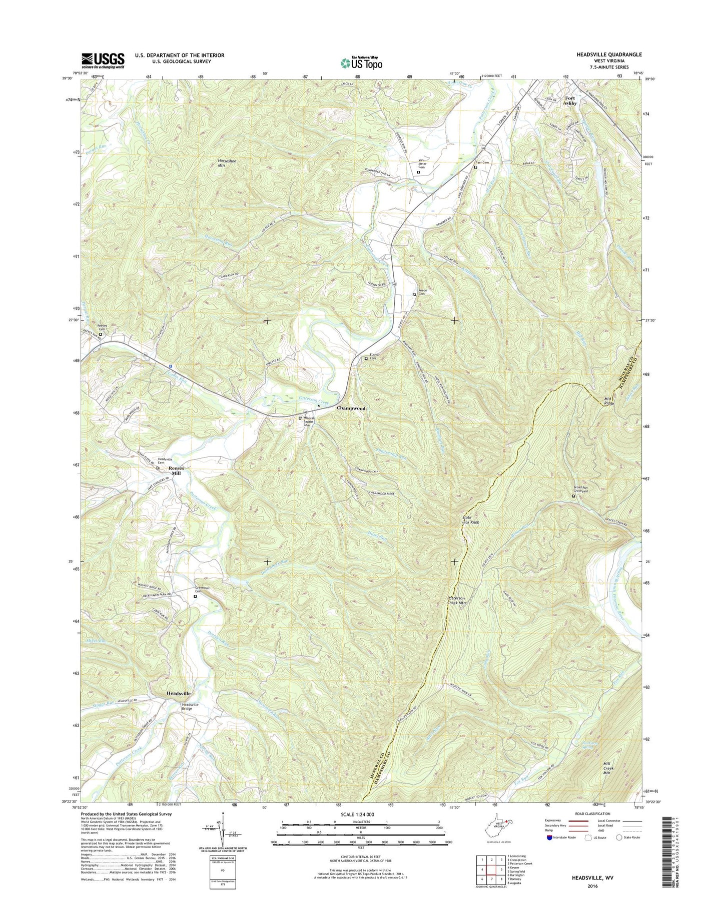
2023 topographic map quadrangle Headsville in the state of West Virginia. Scale: 1:24000. Based on the newly updated USGS 7.5' US Topo map series, this map is in the following counties: Mineral, Hampshire. The map contains contour data, water features, and other items you are used to seeing on USGS maps, but also has updated roads and other features. This is the next generation of topographic maps. Printed on high-quality waterproof paper with UV fade-resistant inks.
Quads adjacent to this one:
West: Keyser
Northwest: Lonaconing
Northeast: Patterson Creek
East: Springfield
Southeast: Augusta
South: Romney
Southwest: Burlington
This map covers the same area as the classic USGS quad with code o39078d7.
Contains the following named places: Allen Run, Beaver Run, Broad Run, Broad Run Graveyard, Cabin Run, Cabin Run Church, Camp Minco, Carr Cemetery, Champwood, Davis School, Dowden Run, Eusebia Church, Eusebia Church Cemetery, Fort Ashby Census Designated Place, Fox Farm Spring, Graveyard Run, Greenwall Cemetery, Hazel Run, Headsville, Headsville Bridge, Headsville Methodist Episcopal Church Cemetery, Hollenbeck Run, Horseshoe Mountain, Horseshoe Run, Horseshoe School, Kellar Run, Long Run, Mikes Run, Mill Run, Mineral Baptist Cemetery, Mineral Church, Ochre Run, Painter School, Pargut Run, Patterson Creek Church, Patterson Creek Structure 36 Dam, Patterson Creek Structure 37 Dam, Patterson Creek Structure 38 Dam, Patterson Creek Structure 44 Dam, Patterson Creek Structure 45 Dam, Patterson Creek Structure 46 Dam, Rees Memorial Cemetery, Reeses Mill, Reeves Cemetery, Rinehart Run, Slate Lick Knob, Slaty Lick Knob Lookout Tower, Spring Run, Staggs Run, Sugarcamp Run, Sycamore Run, Sycamore School, West Virginia State Police Troop 2 - Keyser Detachment, WJJB-FM (Romney), ZIP Code: 26719