MyTopo
Sector West Virginia US Topo Map
Couldn't load pickup availability
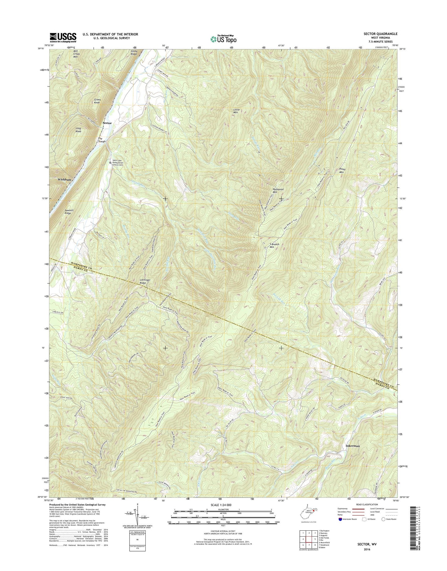
2023 topographic map quadrangle Sector in the state of West Virginia. Scale: 1:24000. Based on the newly updated USGS 7.5' US Topo map series, this map is in the following counties: Hampshire, Hardy. The map contains contour data, water features, and other items you are used to seeing on USGS maps, but also has updated roads and other features. This is the next generation of topographic maps. Printed on high-quality waterproof paper with UV fade-resistant inks.
Quads adjacent to this one:
West: Old Fields
Northwest: Burlington
North: Romney
Northeast: Augusta
East: Rio
Southeast: Baker
South: Needmore
Southwest: Moorefield
This map covers the same area as the classic USGS quad with code o39078b7.
Contains the following named places: Bonner School, Brushy Run, Devil Hole Run, Glebe, Green Knob, Horn Camp Run, Horn Camp School, Inkerman, Island Ridge, Little Devil Hole Run, Little Mountain, Lockinger Ridge, Long Knob, Markwood School, Mount Olive Church, Nathaniel Mountain, Nathaniel Mountain Lookout Tower, Nathaniel Mountain Wildlife Management Area, Piney Mountain, Saint Luke Presbyterian Church Cemetery, Saint Lukes Church, Sawmill Run, Sector, Skaggs Run, South Branch Mountain, The Trough, Wickham, Wood School