MyTopo
Romney West Virginia US Topo Map
Couldn't load pickup availability
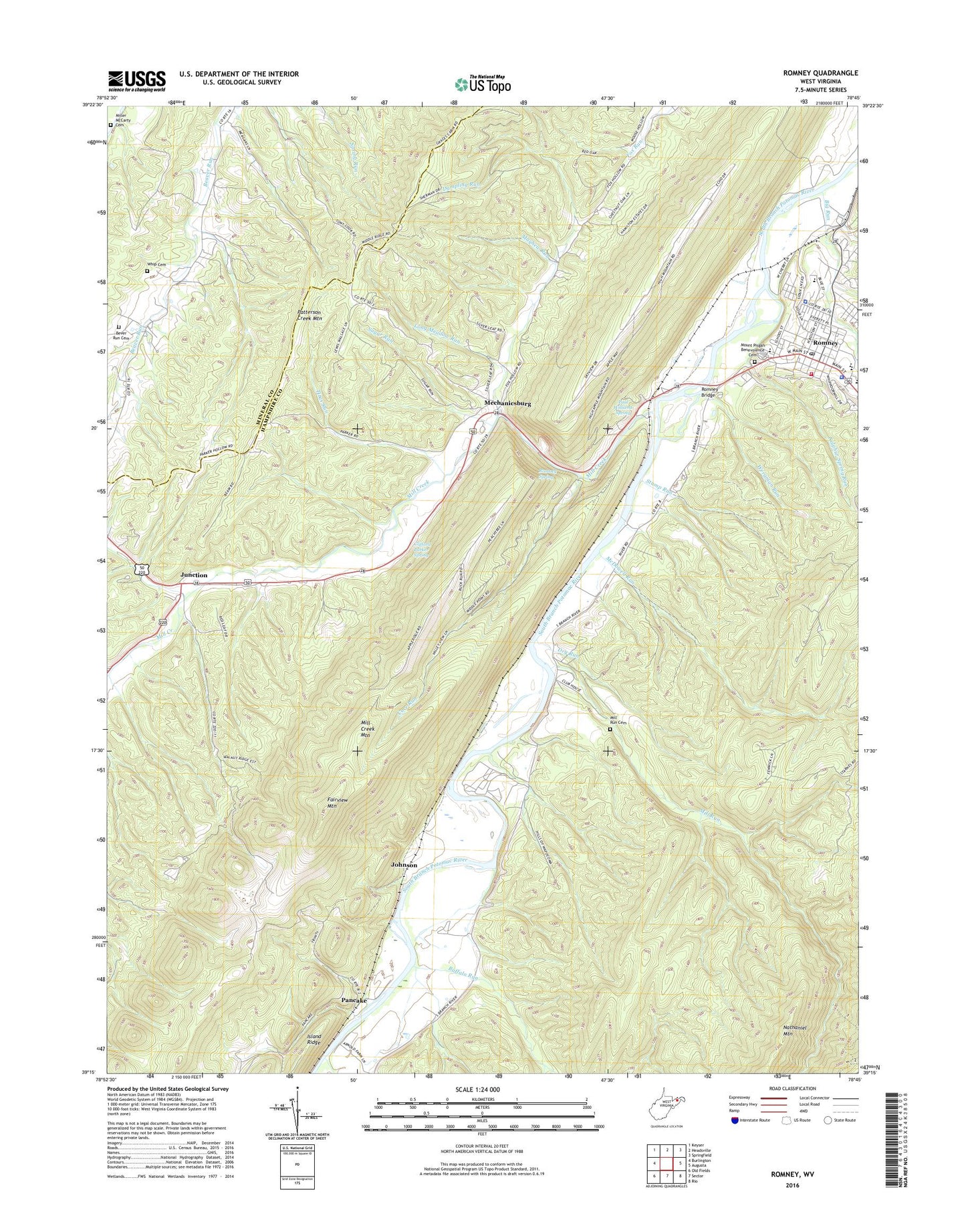
2023 topographic map quadrangle Romney in the state of West Virginia. Scale: 1:24000. Based on the newly updated USGS 7.5' US Topo map series, this map is in the following counties: Hampshire, Mineral. The map contains contour data, water features, and other items you are used to seeing on USGS maps, but also has updated roads and other features. This is the next generation of topographic maps. Printed on high-quality waterproof paper with UV fade-resistant inks.
Quads adjacent to this one:
West: Burlington
Northwest: Keyser
North: Headsville
Northeast: Springfield
East: Augusta
Southeast: Rio
South: Sector
Southwest: Old Fields
This map covers the same area as the classic USGS quad with code o39078c7.
Contains the following named places: Beaver Run Church, Beaver Run School, Bethesda Church, Bever Run Cemetery, Big Run, Buffalo Run, Church of Christ, City of Romney, Clifford Parker Spring, Core Run, Dry Run, Dumpling Run, Fairview Mountain, Fort Mill Ridge Wildlife Management Area, Fort Pearsall, Hampshire Club, Hampshire Convention and Visitors Bureau, Hampshire County Courthouse, Hampshire County Sheriff's Office, Horselick Run, Indian Mound Cemetery, Johnson, Junction, Lamberts Ambulance Service 1, Literary Hall, Long Meadow Run, Maranatha Christian Academy, Mayhew Run, McDowell Run, Mechanicsburg, Mechanicsburg School, Mill Creek, Mill Creek Mountain, Mill Run, Mill Run Cemetery, Miller McCarty Cemetery, Mount Pisgah Benevolence Cemetery, Pancake, Pancake School, Patterson Creek Structure 27 Dam, Paul Williams Spring, Potomac Center, Romney, Romney Bridge, Romney Christian Church, Romney Church of the Nazarene, Romney Classical Institute, Romney District, Romney Elementary School, Romney Junction, Romney Police Department, Romney Post Office, Romney Spring, Romney Volunteer Fire Department, Romney Volunteer Rescue Squad Company 11, Rosedale School, South Branch School, Stony Run, Stump Run, Sugar Run, Sulphur Spring Run, Titus Run, Trinity Church, Union School, Valley, Wergman Run, West Romney Station, West Virginia Division of Forestry Romney Field Office, West Virginia School for the Blind, West Virginia State Police Troop 2 - Romney Detachment, Whip Cemetery, WJGF-FM (Romney)