MyTopo
Burning Springs West Virginia US Topo Map
Couldn't load pickup availability
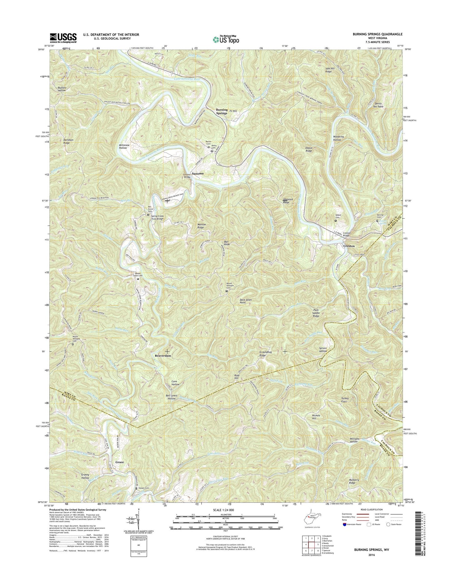
2023 topographic map quadrangle Burning Springs in the state of West Virginia. Scale: 1:24000. Based on the newly updated USGS 7.5' US Topo map series, this map is in the following counties: Wirt, Roane, Calhoun. The map contains contour data, water features, and other items you are used to seeing on USGS maps, but also has updated roads and other features. This is the next generation of topographic maps. Printed on high-quality waterproof paper with UV fade-resistant inks.
Quads adjacent to this one:
West: Reedy
Northwest: Elizabeth
North: Girta
Northeast: MacFarlan
East: Annamoriah
Southeast: Arnoldsburg
South: Spencer
Southwest: Peniel
This map covers the same area as the classic USGS quad with code o38081h3.
Contains the following named places: Anns Run, Anns Run School, Ball Knob, Barnes Run, Barnes Run School, Bear Fork, Bear Run, Beatty School, Beaty Cemetery, Beaverdam, Beaverdam Run, Beaverdam School, Bell Lewis Hollow, Big Run, Boggs School, Buck Run, Burning Springs, Burning Springs High School, Burning Springs Oil Field, Burning Springs Run, Calm School, Cave Hollow, Coal Run, Creston, Creston Bridge, Creston Ferry, Creston School, Creston United Methodist Church, Dave Allen Point, Davidson Ridge, Depue Cemetery, Depue Ridge, Devils Tea Table, Dry Run, Dye Run, Evelyn, Fish Run, Fishpot Run, Fort Hill, Goosenest Run, Goosenest School, Grace, Grace Community Park, Granny Hollow, Grannys Run, Grape Hill Farm, Groundhog Ridge, Henthorn Fork, Hilbert, Hill Grove Baptist Church, Hill Grove Cemetery, Hill Grove School, Hodam Cemetery, Honey Run, Horse Run, Island Run, Island Run School, Ivan, Kane Run, Kanes School, Little Bear Fork, Little Creek, Little Creek School, Little Lost Run, Little Rockcamp Run, Little Spring Creek, Little Two Run, Lost Run, McCrae Cemetery, Mile Run, Millard, Millstone Hollow, Monroe Ridge, Mount Pleasant Cemetery, Mount Pleasant Church, Mount Pleasant School, Mount Solon Cemetery, Mount Williams Cemetery, Mount Williams Church, Nettle Run, Nichols Hill, Old Ruble School, Pack Saddle Ridge, Pack Saddle Run, Petes Run, Rector Cemetery, Rector Methodist Church, Robert Run, Rock Run, Rockcamp Run, Rose Hill, Ruble Church, Salk Hill Ridge, Sand Fork, Sanoma, Sanoma Bridge, Short Run, Siegret Spring, Split Rock Run, Spring Creek, Spring Creek Truss Bridge, Spruce Hollow, Toms Run, Turkey Flats, Turkey Run, Two Run, Two Run School, Umpsted Ridge, Vincent Run, Vincent School, Wagon Run, Wells Fork, West Fork Little Kanawha River, Williams Hollow, Woodring Hollow