MyTopo
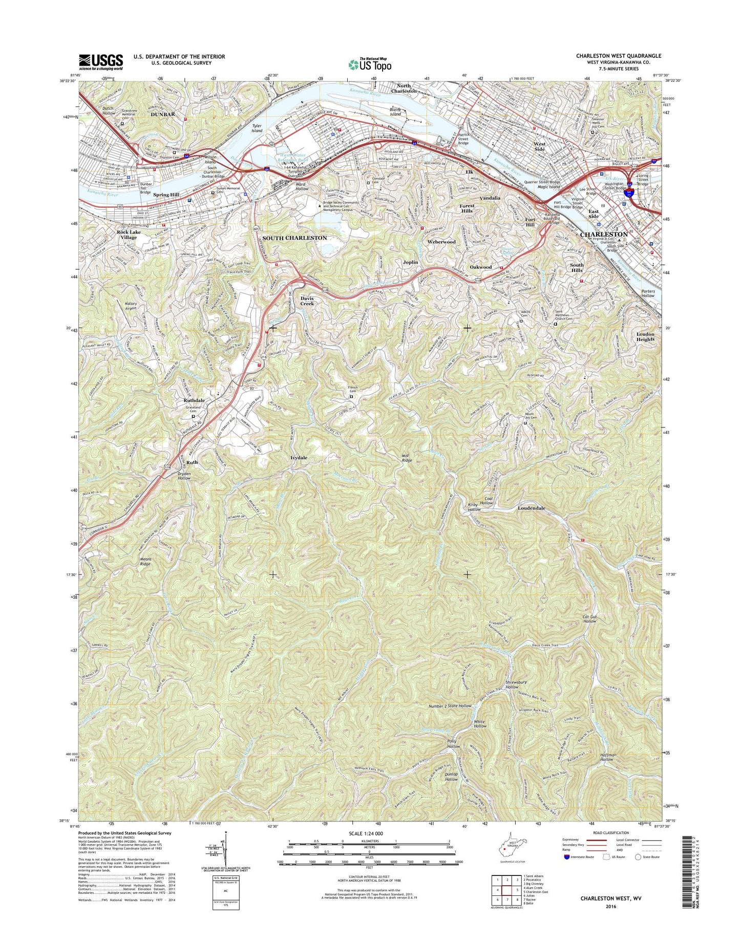
Charleston West West Virginia US Topo Map
Couldn't load pickup availability
2023 topographic map quadrangle Charleston West in the state of West Virginia. Scale: 1:24000. Based on the newly updated USGS 7.5' US Topo map series, this map is in the following counties: Kanawha. The map contains contour data, water features, and other items you are used to seeing on USGS maps, but also has updated roads and other features. This is the next generation of topographic maps. Printed on high-quality waterproof paper with UV fade-resistant inks.
Quads adjacent to this one:
West: Alum Creek
Northwest: Saint Albans
North: Pocatalico
Northeast: Big Chimney
East: Charleston East
Southeast: Belle
South: Racine
Southwest: Julian
This map covers the same area as the classic USGS quad with code o38081c6.
Contains the following named places: Aarons Creek, Adkins Cemetery, Bays Fork, Berry Hills Country Club Golf Course, Bible Center School, Bigley School, Blaine Island, Bridgeview Elementary School, Buds Run, Cabell Alternative High School, CAMC - General Rooftop Heliport, Cane Fork, Cane Fork School, Cat Gut Hollow, Cato Park Golf Course, Charleston, Charleston Area Medical Center General Hospital, Charleston Area Medical Center Women and Childrens Hospital, Charleston Area Medical Center Women and Children's Hospital, Charleston Area Medical Center-General Division, Charleston Art Gallery, Charleston Catholic High School, Charleston City Hall, Charleston Civic Center Coliseum, Charleston Fire Department Station 1, Charleston Fire Department Station 2, Charleston High School, Charleston Post Office, Charleston Seventh Day Adventist School, Charleston Town Center Mall Shopping Center, City of Charleston, City of Dunbar, City of South Charleston, Coal Hollow, Cunningham Fly Ash Pond, Cunningham Flyash Disposal Pond Number Four Dam, Davis Creek, District 2, Dry Branch, Dry Branch School, Dryden Hollow, Dudley Plaza, Dunbar, Dunbar City Hall, Dunbar Intermediate School, Dunbar Park, Dunbar Post Office, Dunbar Toll Bridge, Dunbar Village Shopping Center, Dunlop Hollow, Dutch Hollow, East Side, Edison Elementary School, Elk, Elk River, Eye and Ear Clinic of Charleston, Fernbank Public School, Ferry Branch, Fmc Waste Retention Basin Dam, Ford Elementary School, Forest Hills, Fort Hill, Fort Hill Bridge, Fort Hill Elementary School, Fort Lee, Fort Scammon, French Cemetery, Fruth School, Garnet Career Center, Gateways Shopping Center, George Washington High School, Glendale Cemetery, Glenwood Elementary School, Graceland Cemetery, Grandview Memorial Cemetery, Grandview School, Grasscup Road Historic District, Hill Valley School, Hoffman Hollow, Holz Elementary School, I-64 Kanawha Turnpike Overpass, Ivydale, J E Robins Elementary School, Jackson High School, Jefferson Junior High School, Jefferson Park, John Adams Middle School, John F Kennedy Center, Joplin, Joplin Branch, Kanawha Boulevard Bridge, Kanawha Country Club, Kanawha County Courthouse, Kanawha County Jail, Kanawha County Public Library, Kanawha Fork, Kanawha State Forest, Kanawha Valley Memorial Hospital, Kenna Elementary School, Kenna Homes, Kirby Hollow, Kyle Elementary School, Laidley Court Shopping Center, Lee Street Bridge, Lincoln School, Little Creek Country Club Golf Course, Little Creek Park, Lock 6, Logg-Odell School, Long Branch, Loudendale, Loudon Heights, Loudon High School, Magic Island, Mallory Airport, Marshall University - Graduate College, Mary C Snow Westside Elementary School, Means Ridge, Mercer School, Middle Fork, Middle Ridge, Middle Ridge School, Middlelick Branch, Midkiff School, Moccasin Branch, Montrose Elementary School, Mound, Mound Elementary School, Mount Joy Cemetery, Mountain State Memorial Hospital, Mudsuck Branch, North Charleston, North Charleston Recreation Center, Number 2 Store Hollow, Oakwood, Oakwood Elementary School, Overbrook Elementary School, Patrick Street Bridge, Patrick Street Market, Patrick Street Plaza Shopping Center, Pfieffer Branch, Piedmont Elementary School, Pine Top School, Polly Hollow, Portercamp Branch, Porters Hollow, Pot Branch, Prestera Center Crisis Unit East, Quarrier Street Bridge, Rattlesnake Run, Rays Branch, Richmond Elementary School, Riverwalk Plaza Shopping Center, Robins School, Rock Lake Village, Roxalana Elementary School, Ruffner Memorial Park, Ruth, Ruthdale, Ruthlawn Elementary School, Sacred Heart Grade School, Saint Anthony Catholic School, Saint Francis Hospital, Saint John Heart and Hand Day Care, Saint Matthews Church Cemetery, Sawmill School, Second Avenue Community Center, Select Specialty Hospital Charleston, Select Specialty Hospital Charleston Campus, Shoppes at Trace Fork, Short Branch, Shrewsbury Hollow, Simpson Branch, South Charleston, South Charleston - Dunbar Bridge, South Charleston Branch Kanawha County Public Library, South Charleston Christian Academy, South Charleston High School, South Charleston Middle School, South Charleston Post Office, South Hills, South Ridge Center, South Side Bridge, Southern Hills Hospital, Southridge Centre Post Office, Spring Hill, Spring Hill Elementary School, Spring Hill Junior High School, Spring Hill Post Office, Spring Street Bridge, Staats Hospital, Staunton Elementary School, Stitt Branch, Stonewall Jackson Middle School, Stonewall New Post Office, Sugarcamp Branch, Sugarcamp Creek, Sunrise Bird Sanctuary Museum, Sunset Memorial Park, Swannor Watts Hill Cemetery, Technical High School, Thayer Spring, Thomas Memorial Hospital, Thurston Cemetery, Timberland Park, Tiskelwah Elementary School, Town Center Post Office, Trace Fork, Truslow Public School, Twomile Creek, Tyler Creek, Tyler Island, Vandalia, Vandalia School, Village School, Virginia Street Bridge, Wall Fork, Ward Hollow, Washington Street Bridge, Waste Water Retention Pond, Watts Elementary School, Weberwood, Weberwood Elementary School, West Side, West Virginia Junior College, White Hollow, Wilson High School, Wilson Island, Woodward Branch, WVSR-AM (Charleston), WVSR-FM (Charleston), ZIP Codes: 25301, 25303, 25309, 25314


