MyTopo
Corliss West Virginia US Topo Map
Couldn't load pickup availability
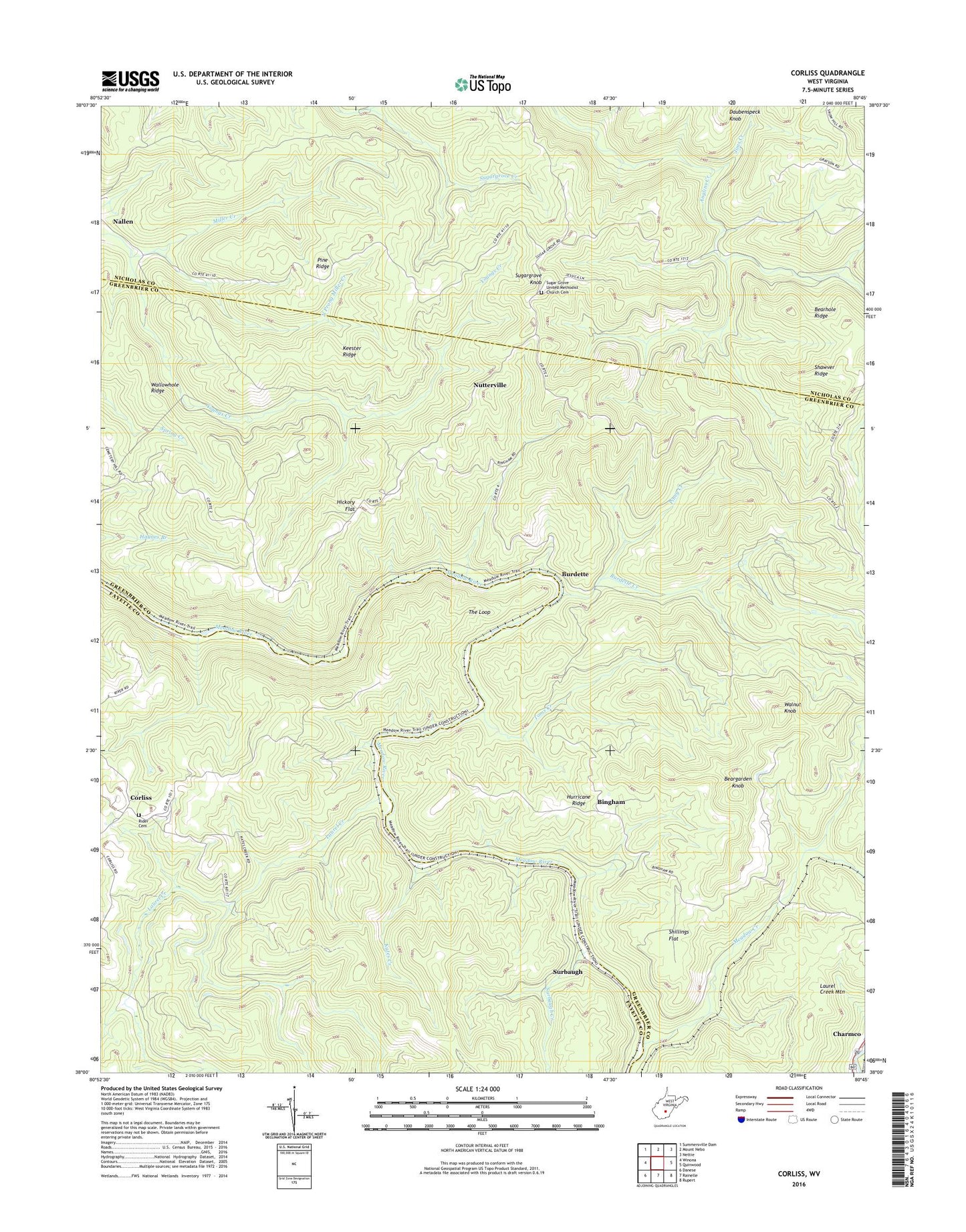
2019 topographic map quadrangle Corliss in the state of West Virginia. Scale: 1:24000. Based on the newly updated USGS 7.5' US Topo map series, this map is in the following counties: Greenbrier, Fayette, Nicholas. The map contains contour data, water features, and other items you are used to seeing on USGS maps, but also has updated roads and other features. This is the next generation of topographic maps. Printed on high-quality waterproof paper with UV fade-resistant inks.
Quads adjacent to this one:
West: Winona
Northwest: Summersville Dam
North: Mount Nebo
Northeast: Nettie
East: Quinwood
Southeast: Rupert
South: Rainelle
Southwest: Danese
Contains the following named places: Beargarden Knob, Bearhole Ridge, Bingham, Burdette, Burdette Creek, Cemetery Hill Church, Corlis School, Corliss, Forest View School, Germany School, Hickory Flat, Honeydew, Hurricane Ridge, Hurricane Ridge School, Jims Creek, Kates Creek, Keester Ridge, Laurel Creek, Loop School, Meadow Creek, Miller Creek, Minnie Belle Baptist Church, New Prospect School, North Prong Miller Creek, Nutter School, Nutterville, Nutterville School, Pine Ridge, Piney Creek, Rader Ford, Rider Cemetery, Shawver Ridge, Shillings Flat, Sugar Grove Lookout Tower, Sugar Grove United Methodist Church, Sugar Grove United Methodist Church Cemetery, Sugargrove Knob, Sugargrove School, Surbaugh, Surbaugh Creek, The Loop, Toms Creek, Wallowhole Ridge, Walnut Knob, ZIP Codes: 25958, 26680