MyTopo
Summersville Dam West Virginia US Topo Map
Couldn't load pickup availability
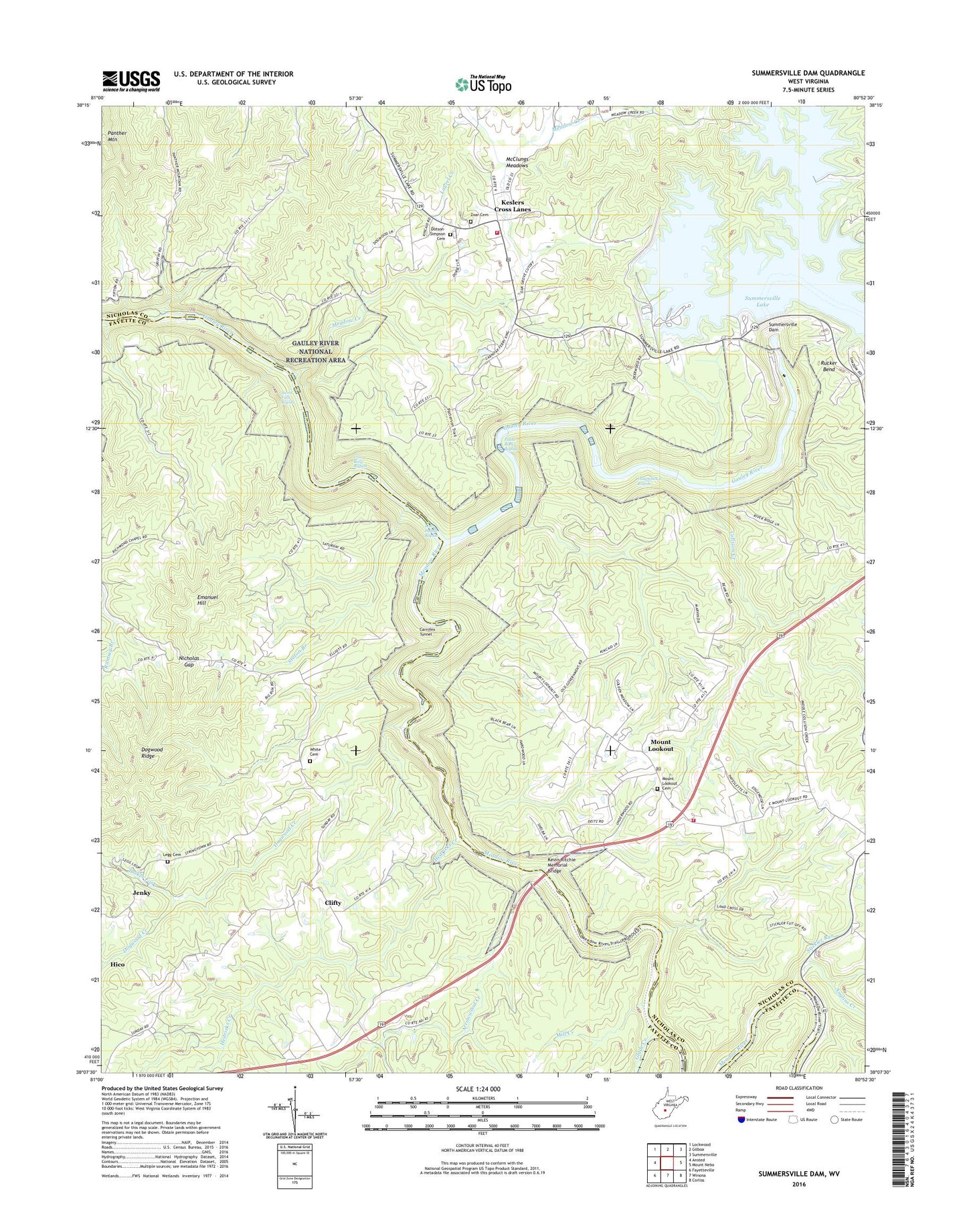
2023 topographic map quadrangle Summersville Dam in the state of West Virginia. Scale: 1:24000. Based on the newly updated USGS 7.5' US Topo map series, this map is in the following counties: Nicholas, Fayette. The map contains contour data, water features, and other items you are used to seeing on USGS maps, but also has updated roads and other features. This is the next generation of topographic maps. Printed on high-quality waterproof paper with UV fade-resistant inks.
Quads adjacent to this one:
West: Ansted
Northwest: Lockwood
North: Gilboa
Northeast: Summersville
East: Mount Nebo
Southeast: Corliss
South: Winona
Southwest: Fayetteville
This map covers the same area as the classic USGS quad with code o38080b8.
Contains the following named places: Anglins Creek, Arrowwood Creek, Backus School, Battle Run, Bell School, Camp Gauley, Carnifex Ferry, Carnifex Ferry Battlefield State Park, Carnifex School, Carnifex Trail, Carnifex Tunnel, Clifty, Clifty Church, Collison Creek, Copenhaver School, Deegans, Dogwood Creek, Dogwood Ridge, Dotson - Simpson Cemetery, Elliot, Emanuel Hill, Gad, Glade Creek, Hedricks Creek, Insignificant Rapids, Iron Ring Rapids, Jenky, Keslers Cross Lanes, Keslers Cross Lanes Post Office, Keslers Memorial Church, Kessler School, Kesslers Cross Lane Volunteer Fire Department, Kevin Ritchie Memorial Bridge, Koontz School, Legg Cemetery, Legg School, Lost Paddle Rapids, McClungs Meadows, McKee Creek, Meadow Creek, Meadow Creek School, Meadow River, Mill Creek, Morrison, Mount Lookout, Mount Lookout Post Office, Mount Pleasant Baptist Church Cemetery, Mount Pleasant Church, New Milton School, Nicholas Gap, Oak Grove School, Old Carnifex Ferry Site, Panther Mountain, Pillow Rock Rapids, Pine Bluff School, Pine Grove School, Richmond Chapel, Rucker Bend, Shady Grove Church, Shawver Bridge, Sparks, Staton Branch, Stickler Run, Summersville Dam, Sunday Road School, Sweet Falls Rapids, Tucker Fork, Vinton, White Cemetery, White School, Wilderness Volunteer Fire Department, Zoar Cemetery, Zoar Church, ZIP Codes: 25854, 26678