
MyTopo
Gassaway West Virginia US Topo Map
Couldn't load pickup availability
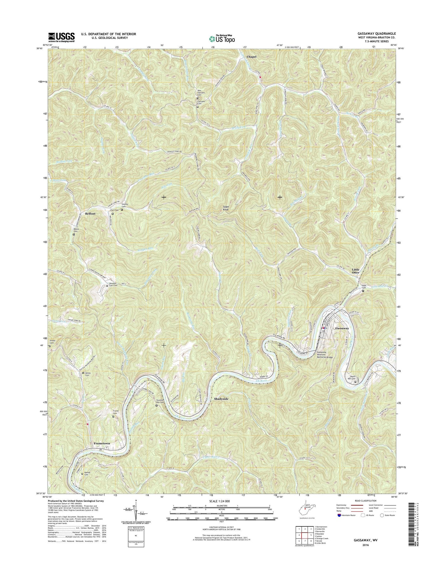
2019 topographic map quadrangle Gassaway in the state of West Virginia. Scale: 1:24000. Based on the newly updated USGS 7.5' US Topo map series, this map is in the following counties: Braxton. The map contains contour data, water features, and other items you are used to seeing on USGS maps, but also has updated roads and other features. This is the next generation of topographic maps. Printed on high-quality waterproof paper with UV fade-resistant inks.
Quads adjacent to this one:
West: Rosedale
Northwest: Normantown
North: Cedarville
Northeast: Burnsville
East: Sutton
Southeast: Little Birch
South: Herold
Southwest: Strange Creek
Contains the following named places: Bealls Mill Cemetery, Bear Run, Belfont, Big Run, Bills Fork, Blowntimber Run, Boone Cemetery, Brady Fork, Brushy Branch, Brushy Fork, Buena Branch, Canoe Run, Carr Cemetery, Chapel, Chapel Volunteer Fire Department, Clickton, Coon Creek, Davis Elementary School, Davison, Dickey Cemetery, Elizabeth Chapel, Fairview Cemetery, Fairview Church, Frametown, Frametown Cemetery, Frametown Elementary School, Frametown Post Office, Frametown Volunteer Fire Department, Gassaway, Gassaway Police Department, Gassaway Post Office, Gassaway Public Library, Gassaway Veterans Memorial Bridge, Gassaway Volunteer Fire Department, Grasslick Run, Home, Houston - Carr Cemetery, James Cemetery, Jerusha Church, Keener Cemetery, Limestone Run, Little Buffalo Creek, Little Otter, Little Otter Church, Little Otter Creek, Lower Rockcamp Run, New Fairview Cemetery, Otter Cemetery, Panther Fork, Perkins Branch, Pigeon Run, Plantation Fork, Richmond Church, Rockcamp Run, Rush Fork, Shadyside, Simpson Church, Skidmore School, Starkey Cemetery, Straight Fork, Stumble Run, Stumble Run Cemetery, Sugar Creek, Sugar Creek Church, Sugar Knob, Sycamore Run, Town of Gassaway, Upper Mill Creek, Walnut Fork, West Virginia Division of Forestry Braxton County Field Office, Western District, Wolfpen Run, ZIP Codes: 26623, 26624


