MyTopo
Cedarville West Virginia US Topo Map
Couldn't load pickup availability
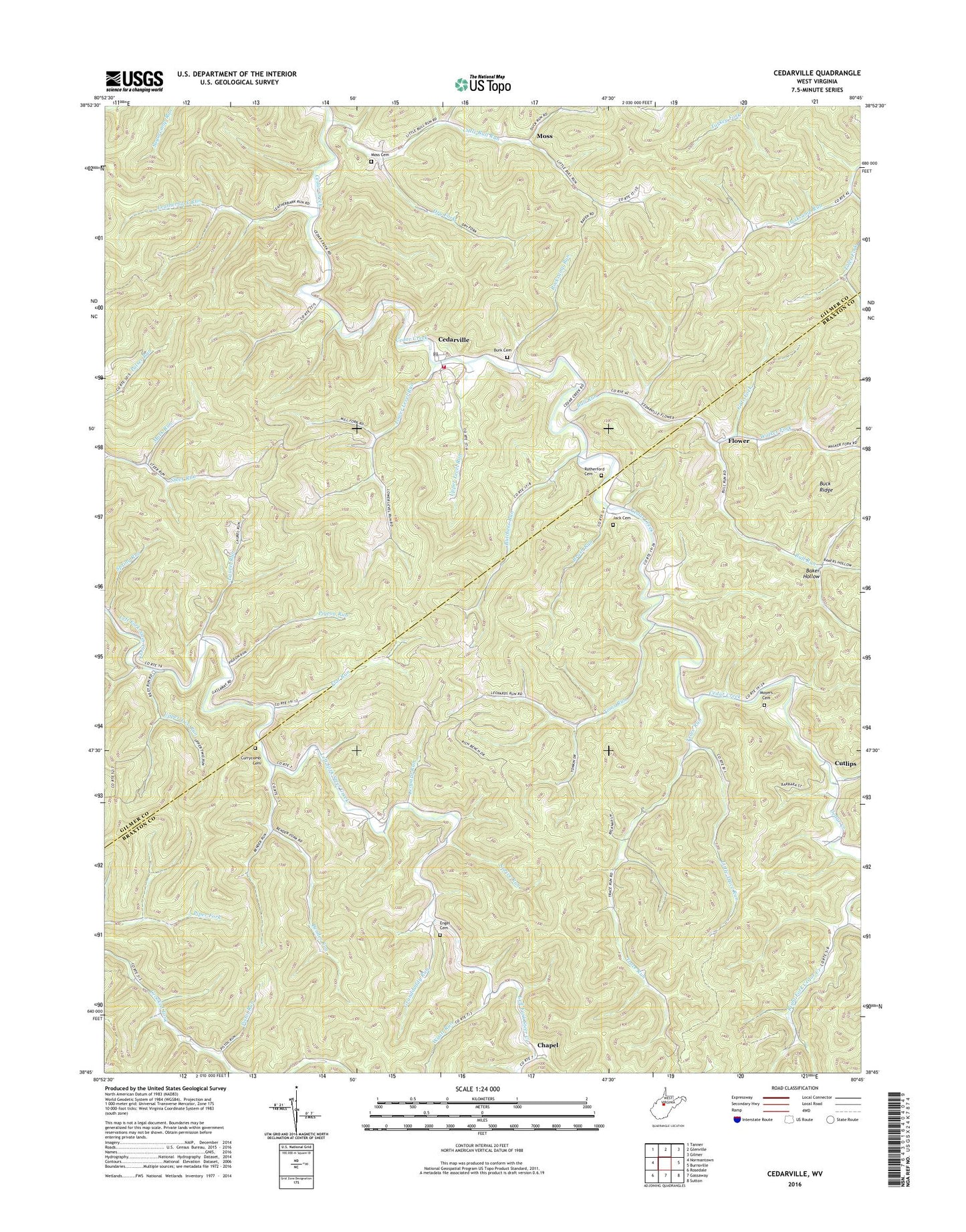
2023 topographic map quadrangle Cedarville in the state of West Virginia. Scale: 1:24000. Based on the newly updated USGS 7.5' US Topo map series, this map is in the following counties: Braxton, Gilmer. The map contains contour data, water features, and other items you are used to seeing on USGS maps, but also has updated roads and other features. This is the next generation of topographic maps. Printed on high-quality waterproof paper with UV fade-resistant inks.
Quads adjacent to this one:
West: Normantown
Northwest: Tanner
North: Glenville
Northeast: Gilmer
East: Burnsville
Southeast: Sutton
South: Gassaway
Southwest: Rosedale
This map covers the same area as the classic USGS quad with code o38080g7.
Contains the following named places: Back Fork School, Baker Hollow, Bender Run, Bender Run Church, Brush Camp Run, Brush Run, Bull Run, Burk Cemetery, Butchers Run, Butchers Run Truss Bridge, Cedar Creek Church, Cedarville, Cedarville Post Office, Currycomb Cemetery, Cutlips, Dry Fork, Dusk, Dusk Church, Engel Cemetery, Engel School, Fairview School, Flat Run, Flower, Gate Fork, German, Gilmer County Volunteer Fire Department Cedarville Station, Granddaddy Run, Hines School, Hope, Jack Cemetery, Laurel Run, Laurel Run School, Leatherbark Run, Leatherbark School, Leopard Run, Little Bull Run, Little Trace Run, Lower Bull Run School, Lower Level Run, Lower Two Run, Mark Run, Moss, Moss Cemetery, Moyers Cemetery, Pigeon Run, Pistol Run, Progress, Rhodes Chapel, Rider School, Rockcamp Run, Romeich Church, Rutherford Cemetery, Shock School, Spring Run, Sprive Run, Steer Run School, Toler Fork, Toms Run, Trace Run, Trace School, Upper Level Run, Upper Steer Run Church, Upper Two Run, Waldeck Church, Walker Fork, Walker Fork School, Wyatt Run, ZIP Codes: 26430, 26611