MyTopo
Herold West Virginia US Topo Map
Couldn't load pickup availability
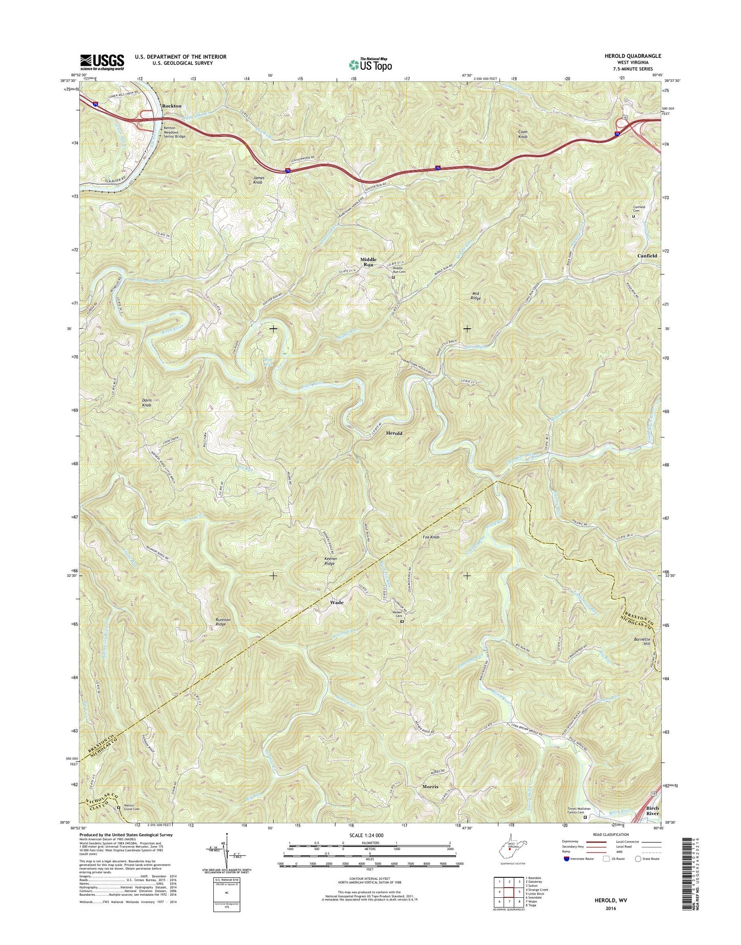
2023 topographic map quadrangle Herold in the state of West Virginia. Scale: 1:24000. Based on the newly updated USGS 7.5' US Topo map series, this map is in the following counties: Braxton, Nicholas, Clay. The map contains contour data, water features, and other items you are used to seeing on USGS maps, but also has updated roads and other features. This is the next generation of topographic maps. Printed on high-quality waterproof paper with UV fade-resistant inks.
Quads adjacent to this one:
West: Strange Creek
Northwest: Rosedale
North: Gassaway
Northeast: Sutton
East: Little Birch
Southeast: Tioga
South: Widen
Southwest: Swandale
This map covers the same area as the classic USGS quad with code o38080e7.
Contains the following named places: Barnette Hill, Baughman Church, Big Run, Blue Hole, Brushy Fork, Buckeye Fork, Canfield, Canfield Cemetery, Coalbed Run, Coon Knob, Cox Cemetery Church, Davis Knob, Diatter Run, Dry Fork, Elk River Church, Eureka Church, Feedtrough Run, Fox Knob, Frame Run, Herold, James Knob, Keener Ridge, Kenton Meadows Senior Bridge, Leatherwood Run, Little Birch River, Long Run, Lower Mill Creek, Meadville, Middle Ridge, Middle Run, Middle Run Cemetery, Mill Creek, Morris, Mount Olive Church, New Hope Church, Polemic Run, Polemic Run Church, Powell Creek, Road Run, Rockton, Rose Hill School, Runnion Ridge, Slabcamp Run, Southern District, Spring Bottom Run, Spruce Grove Church, Sutton Run, Tinnel - Mollohan Family Cemetery, Trace Fork, Twistville, Wade, Walker Cemetery, Walnut Grove Cemetery, Walnut Grove United Methodist Church, Wolf Pen Run, ZIP Code: 26617