MyTopo
Little Birch West Virginia US Topo Map
Couldn't load pickup availability
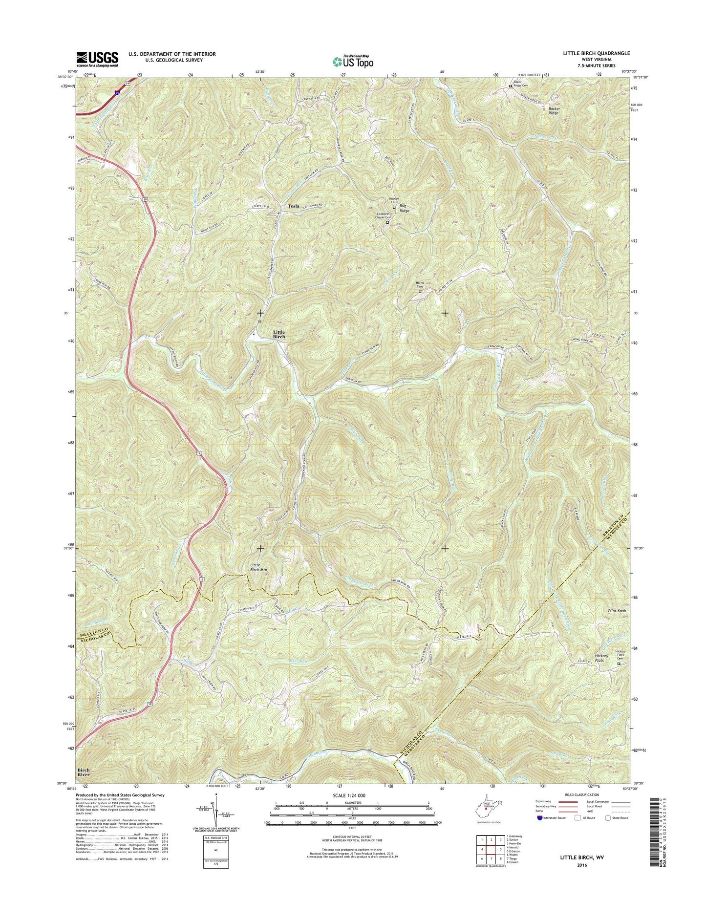
2023 topographic map quadrangle Little Birch in the state of West Virginia. Scale: 1:24000. Based on the newly updated USGS 7.5' US Topo map series, this map is in the following counties: Braxton, Nicholas, Webster. The map contains contour data, water features, and other items you are used to seeing on USGS maps, but also has updated roads and other features. This is the next generation of topographic maps. Printed on high-quality waterproof paper with UV fade-resistant inks.
Quads adjacent to this one:
West: Herold
Northwest: Gassaway
North: Sutton
Northeast: Newville
East: Erbacon
Southeast: Cowen
South: Tioga
Southwest: Widen
This map covers the same area as the classic USGS quad with code o38080e6.
Contains the following named places: Baker Ridge Cemetery, Barker Ridge, Bays, Bear Run, Birch River Union Church, Bluelick Run, Brier Run, Bug Ridge, Carpenter Fork, Coon Den Run, Crites Mountain School, Elizabeth Chapel, Elizabeth Chapel Cemetery, Fisher Run, Gravel Fork, Harris Cemetery, Hickory Flats, Hickory Flats Cemetery, Holstead, Hoover Cemetery, Jackson Memorial Church, Laurel Run, Little Birch, Little Birch Elementary School, Little Birch Mountain, Little Birch Post Office, May Fork, Pilot Knob, Ramp Run, Right Fork Little Birch River, Road Fork, Rose Run, Seng Run, Skyles, Skyles Creek, Spring Run, Spruce Fork, Spruce Fork Church, Stump Chapel, Tesla, Twolick Run, Waggy, Windy Run, Windy Run Grade School, ZIP Code: 26629