MyTopo
Garretts Bend West Virginia US Topo Map
Couldn't load pickup availability
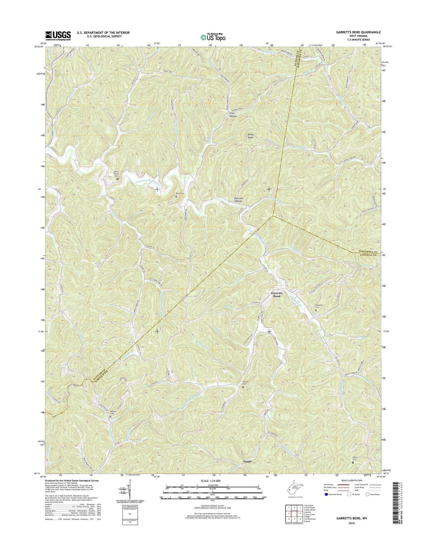
2023 topographic map quadrangle Garretts Bend in the state of West Virginia. Scale: 1:24000. Based on the newly updated USGS 7.5' US Topo map series, this map is in the following counties: Lincoln, Putnam, Kanawha. The map contains contour data, water features, and other items you are used to seeing on USGS maps, but also has updated roads and other features. This is the next generation of topographic maps. Printed on high-quality waterproof paper with UV fade-resistant inks.
Quads adjacent to this one:
West: Hamlin
Northwest: Hurricane
North: Scott Depot
Northeast: Saint Albans
East: Alum Creek
Southeast: Julian
South: Griffithsville
Southwest: Hager
This map covers the same area as the classic USGS quad with code o38081c8.
Contains the following named places: Adkins Fork, Bird Cemetery, Bridge Creek, Browns Creek Church, Bryan Branch, Buck Branch, Central School, Curry District, District 3, Donley Fork, Dry Branch, Dry Branch School, Elizabeth Church, Fairview School, Flint Hollow, Garretts Bend, Garretts Bend School, Good Hope Church, Hayzlett Cemetery, Hayzlett Fork, Highland School, Hilbert Wildlife Management Area, Joes Creek, Joes Creek Church, Kellys Creek, King Creek School, Laurel Fork, Lefthand Fork Turkey Creek, Lick Branch, Lick Creek, Long Branch, Martin Run, Mount Moriah Cemetery, Mount Moriah Church, Mount Zion Church, Nelson Cemetery, New Hope School, Pleasant View School, Providence Church, Raccoon Hollow, Road Fork, Robinson School, Rockhouse Branch, Rocky Knob, Sanson Cemetery, Spring Hollow School, Sunnydale School, Tango, Tango Branch, Tango School, Toms Branch, Tony Branch, Trace Branch, Trace Creek, Turkey Creek, Twomile Branch, Watts Cemetery, Youngs Chapel, ZIP Code: 25564