MyTopo
Glen Easton West Virginia US Topo Map
Couldn't load pickup availability
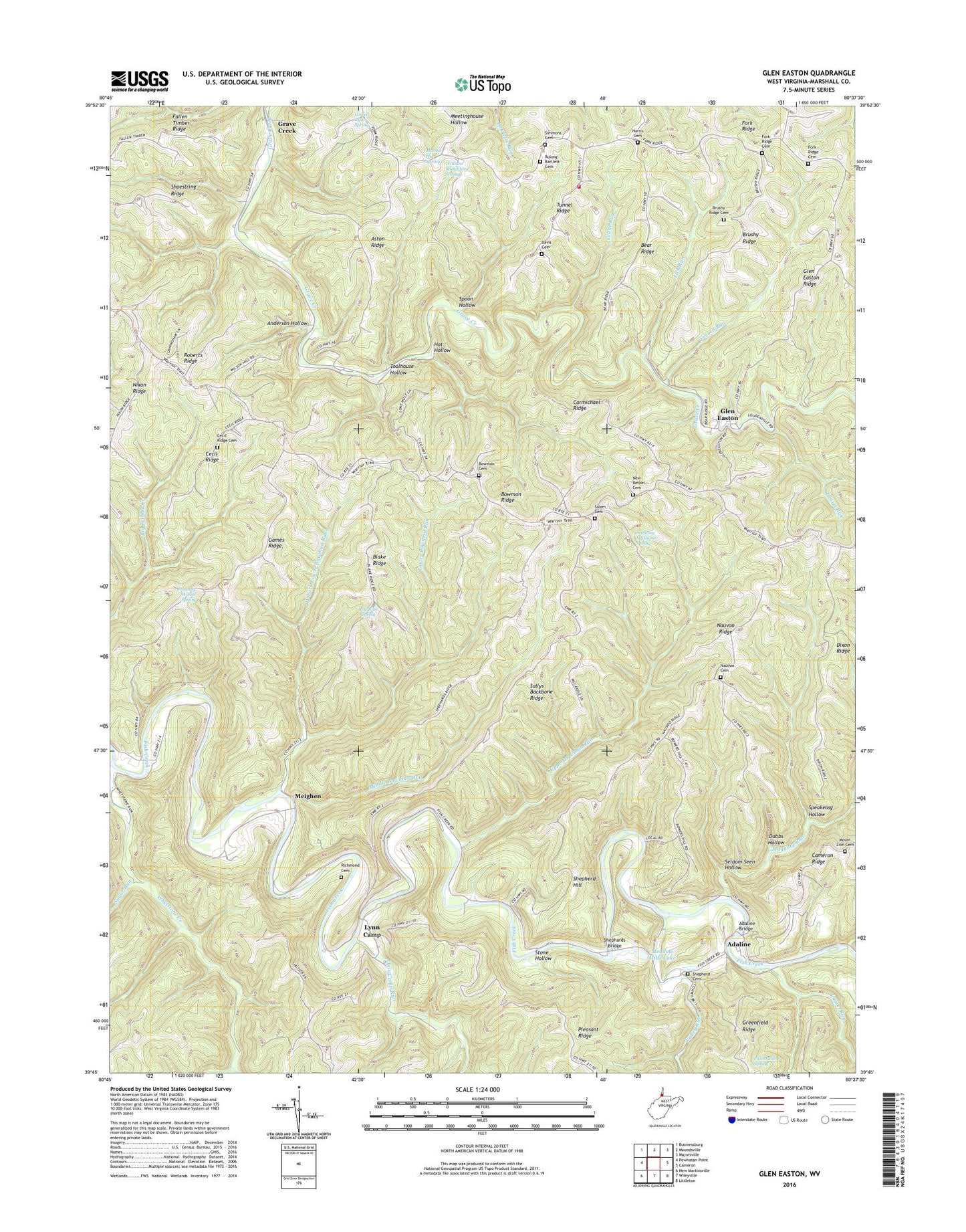
2023 topographic map quadrangle Glen Easton in the state of West Virginia. Scale: 1:24000. Based on the newly updated USGS 7.5' US Topo map series, this map is in the following counties: Marshall. The map contains contour data, water features, and other items you are used to seeing on USGS maps, but also has updated roads and other features. This is the next generation of topographic maps. Printed on high-quality waterproof paper with UV fade-resistant inks.
Quads adjacent to this one:
Northwest: Businessburg
North: Moundsville
Northeast: Majorsville
East: Cameron
Southeast: Littleton
South: Wileyville
Southwest: New Martinsville
This map covers the same area as the classic USGS quad with code o39080g6.
Contains the following named places: Adaline, Adaline Bridge, Adaline Community Center, Adaline School, Anderson Hollow, Anthony Mysliwiec Spring, Aston Ridge, Bear Ridge, Bethel School, Big Run, Blake Ridge, Bowman Cemetery, Bowman Ridge, Bowman United Methodist Church, Brushy Ridge, Brushy Ridge Cemetery, Burch Run, Carmichael Ridge, Cecil Ridge, Cecil Ridge Cemetery, Cedar Run, Center School, Davis Cemetery, District 3, Dixon Ridge, Dixon School, Dobbs Hollow, Dorothy Wetzel Spring, Fallen Timber Ridge, Fork Ridge, Fork Ridge Cemetery, Fork Ridge Church, Fork Ridge Community Volunteer Fire Department and Emergency Medical Services, French Run, Games Ridge, Games School, Glen Easton, Glen Easton Ridge, Glen Easton United Methodist Church, Glen Easton-Gunn School, Gorby School, Grave Creek, Grave Creek School, Harris Cemetery, Harris School, Hope School, Hot Hollow, Laurel Run, Left Fork Maggoty Run, Lick Run, Lowell Ryan Spring, Lower Bane School, Lower Bowman Run, Lynn Camp, Lynn Camp Run, Lynn Camp School, Lynn Camp United Methodist Church, Maggoty Run, Marshall County, Martin Hill Spring, Martin School, McElroy Mine, Meadow Hills Lake, Meighen, Meighen School, Middle Bowman Run, Mount Zion Cemetery, Mount Zion Church, Mountain Hill School, Nauvoo Cemetery, Nauvoo Church, Nauvoo Ridge, Nauvoo School, New Bethel Cemetery, New Bethel Church, Nixon School, Paul Adams Spring, Pleasant Ridge, Richmond Cemetery, Rockdale School, Rocky Fork, Rosbys Rock, Rosbys Rock Methodist Church, Rosbys Rock School, Roy Rine Spring, Rulong - Bartlett Cemetery, Salem Cemetery, Salem Church, Sallys Backbone Ridge, Seldom Seen Hollow, Shephards Bridge, Shepherd Cemetery, Shepherd Hill, Shepherd United Methodist Church, Shoestring Ridge, Simmons Cemetery, Speakeasy Hollow, Spoon Hollow, Stone Hollow, Stony Hollow School, Sugar Run, Terrill Church, Terrill School, Teutonic, Toolhouse Hollow, Tunnel Ridge, Upper Bowman Run, Upper Bowman School, Valley Run, West Fork Lower Bowman Run, Whetstone Creek, William Standiford Spring, Windy Gap School, ZIP Code: 26039