MyTopo
McGraws West Virginia US Topo Map
Couldn't load pickup availability
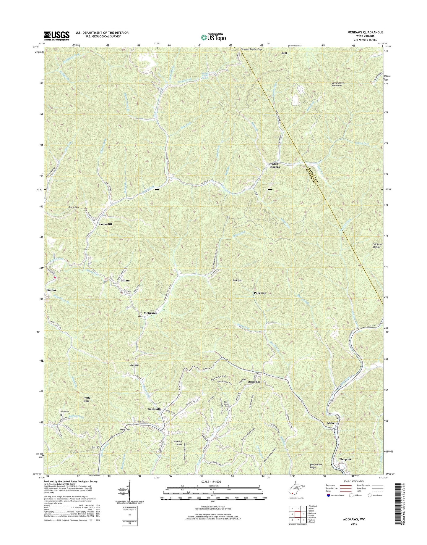
2023 topographic map quadrangle McGraws in the state of West Virginia. Scale: 1:24000. Based on the newly updated USGS 7.5' US Topo map series, this map is in the following counties: Wyoming, Raleigh. The map contains contour data, water features, and other items you are used to seeing on USGS maps, but also has updated roads and other features. This is the next generation of topographic maps. Printed on high-quality waterproof paper with UV fade-resistant inks.
Quads adjacent to this one:
West: Matheny
Northwest: Pilot Knob
North: Arnett
Northeast: Eccles
East: Lester
Southeast: Rhodell
South: Mullens
Southwest: Pineville
This map covers the same area as the classic USGS quad with code o37081f4.
Contains the following named places: Bear Fork, Bearwallow Ridge, Big Branch, Bobs Fork, Bridge Branch, Buck Fork, Buck Fork Dam, Buck Fork Lake, Castle, Franks Fork, Friendship Church, Frye Cemetery, Glen Gap, Glen Rogers, Glen Rogers Grade School, Glen Rogers High School, Glen Rogers Post Office, Hickory Knob, James Brooks Spring, Lewis Fork, Low Gap, Maben, Maben Post Office, Manns Camp Branch, Marsh Fork, McGraws, McGraws Post Office, Measle Fork, Milam, Milam Fork, Mouse Fork, Old Slab Fork, Otter Fork, Pierpoint Freewill Baptist Church, Pierpont, Pinegrove Church, Polk Gap, Pretty Ridge, Ravencliff, Ravencliff Post Office, Rush Branch, Saulsville, Saulsville Baptist Church, Skinned Poplar Gap, Station Gap, Sweet Home Church, Tilley-Tolliver Cemetery, Trough Fork, Twin Falls Resort State Park Golf Course, Twin Falls State Park, Upper Big Branch, Upper Laurel Volunteer Fire and Ambulance Service, Wallis Branch, Watt Oliver Branch, White Oak Branch, Wolf Gap, Wolfpen Branch, ZIP Codes: 25848, 25870, 25875, 25876, 25882, 25913, 25916