MyTopo
Mullens West Virginia US Topo Map
Couldn't load pickup availability
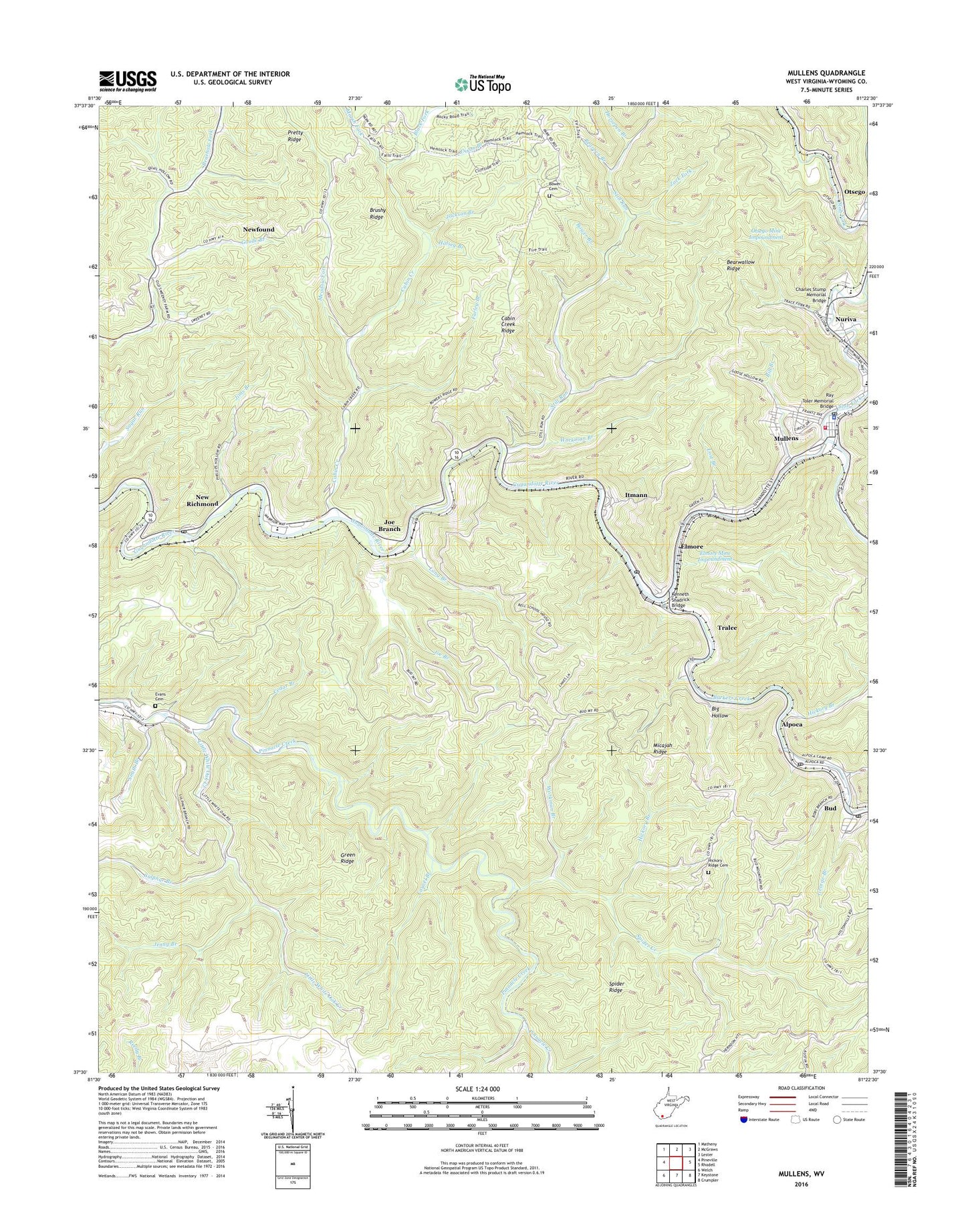
2023 topographic map quadrangle Mullens in the state of West Virginia. Scale: 1:24000. Based on the newly updated USGS 7.5' US Topo map series, this map is in the following counties: Wyoming. The map contains contour data, water features, and other items you are used to seeing on USGS maps, but also has updated roads and other features. This is the next generation of topographic maps. Printed on high-quality waterproof paper with UV fade-resistant inks.
Quads adjacent to this one:
West: Pineville
Northwest: Matheny
North: McGraws
Northeast: Lester
East: Rhodell
Southeast: Crumpler
South: Keystone
Southwest: Welch
This map covers the same area as the classic USGS quad with code o37081e4.
Contains the following named places: Alpoca, Alpoca Post Office, Barkers Creek, Bearpen Branch, Bethel African Methodist Episcopal Church, Big Hollow, Bill Branch, Black Fork, Bower Branch, Bower Cemetery, Brushy Ridge, Bud, Bud - Alpoca Volunteer Fire Department, Bud Census Designated Place, Bud Post Office, Bud-Alpoca Methodist Church, Cabin Creek, Cabin Creek Ridge, Cedar Branch, Cedar Creek, Charles Stump Memorial Bridge, City of Mullens, Conley School, Copperhead Branch, District 1, Dixon Branch, Elmore, Elmore Mine Impoundment, Evans Cemetery, Farley Branch, First Baptist Church, George Branch, Goode Branch, Green Ridge, Halsey Branch, Hickory Branch, Hickory Ridge Cemetery, Highland Avenue Baptist Church, Horsepen Branch, Itmann, Itmann Census Designated Place, Itmann Post Office, Itmann School, Jackson Branch, Jenny Branch, Jims Branch, Joe Branch, Joes Branch Refuse Impoundment, Joes Branch Refuse Impoundment Dam, Kenneth Shadrick Bridge, Laurel Branch, Leonard Valentine Memorial Bridge, Little White Oak Creek, Long Branch, Lost Branch, Marsh Fork, Meadow Fork, Micajah Ridge, Mill Branch, Mullens, Mullens Area Public Library, Mullens City Hall, Mullens Elementary School, Mullens Fire Department, Mullens High School, Mullens Middle School, Mullens Police Department, Mullens Post Office, New Richmond, New Richmond Census Designated Place, New Richmond Post Office, Newfound, Nuriva, Otsego, Otsego Mine Impoundment, Ray Toler Memorial Bridge, Saint Johns Church, Slab Fork, Slab Fork Church, Slab Fork-Otsego Dam, Smith Branch, Sonlight Christian Academy, Spider Creek, Spider Ridge, Stat Ambulance Service Incorporated, Still Run, Sulphur Branch, Terry Branch, Tralee, Workman Branch, WPMW-FM (Mullens), Wyco Number Two Refuse Embankment Dam, Wyoming County East High School, Zack Fork, ZIP Codes: 24847, 24867