MyTopo
Valley Head West Virginia US Topo Map
Couldn't load pickup availability
Also explore the Valley Head Forest Service Topo of this same quad for updated USFS data
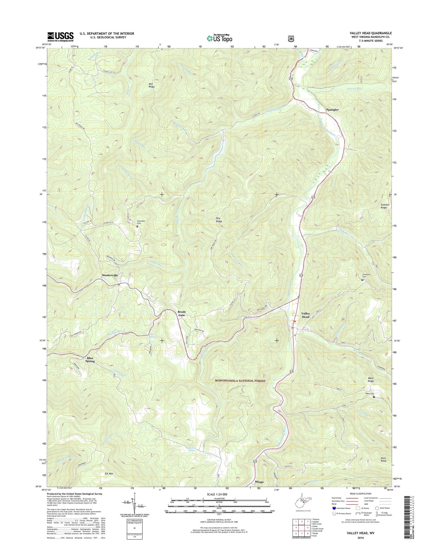
2023 topographic map quadrangle Valley Head in the state of West Virginia. Scale: 1:24000. Based on the newly updated USGS 7.5' US Topo map series, this map is in the following counties: Randolph. The map contains contour data, water features, and other items you are used to seeing on USGS maps, but also has updated roads and other features. This is the next generation of topographic maps. Printed on high-quality waterproof paper with UV fade-resistant inks.
Quads adjacent to this one:
West: Samp
Northwest: Pickens
North: Adolph
Northeast: Mill Creek
East: Snyder Knob
Southeast: Cass
South: Mingo
Southwest: Sharp Knob
This map covers the same area as the classic USGS quad with code o38080e1.
Contains the following named places: Big Run, Blue Spring, Brady Gate, Chestnut Grove School, Clay Run, Conley Run, Dry Ridge, Elk Mountain, Elkwater Fork, Ezra Bennett Spring, Fish Hole Run, Fortlick Run, Friendship Church, Hamilton Run, Lieutenant Colonel Washington Memorial, Limekiln Run, Logan Run, Mill Ridge, Mingo District, Monterville, Monterville Post Office, Mowry Run, Mudlick Run, Oak Grove Church, Oxley Run, Pine Grove School, Ralston Run, Rich Knob, Simmons Cemetery, Snake Run, Spangler, Stainaker Cemetery, Stewart Run, Stony Run, Swecker Ridge, Trough Spring School, Valley Head, Valley Head Census Designated Place, Valley Head Elementary School, Valley Head Post Office, Valley Head Public Library, Valley Head Volunteer Fire Department, Valley Head Volunteer Fire Department-Station 2, Wamsley Run, Wares Ridge Cemetery, Windy Run, ZIP Code: 26294