MyTopo
Mount Nebo West Virginia US Topo Map
Couldn't load pickup availability
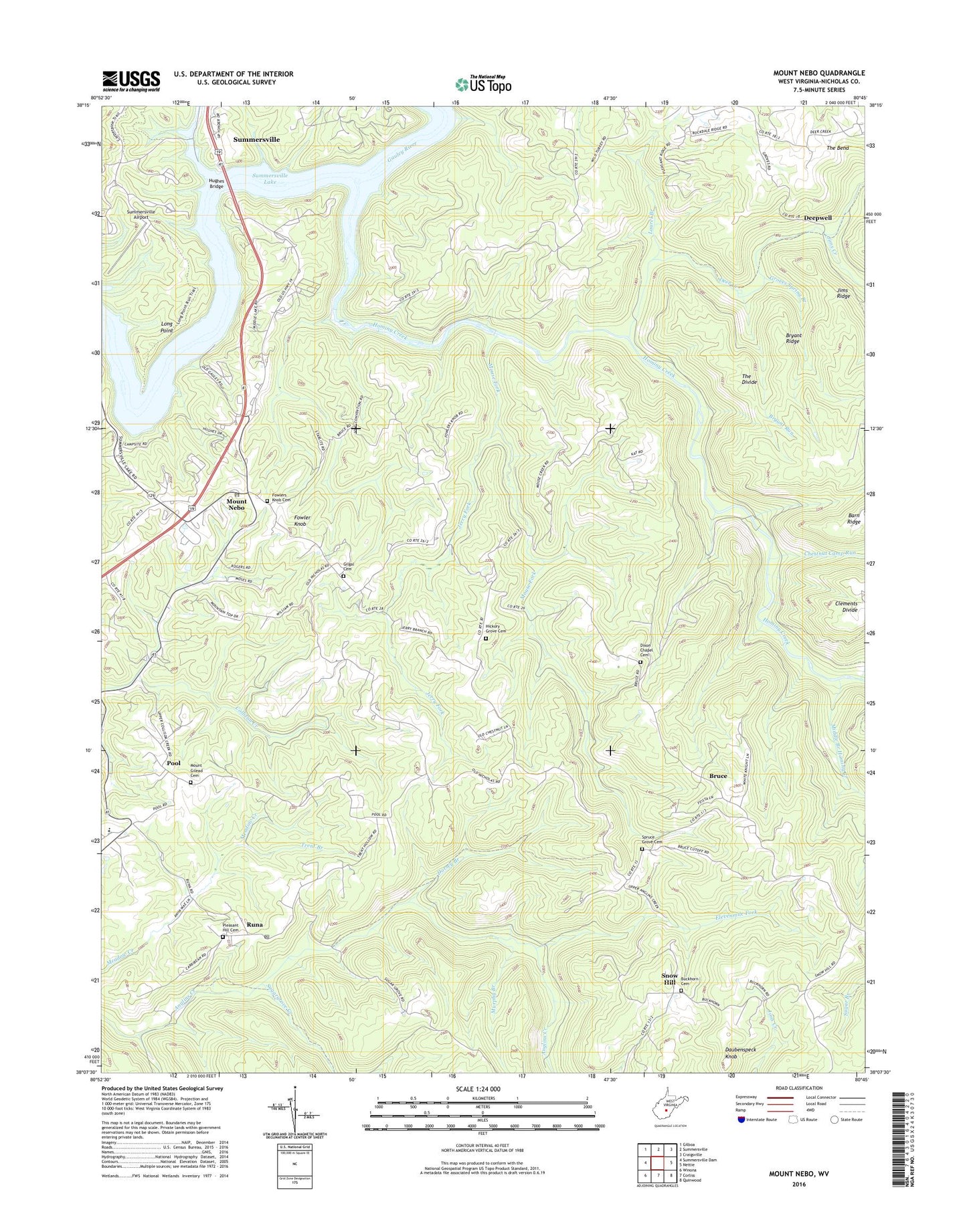
2019 topographic map quadrangle Mount Nebo in the state of West Virginia. Scale: 1:24000. Based on the newly updated USGS 7.5' US Topo map series, this map is in the following counties: Nicholas. The map contains contour data, water features, and other items you are used to seeing on USGS maps, but also has updated roads and other features. This is the next generation of topographic maps. Printed on high-quality waterproof paper with UV fade-resistant inks.
Quads adjacent to this one:
West: Summersville Dam
Northwest: Gilboa
North: Summersville
Northeast: Craigsville
East: Nettie
Southeast: Quinwood
South: Corliss
Southwest: Winona
Contains the following named places: Bean School, Belmont School, Blacks Chapel, Blacks Chapel School, Bruce, Bryant Ridge, Bryant Run, Bryant School, Buckhorn Cemetery, Buckhorn School, Buckhorn United Methodist Church, Chestnut Camp Run, Daubenspeck Knob, Deepwell, Deer Creek, Dixon Chapel Cemetery, Dixon Chapel United Methodist Church, Dorsey Branch, Elevenmile Fork, Fleger Ridge School, Fowler Knob, Fowler Knob Church, Fowlers Knob Cemetery, Gilgal Cemetery, Gilgal School, Gilgal United Methodist Church, Groves Spring Branch, Hickory Grove Cemetery, Hickory Grove United Methodist Church, Hominy Creek, Hughes Bridge, Hughes Ferry Bridge, Jerry Fork, Jims Creek, Jims Ridge, Laurel Branch, Long Point, McMillon School, Middle Branch Hominy Creek, Mount Gilead Cemetery, Mount Gilead Church, Mount Lookout Elementary School, Mount Nebo, Mount Nebo Elementary School, Mount Nebo Post Office, Mouse Fork, Murphy Branch, Oak Hill School, Pleasant Hill Cemetery, Pleasant Hill United Methodist Church, Pool, Rocky Point School, Runa, Runa Post Office, Salmon Run, Snow Hill, Snow Hill Church, Spruce Grove Cemetery, Spruce Grove School, Spruce Grove United Methodist Church, Sugargrove Creek, Summersville Airport, Summersville Lake, The Bend, The Divide, Trent Branch, Wilderness District, ZIP Codes: 26679, 26684