MyTopo
Fellowsville West Virginia US Topo Map
Couldn't load pickup availability
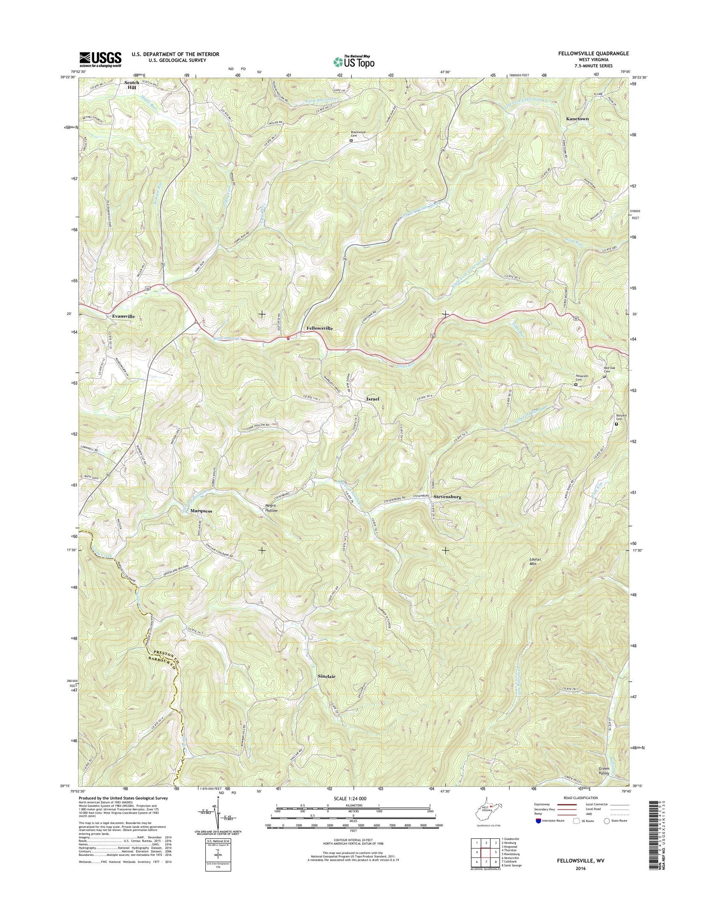
2023 topographic map quadrangle Fellowsville in the state of West Virginia. Scale: 1:24000. Based on the newly updated USGS 7.5' US Topo map series, this map is in the following counties: Preston, Barbour, Tucker. The map contains contour data, water features, and other items you are used to seeing on USGS maps, but also has updated roads and other features. This is the next generation of topographic maps. Printed on high-quality waterproof paper with UV fade-resistant inks.
Quads adjacent to this one:
West: Thornton
Northwest: Gladesville
North: Newburg
Northeast: Kingwood
East: Rowlesburg
Southeast: Saint George
South: Colebank
Southwest: Nestorville
This map covers the same area as the classic USGS quad with code o39079c7.
Contains the following named places: Blackwood Cemetery, Bolyard Cemetery, Brocum Run, Evansville, Evansville United Methodist Church, Fairview School, Fellowsville, Fellowsville Assembly of God Church, Fellowsville Elementary School, Fellowsville United Methodist Church, Fellowsville Volunteer Fire Department, Flag Run Church, Frog Run, Green Valley School, Green Valley United Methodist Church, Halpritter School, Israel, Jeffry Fork, Kanetown, Left Fork Little Sandy Creek, Left Fork Sandy Creek, Lyon District, Marquess, Mount Israel United Methodist Church, Mount Zion United Methodist Church, Mountaineer Ambulance Service, Nazareth Cemetery, Nazareth Church, Negro Hollow, Pleasant Valley, Pleasant Valley Church, Red Oak Cemetery, Redoak School, Ridenour School, Right Fork Little Sandy Creek, School Number 16, Scotch Hill, Scotch Hill School, Shays Chapel United Methodist Church, Sigley School, Sinclair, Sinclair United Methodist Church, Stevensburg, Sugarcamp Run, Summer School, Tibbs Run, Union Church, York Run, York Run Pavillion United Methodist Church, York Run School, ZIP Codes: 26425, 26444