MyTopo
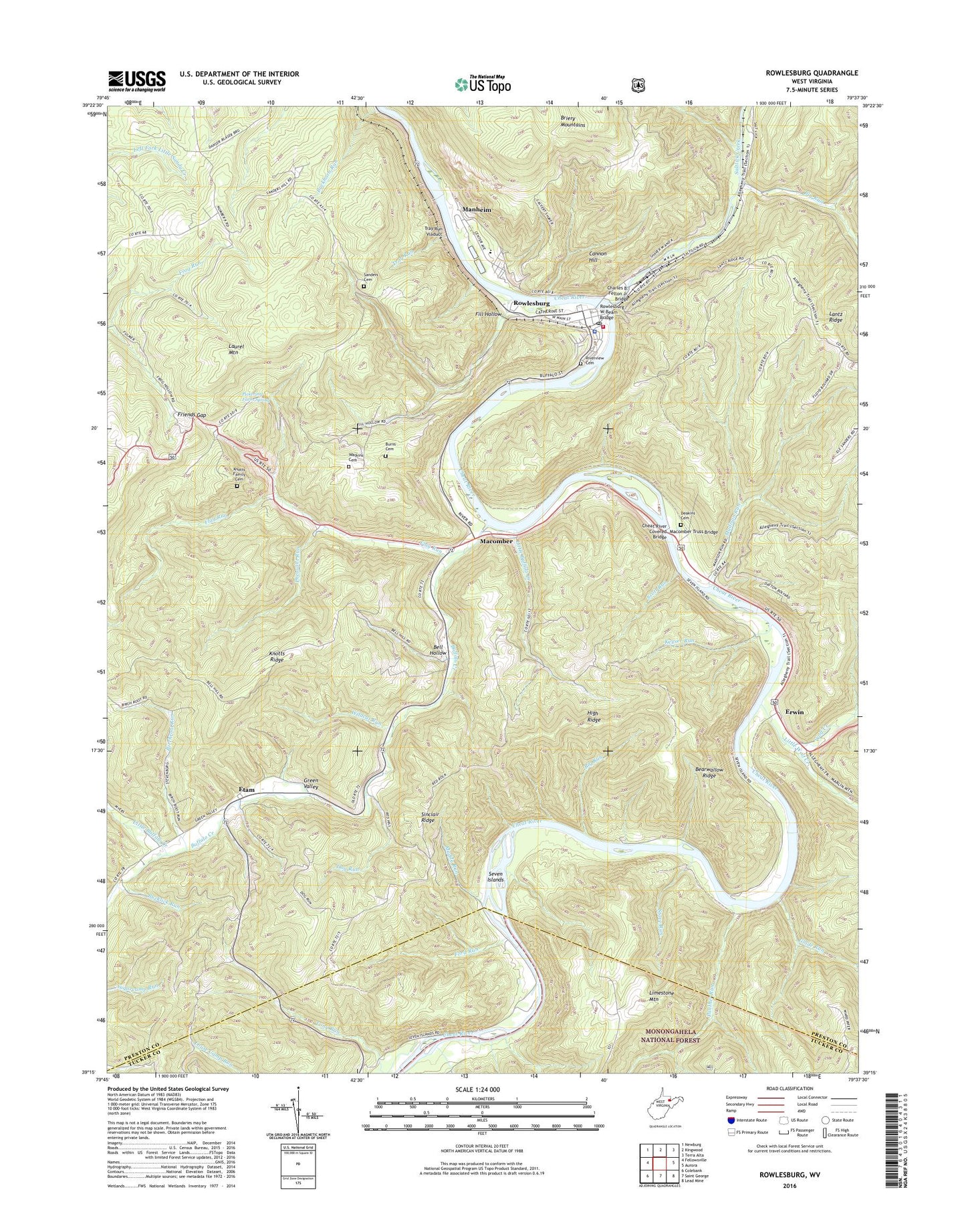
Rowlesburg West Virginia US Topo Map
Couldn't load pickup availability
Also explore the Rowlesburg Forest Service Topo of this same quad for updated USFS data
2023 topographic map quadrangle Rowlesburg in the state of West Virginia. Scale: 1:24000. Based on the newly updated USGS 7.5' US Topo map series, this map is in the following counties: Preston, Tucker. The map contains contour data, water features, and other items you are used to seeing on USGS maps, but also has updated roads and other features. This is the next generation of topographic maps. Printed on high-quality waterproof paper with UV fade-resistant inks.
Quads adjacent to this one:
West: Fellowsville
Northwest: Newburg
North: Kingwood
Northeast: Terra Alta
East: Aurora
Southeast: Lead Mine
South: Saint George
Southwest: Colebank
This map covers the same area as the classic USGS quad with code o39079c6.
Contains the following named places: Bearwallow Ridge, Bell Hollow, Big Run, Birchroot Run, Buckhorn, Buckhorn Run, Bucklick Run, Buffalo Creek, Burns Cemetery, Burns School, Cannon Hill, Charles B. Felton Jr. Bridge, Cheat River Covered Bridge, Christ United Methodist Church, Community Church, Deakins Cemetery, Dog Run, Erwin, Erwin Methodist Church, Etam, Etam United Methodist Church, Fifth District, Fill Hollow, Flag Run, Ford Run, Friends Gap, Glade Run, Green Valley, Hannahsville School, Hardesty, High Ridge, Keyser Run, Knotts Ridge, Little Buffalo Creek, Little Wolf Creek, Macomber, Macomber School, Macomber Truss Bridge, Madison Run, Manheim, Mount Sarah United Methodist Church, Mountain View, Mountain View Church, Mountain View School, Muddy Run, Panther Run, Pheasant Run, Pickering Farm Spring, Pleasant Valley Ford, Pleasant Valley Schoolhouse, Redrock Church, Redrock Schoolhouse, Reno District, Riverview Cemetery, Rowlesburg, Rowlesburg Police Department, Rowlesburg Post Office, Rowlesburg School, Rowlesburg Town Hall, Rowlesburg Volunteer Ambulance Service 10, Rowlesburg Volunteer Fire Department, Rowlesburg W-Beam Bridge, Saint Pauls Methodist Protestant Church, Saint Philomena Catholic Church, Salem School, Saltlick Creek, Sanders Cemetery, Saunders School, Scott Run, Seven Islands, Sinclair Ridge, Stave Run, Town of Rowlesburg, Tray Run, Tray Run Viaduct, Victory Church, Watkins Cemetery, Wildcat Run, Wolf Creek, Wotring Chapel


