MyTopo
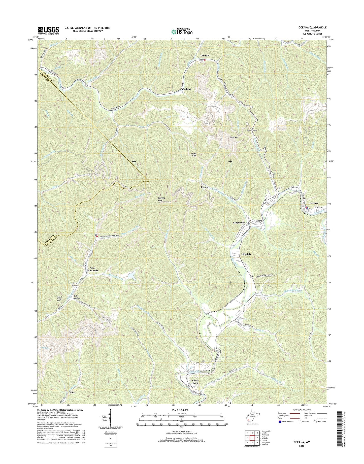
Oceana West Virginia US Topo Map
Couldn't load pickup availability
2023 topographic map quadrangle Oceana in the state of West Virginia. Scale: 1:24000. Based on the newly updated USGS 7.5' US Topo map series, this map is in the following counties: Wyoming, Logan. The map contains contour data, water features, and other items you are used to seeing on USGS maps, but also has updated roads and other features. This is the next generation of topographic maps. Printed on high-quality waterproof paper with UV fade-resistant inks.
Quads adjacent to this one:
West: Mallory
Northwest: Amherstdale
North: Lorado
Northeast: Pilot Knob
East: Matheny
Southeast: Pineville
South: Baileysville
Southwest: Gilbert
This map covers the same area as the classic USGS quad with code o37081f6.
Contains the following named places: Bans Branch, Barn Hollow, Beech Branch, Big Cub Church, Burning Rock, Burning Rock Lookout Tower, Campus, Campus Church of God, Cedar Creek, Clay Branch, Clear Fork, Clear Fork Post Office, Clear Fork Valley Church, Clear Fork Valley Golf Course, Coal Mountain, Coal Mountain Number 9b Mine Refuse Disposal Dam, Coal Mountain Post Office, Coal Mountain School, Coal Mountain Volunteer Fire Department, Cub Trace Branch, Cyclone, Cyclone Church, Cyclone Post Office, Cyclone Volunteer Fire Department, Dave Branch, Dingess Fork, District 3, Doublecamp Branch, Dry Branch, Elk Trace Branch, Elklick Branch, Huff Mountain, Jacob Cook Branch, Joe Branch, Lacoma, Lacoma Baptist Church, Lillydale, Lillydale Census Designated Place, Lillyhaven, Lillyhaven Census Designated Place, Little Branch, Longlick Branch, Lower Gap, Lower Road Branch, Lower Road Branch Lynco Number Two Dam, Lynco, Lynco Number Two Lake, Lynco Post Office, McDonald Fork, McDonald Mill Creek, Milty T Morgan Cemetery, Oceana High School, Oceana Middle School, Oceana Police Department, Oceana Post Office, Oceana Public Library, Oceana Volunteer Fire Department, Oldhouse Branch, Paynter Branch, Reedy Branch, Riggins Branch, Road Branch, Rockhouse Branch, Straight Fork, Sugarcamp Branch, Toler Church, Toler Hollow, Toney Fork, Town of Oceana, Uno, Upper Gap, Upper Road Branch, Upper Sturgeon Branch, Walls Branch, Westside High School, ZIP Codes: 24822, 24857