MyTopo
Skelt West Virginia US Topo Map
Couldn't load pickup availability
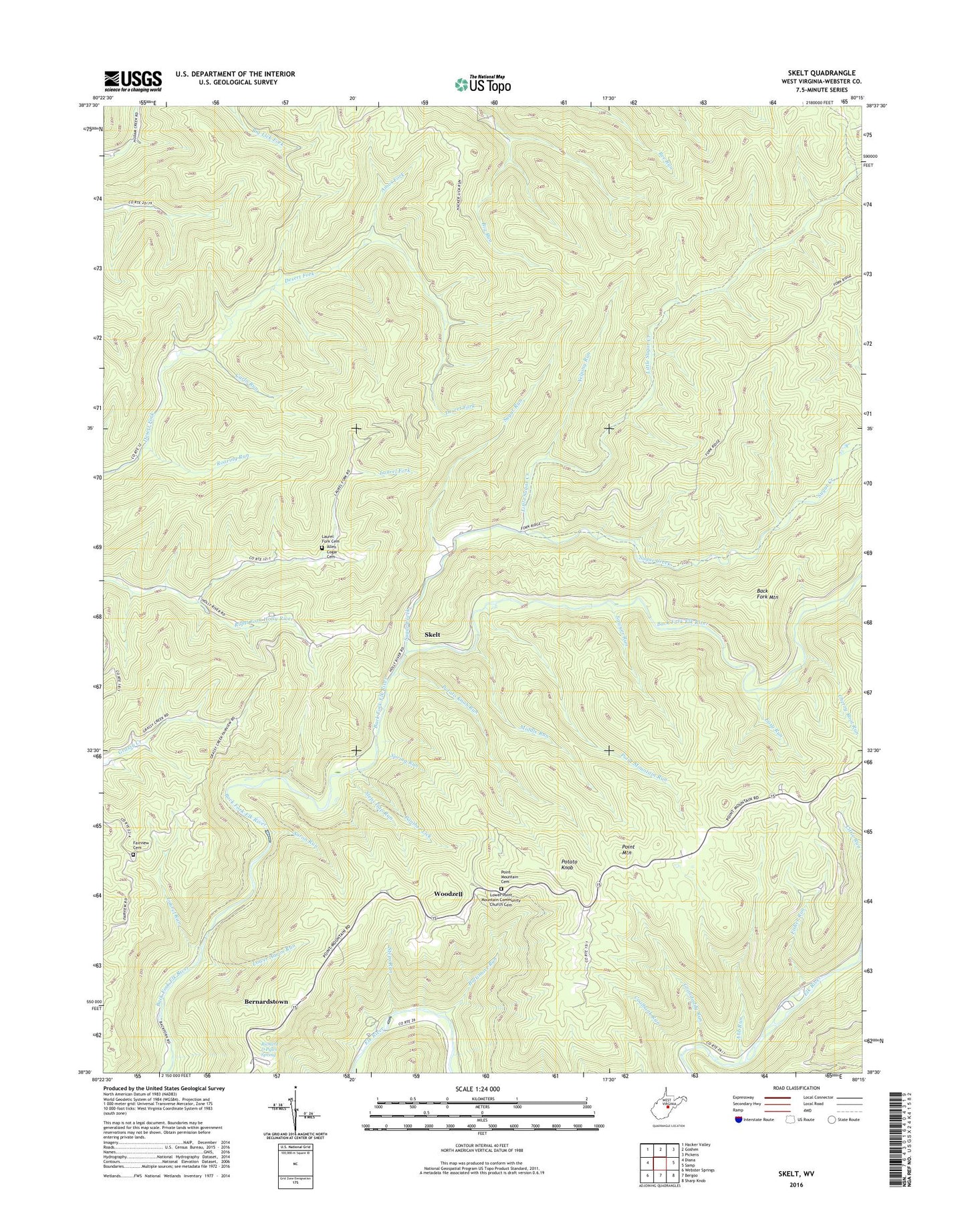
2019 topographic map quadrangle Skelt in the state of West Virginia. Scale: 1:24000. Based on the newly updated USGS 7.5' US Topo map series, this map is in the following counties: Webster. The map contains contour data, water features, and other items you are used to seeing on USGS maps, but also has updated roads and other features. This is the next generation of topographic maps. Printed on high-quality waterproof paper with UV fade-resistant inks.
Quads adjacent to this one:
West: Diana
Northwest: Hacker Valley
North: Goshen
Northeast: Pickens
East: Samp
Southeast: Sharp Knob
South: Bergoo
Southwest: Webster Springs
Contains the following named places: Aaron Run, Abb Run, Allen Cogar Cemetery, Amos Fork, Baltimore Run, Bernardstown, Carlo Run, Cherry Root Run, Chestnut Bottom Church, Chestnut Bottom School, Coalbank Run, Dodrell School, Easy Run, Fairview Cemetery, Fairview Church, Fisher Run, Grandaddy Run, Jumbo School, Laurel Fork, Laurel Fork Cemetery, Laurel Run, Little Sugar Creek, Lower Aaron Run, Lower Point Mountain Community Church Cemetery, McCoy Church, Middle Run, Northern District, Panther Lick, Pantherlick School, Point Mountain Church, Point Mountain Lookout Tower, Point Mountain Run, Potato Knob, Potato Knob Run, Richard D Pyles Spring, Roaring Run, Sand Lick Church, Sawyer Run, Skelt, Spring Run, Steps Gap Run, Steps Run, Sugar Creek, Sugar Run, Woodzell, Yelping Run, ZIP Code: 26288