MyTopo
Springfield West Virginia US Topo Map
Couldn't load pickup availability
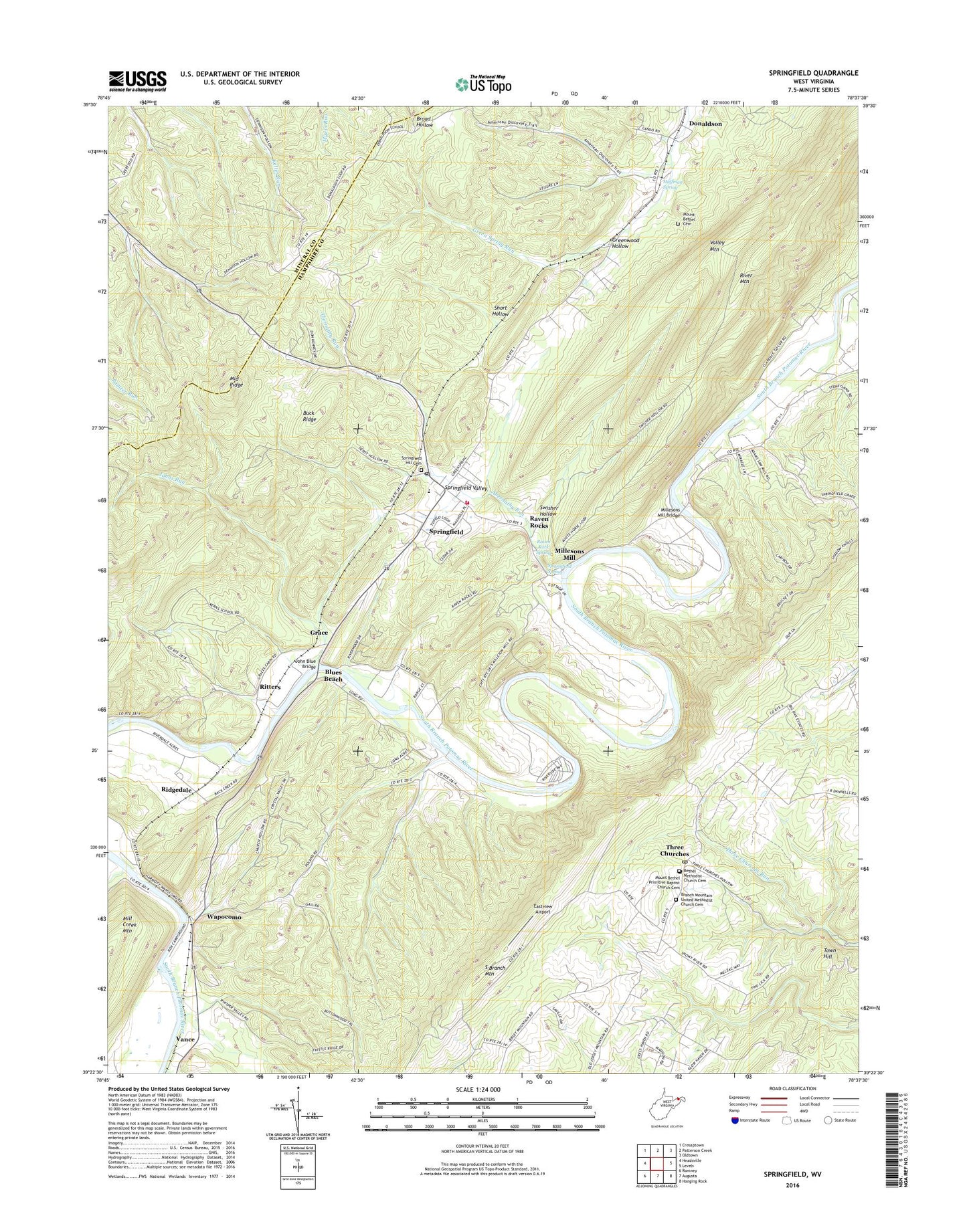
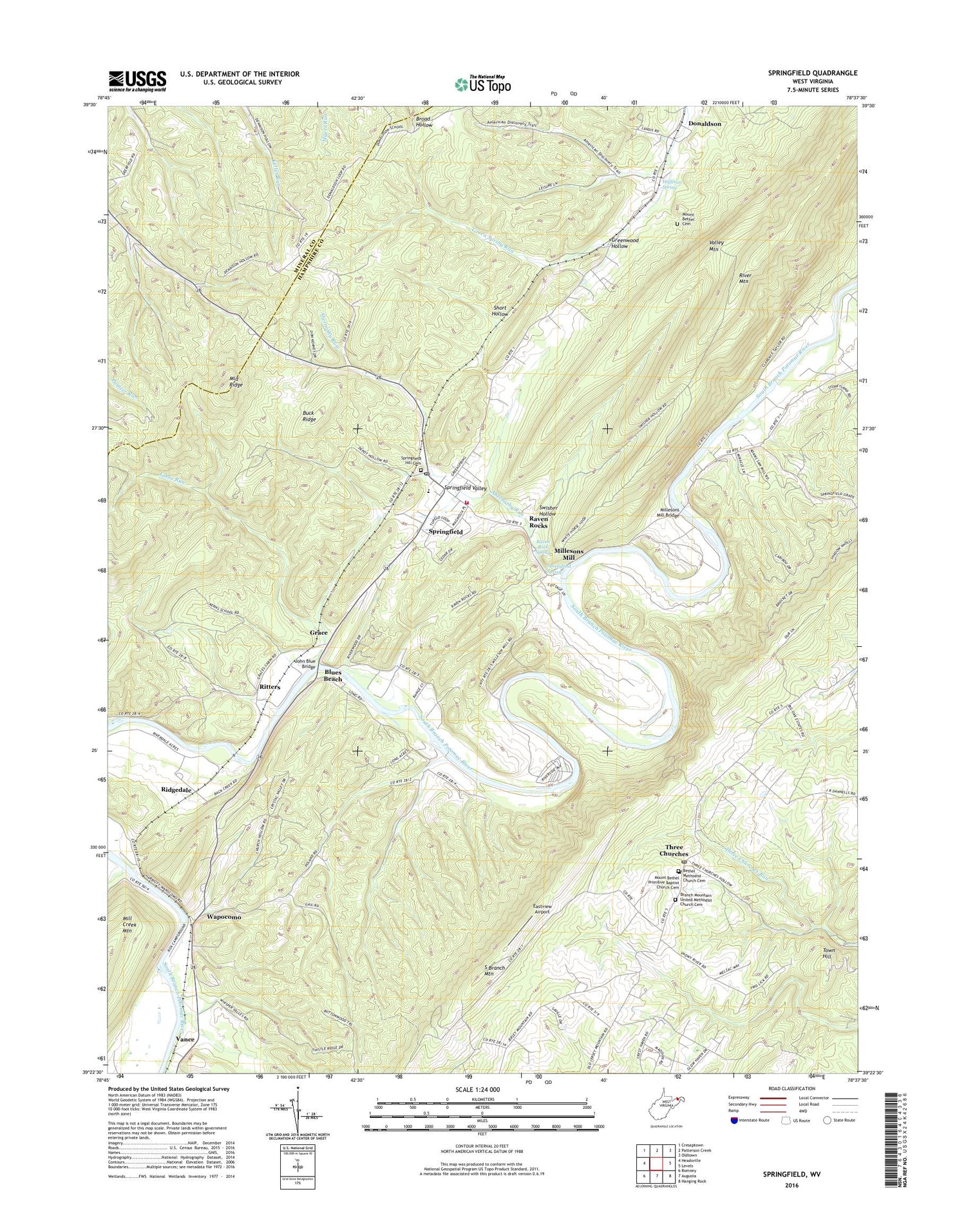
2019 topographic map quadrangle Springfield in the state of West Virginia. Scale: 1:24000. Based on the newly updated USGS 7.5' US Topo map series, this map is in the following counties: Hampshire, Mineral. The map contains contour data, water features, and other items you are used to seeing on USGS maps, but also has updated roads and other features. This is the next generation of topographic maps. Printed on high-quality waterproof paper with UV fade-resistant inks.
Quads adjacent to this one:
West: Headsville
North: Patterson Creek
Northeast: Oldtown
East: Levels
Southeast: Hanging Rock
South: Augusta
Southwest: Romney
Contains the following named places: Abernathy Run, Bethel Methodist Church Cemetery, Blues Beach, Branch Mountain Cemetery, Branch Mountain Methodist Church, Branch Mountain United Methodist Church Cemetery, Buck Ridge, Buffalo Creek, Cornwell School, Dennison Church, Dewey School, Donaldson, Donaldson School, Eastview Airport, Fox Run, Grace, Greenwood Hollow, Huffman Spring, Jersey School, John Blue Bridge, Johns Run, Kerns School, Kincade School, Middle Ridge, Milleson, Millesons Mill, Millesons Mill Bridge, Mount Bethel Cemetery, Mount Bethel Presbyterian Church, Mount Zion Baptist Church, Poland School, Raven Rock Spring, Raven Rocks, Ridgedale, Ritters, River Mountain, Short Hollow, Springfield, Springfield - Green Spring Elementary School, Springfield Area Rescue Squad, Springfield Census Designated Place, Springfield District, Springfield Hill Cemetery, Springfield Post Office, Springfield Spring, Springfield Valley, Springfield Valley Volunteer Fire Department, Springfield Wildlife Management Area, Swisher Hollow, Taylor School, Three Churches, Three Churches Post Office, Valley Mountain, Vance, Wapocomo, ZIP Code: 26763