MyTopo
Sylvester West Virginia US Topo Map
Couldn't load pickup availability
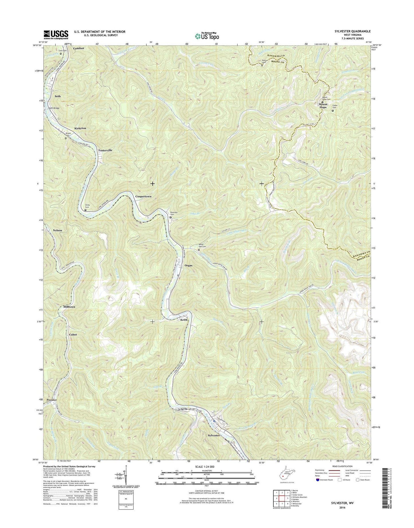
2019 topographic map quadrangle Sylvester in the state of West Virginia. Scale: 1:24000. Based on the newly updated USGS 7.5' US Topo map series, this map is in the following counties: Boone, Kanawha. The map contains contour data, water features, and other items you are used to seeing on USGS maps, but also has updated roads and other features. This is the next generation of topographic maps. Printed on high-quality waterproof paper with UV fade-resistant inks.
Quads adjacent to this one:
West: Williams Mountain
Northwest: Racine
North: Belle
Northeast: Cedar Grove
East: Eskdale
Southeast: Dorothy
South: Whitesville
Southwest: Wharton
Contains the following named places: Big Jarrells Creek, Bowen Cemetery, Cabot, Coon Cemetery, Coon Fork, Coopertown, Foster Cemetery, Fosterville, Fourmile Branch, Gidd Branch, Haggle Branch, Horse Branch, Jakes Branch, Joes Creek, Keith, Kirbyton, Laurel Creek, Lavinia Fork, Left Fork Joes Creek, Left Fork White Oak Creek, Little Elk Creek, Little White Oak Creek, Logan Fork, Mile Branch, Mill Branch, Milltown, Mount Herman Church, Mount Hope, Mount Hope Cemetery, Nelson, Orgas, Orgas Post Office, Oxley Cemetery, Pack Branch, Pettry Cemetery, Pineview Cemetery, Right Fork White Oak Creek, Road Fork, Roundbottom Branch, Seng Fork, Seth, Seth Bridge, Seth Post Office, Sherman High School, Sherman Junior High School, Spruce Fork, Stover Branch, Sylvester, Sylvester Elementary School, Sylvester Police Department, Sylvester Post Office, Threemile Branch, Town of Sylvester, Twomile Branch, White Oak Cemetery, White Oak Creek, ZIP Codes: 25049, 25148, 25193