MyTopo
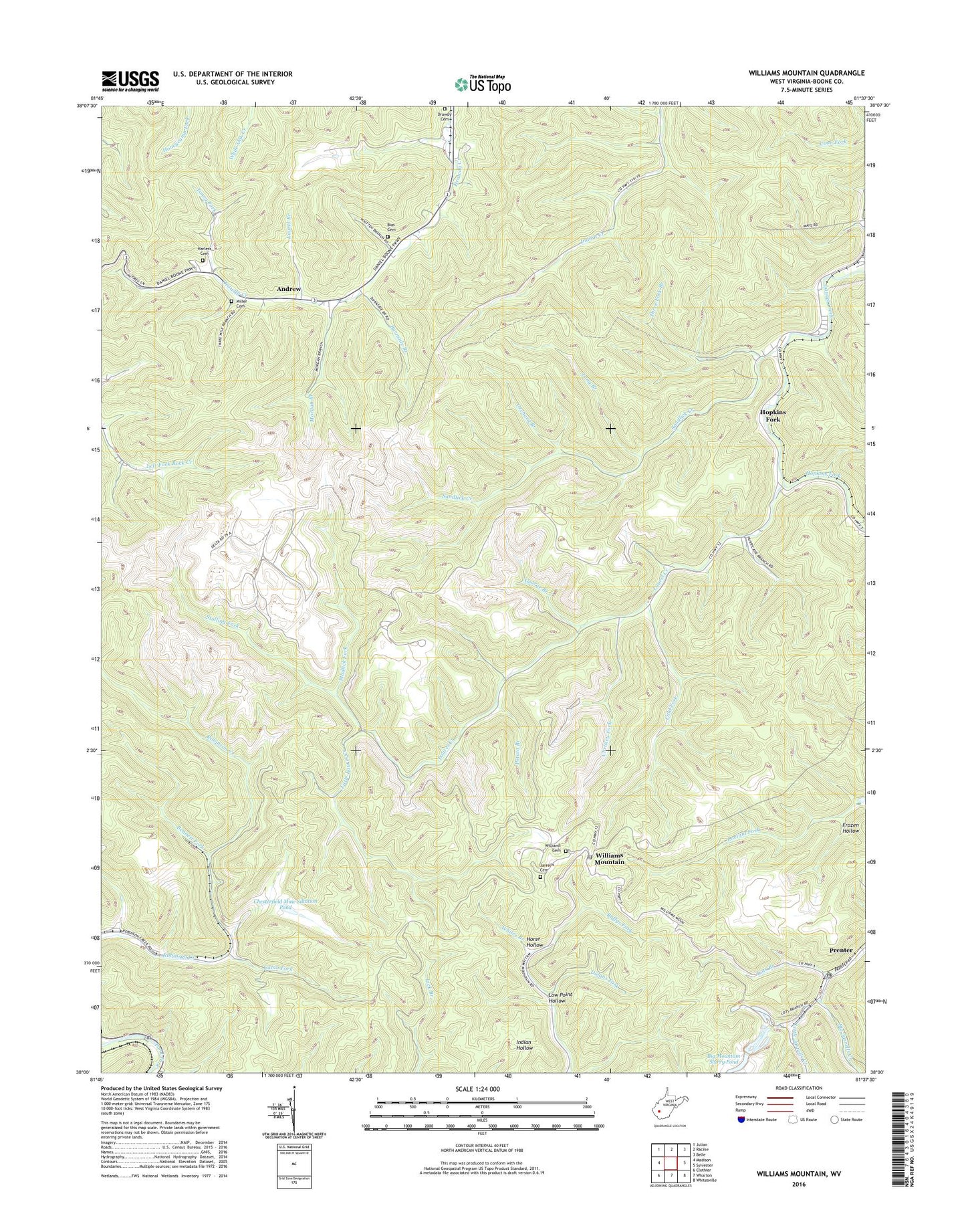
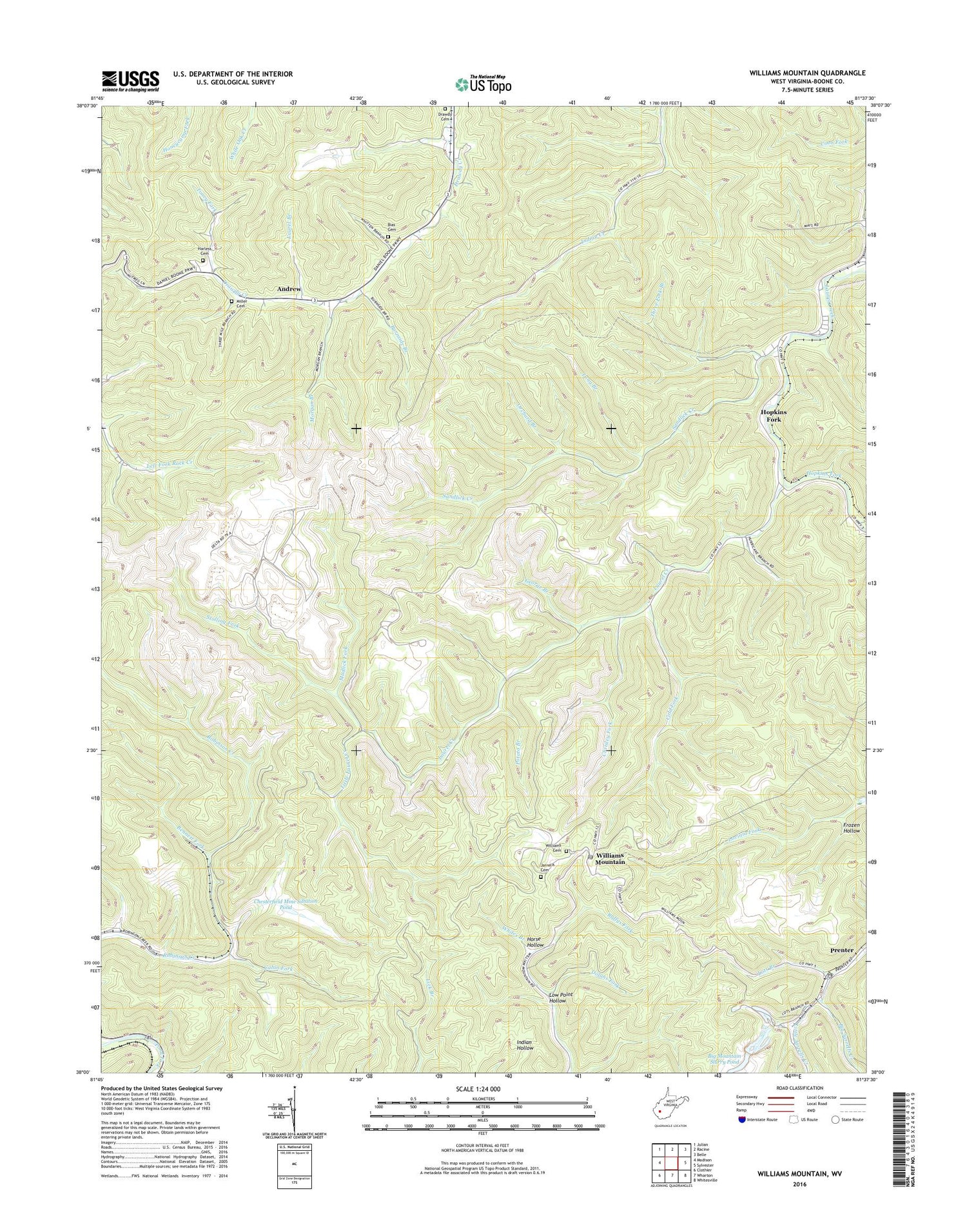
Williams Mountain West Virginia US Topo Map
Couldn't load pickup availability
2023 topographic map quadrangle Williams Mountain in the state of West Virginia. Scale: 1:24000. Based on the newly updated USGS 7.5' US Topo map series, this map is in the following counties: Boone. The map contains contour data, water features, and other items you are used to seeing on USGS maps, but also has updated roads and other features. This is the next generation of topographic maps. Printed on high-quality waterproof paper with UV fade-resistant inks.
Quads adjacent to this one:
West: Madison
Northwest: Julian
North: Racine
Northeast: Belle
East: Sylvester
Southeast: Whitesville
South: Wharton
Southwest: Clothier
This map covers the same area as the classic USGS quad with code o38081a6.
Contains the following named places: Andrew, Atha Chapel, Bennett Fork, Bias Cemetery, Big Mountain Slurry Pond, Boone County, Burnside Branch, Cabin Fork, Chesterfield Mine Siltation Pond, Chrisley Fork, Cold Fork, District 1, Dolans Fork, Drawdy Cemetery, Drawdy Church, Drawdy Creek Church, Frozen Hollow, George Branch, Harless Cemetery, Hopkins Fork, Horse Hollow, Jarrells Cemetery, Laurel Branch, Little Jarrells Creek, Little Laurel Creek, Long Branch, Lots Branch, Lotts Branch Slurry Impoundment Dam, Low Point Hollow, Miller Cemetery, Morgan Branch, Mudlick Fork, Orchard Branch, Potato Branch, Prenter, Prenter Post Office, Road Fork Dam Number 1 Upper, Road Fork Dam Number 2 Lower, Ruffys Fork, Sandlick Creek, Sterling, Stolling Fork, Three Fork Branch, Toney Fork, Williams Cemetery, Williams Hill Lookout Tower, Williams Mountain, Williams Mountain Post Office, ZIP Codes: 25154, 25181