MyTopo
Eskdale West Virginia US Topo Map
Couldn't load pickup availability
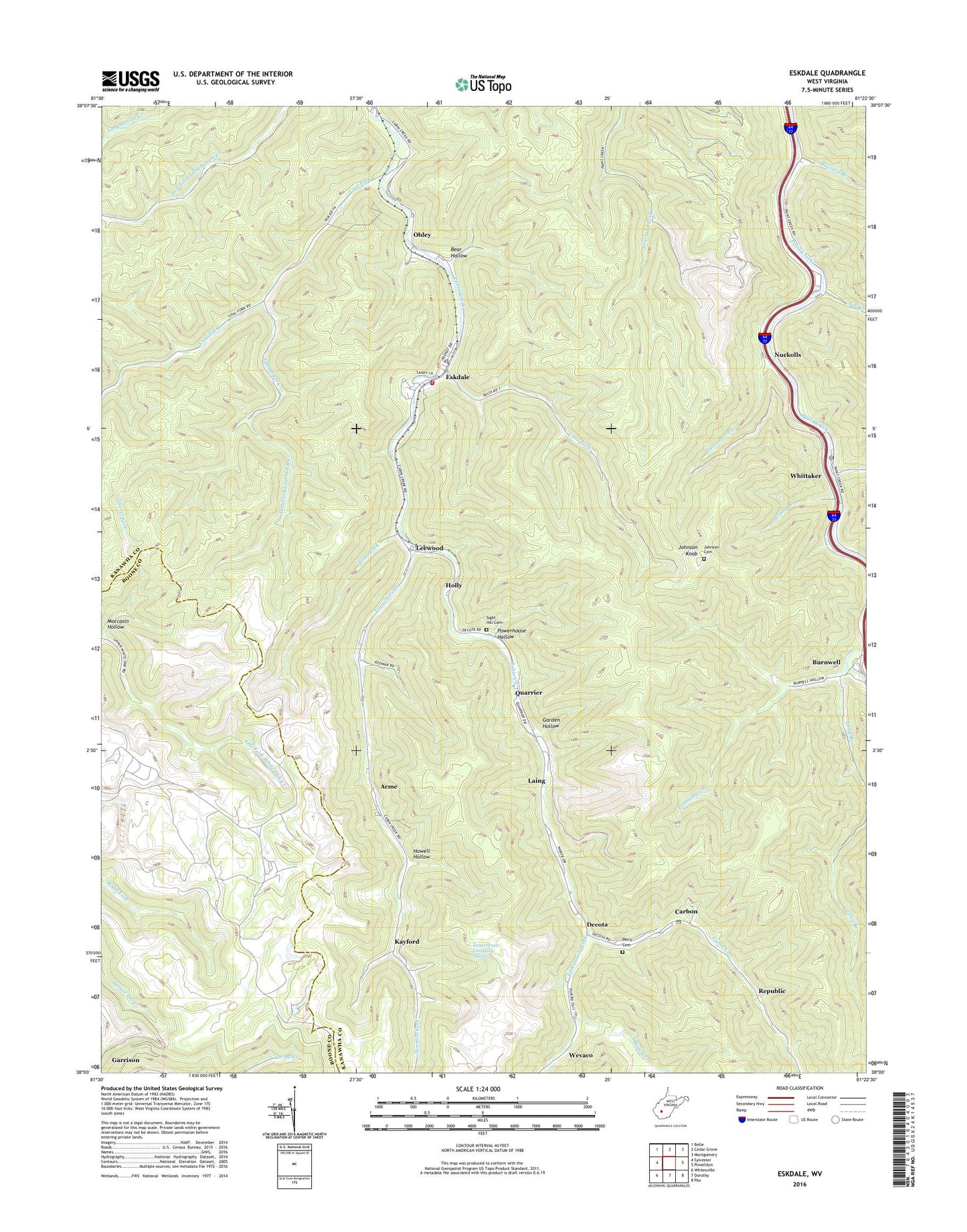
2023 topographic map quadrangle Eskdale in the state of West Virginia. Scale: 1:24000. Based on the newly updated USGS 7.5' US Topo map series, this map is in the following counties: Kanawha, Boone. The map contains contour data, water features, and other items you are used to seeing on USGS maps, but also has updated roads and other features. This is the next generation of topographic maps. Printed on high-quality waterproof paper with UV fade-resistant inks.
Quads adjacent to this one:
West: Sylvester
Northwest: Belle
North: Cedar Grove
Northeast: Montgomery
East: Powellton
Southeast: Pax
South: Dorothy
Southwest: Whitesville
This map covers the same area as the classic USGS quad with code o38081a4.
Contains the following named places: Abbott Creek, Acme, Ash Branch, Bear Hollow, Brushy Branch, Burnwell, Buzzard Branch, Cabin Creek Volunteer Fire Department, Cane Fork, Cane Fork Yards, Carbon, Carbon Post Office, Coal, Coal Fork, Decota, Eskdale, Eskdale Census Designated Place, Eskdale Post Office, Fifteenmile Fork, Garden Hollow, Holly, Howell Hollow, Hurricane Branch, Johnson Cemetery, Johnson Knob, Johnson Knob Lookout Tower, Kayford, Laing, Laurel Fork, Leewood, Left Fork Laurel Fork, Long Branch, Moccasin Hollow, Nuckolls, Ohley, Perry Cemetery, Powerhouse Hollow, Quarrier, Red Warrior, Republic, Saint Johns Church, Sight Hill Cemetery, Tenmile Fork, Toms Branch, Toms Fork, Truax-Traer Company Spring, Wake Forest School, Wevaco, Whittaker, Whittaker Post Office, ZIP Codes: 25054, 25075