MyTopo
Upper Tract West Virginia US Topo Map
Couldn't load pickup availability
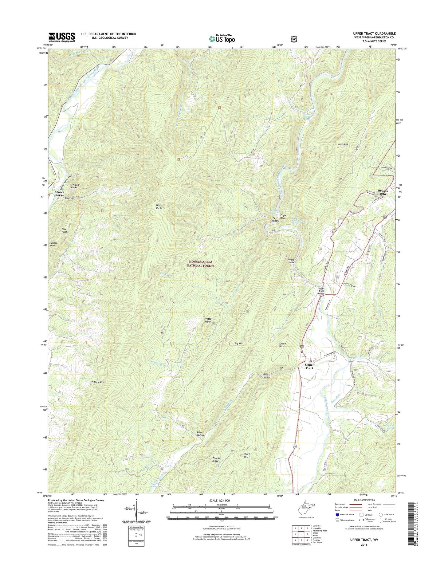
2019 topographic map quadrangle Upper Tract in the state of West Virginia. Scale: 1:24000. Based on the newly updated USGS 7.5' US Topo map series, this map is in the following counties: Pendleton. The map contains contour data, water features, and other items you are used to seeing on USGS maps, but also has updated roads and other features. This is the next generation of topographic maps. Printed on high-quality waterproof paper with UV fade-resistant inks.
Quads adjacent to this one:
West: Onego
Northwest: Laneville
North: Hopeville
Northeast: Petersburg West
East: Mozer
Southeast: Fort Seybert
South: Franklin
Southwest: Circleville
Contains the following named places: Alt Farm Spring, Big Mountain, Big Spring, Briggs Run, Cave Mountain, Deer Run, Dry Hollow, Dry Run, Eagle Rock, Eagle Rock Spring, Eliza Hollow, Evergreen Church, Harper Knob, Hermit Island Spring, High Knob, Kyle School, Little Mountain, Long Hollow, Mill Run, Mount Hope Church, North Fork Mountain Lookout Tower, North Mountain Trail, Pretty Ridge, Pretty Ridge School, Reeds Creek, Reeds Creek Church, Reeds Creek School, Roy Gap, Saint Georges Church, Seneca Creek, Seneca Rock Elementary School, Seneca Rocks, Seneca Rocks Recreation Site, Seneca Rocks Visitor Center, Seneca School, Shuckleford Run, Smoke Hole Campground, Smoke Hole Church, South Branch Trail, Twin Run, Upper Tract, Upper Tract Bridge, Upper Tract Post Office, Upper Tract Volunteer Fire Department Company 3, Upper Tract Volunteer Fire Department Regional Training Center, Waggy Farm Spring, Wilson Church