MyTopo
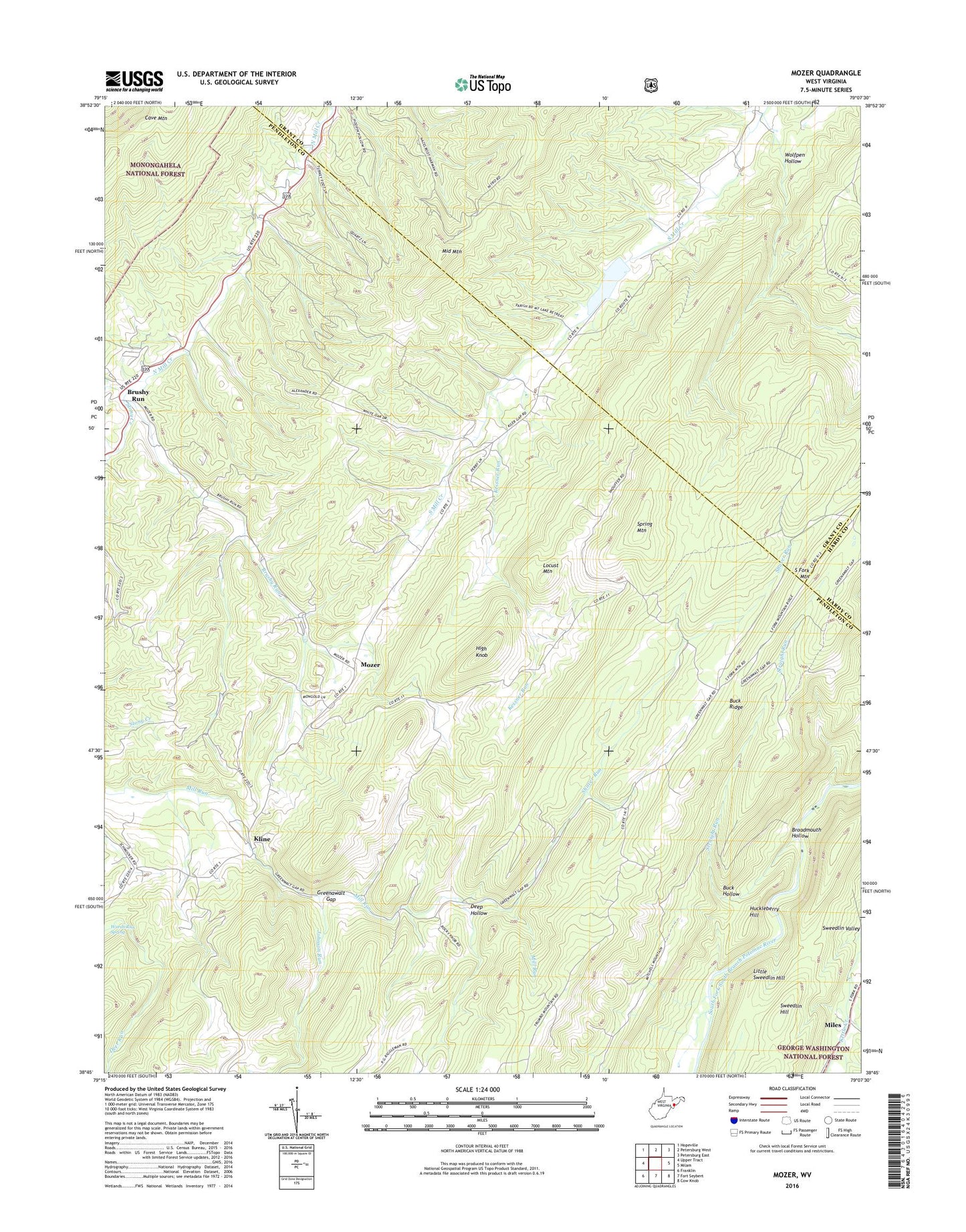
Mozer West Virginia US Topo Map
Couldn't load pickup availability
Also explore the Mozer Forest Service Topo of this same quad for updated USFS data
2023 topographic map quadrangle Mozer in the state of West Virginia. Scale: 1:24000. Based on the newly updated USGS 7.5' US Topo map series, this map is in the following counties: Pendleton, Grant, Hardy. The map contains contour data, water features, and other items you are used to seeing on USGS maps, but also has updated roads and other features. This is the next generation of topographic maps. Printed on high-quality waterproof paper with UV fade-resistant inks.
Quads adjacent to this one:
West: Upper Tract
Northwest: Hopeville
North: Petersburg West
Northeast: Petersburg East
East: Milam
Southeast: Cow Knob
South: Fort Seybert
Southwest: Franklin
This map covers the same area as the classic USGS quad with code o38079g2.
Contains the following named places: Alt School, Borror School, Broadmouth Hollow, Brushy Run, Buck Hollow, Buck Ridge, Camp Run, Deep Hollow, Greenawalt Gap, Greenawalt School, High Knob, High Ridge School, High Rock School, Huckleberry Hill, Johnson Run, Judy School, Kessner Run, Kline, Little Sweedlin Hill, Locust Mountain, Lough School, Middle Mountain, Miles, Mount Horeb Church, Mozer, Schmucker School, Seemly, Shaver Run, South Mill Creek Church, Spring Mountain, Stony Creek, Straight Run, Trinity Church, Wards Run Spring, Wolfpen Hollow, ZIP Code: 26866