MyTopo
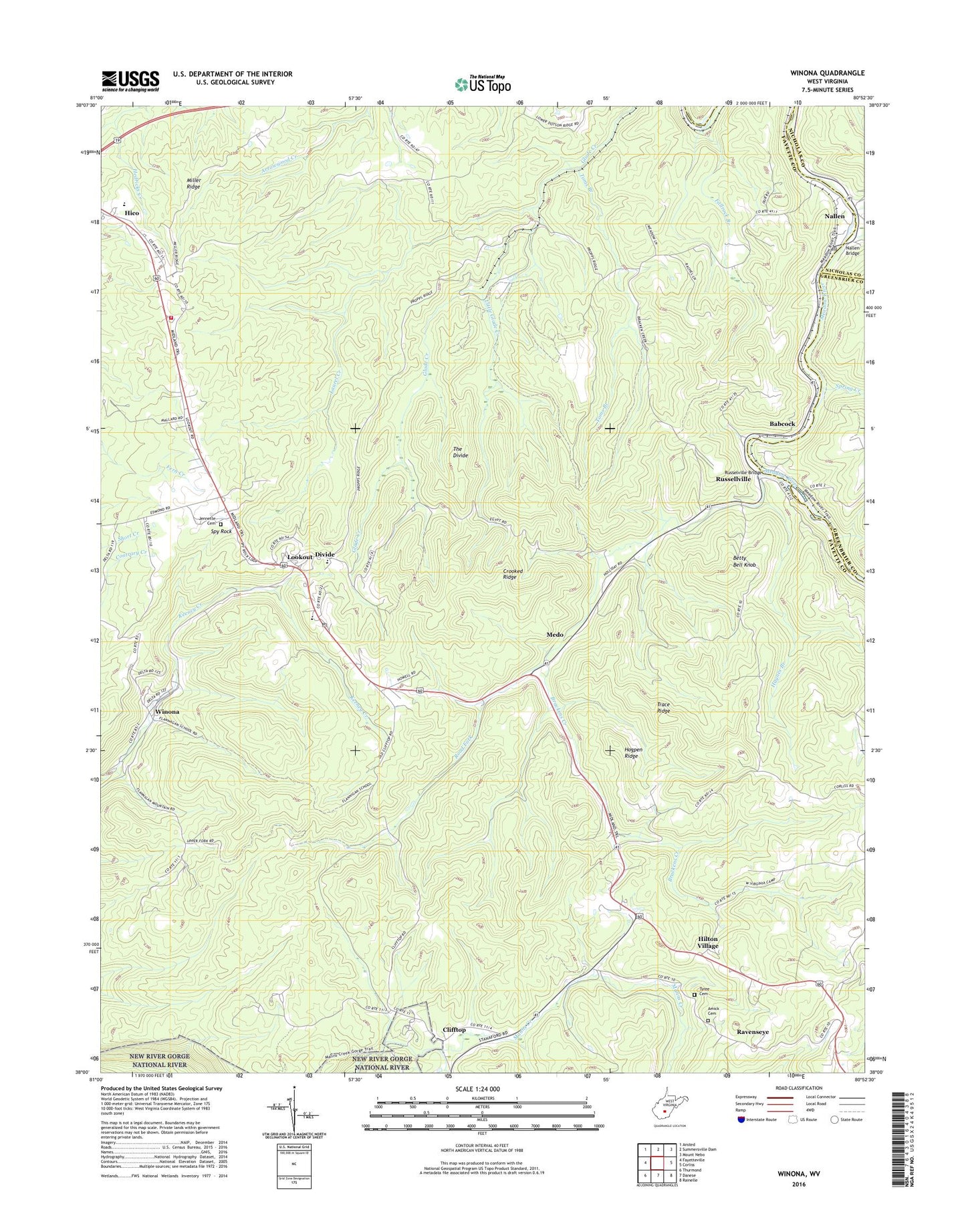
Winona West Virginia US Topo Map
Couldn't load pickup availability
2019 topographic map quadrangle Winona in the state of West Virginia. Scale: 1:24000. Based on the newly updated USGS 7.5' US Topo map series, this map is in the following counties: Fayette, Greenbrier, Nicholas. The map contains contour data, water features, and other items you are used to seeing on USGS maps, but also has updated roads and other features. This is the next generation of topographic maps. Printed on high-quality waterproof paper with UV fade-resistant inks.
Quads adjacent to this one:
West: Fayetteville
Northwest: Ansted
North: Summersville Dam
Northeast: Mount Nebo
East: Corliss
Southeast: Rainelle
South: Danese
Southwest: Thurmond
Contains the following named places: Amick Cemetery, Babcock, Bays Chapel, Bays School, Betty Bell Knob, Brackens Creek, Brackens Creek Church, Chesnut Grove School, Chestnut Grove Church, Clifftop, Crooked Ridge, Divide, Divide Elementary School, Dubree, Fallrock Branch, Flannigan School, Floyd Creek, Haynes Branch, Haynes School, Hilton Village, Hogpen Ridge, Jennette Cemetery, Laurel Creek, Little Glade Creek, Lookout, Lookout Census Designated Place, Lookout Post Office, Medo, Midland Trail High School, Miller Church, Miller Ridge, Nallen, Nallen Bridge, Nallen Post Office, New Haven District, Nuttall Middle School, Nuttall Volunteer Fire Department, Old Stone House, Pleasant Hill School, Prosperity School, Ravenseye, Road Fork, Russellville, Russelville Bridge, Shawver School, Shelton School, Spring Creek, Spy Rock, The Divide, Toms Branch, Trace Ridge, Tyree Cemetery, West Virginia State College 4-H Camp, Winona, Winona Census Designated Place, Withrows Mill, Youngs Creek, ZIP Codes: 25868, 25942