MyTopo
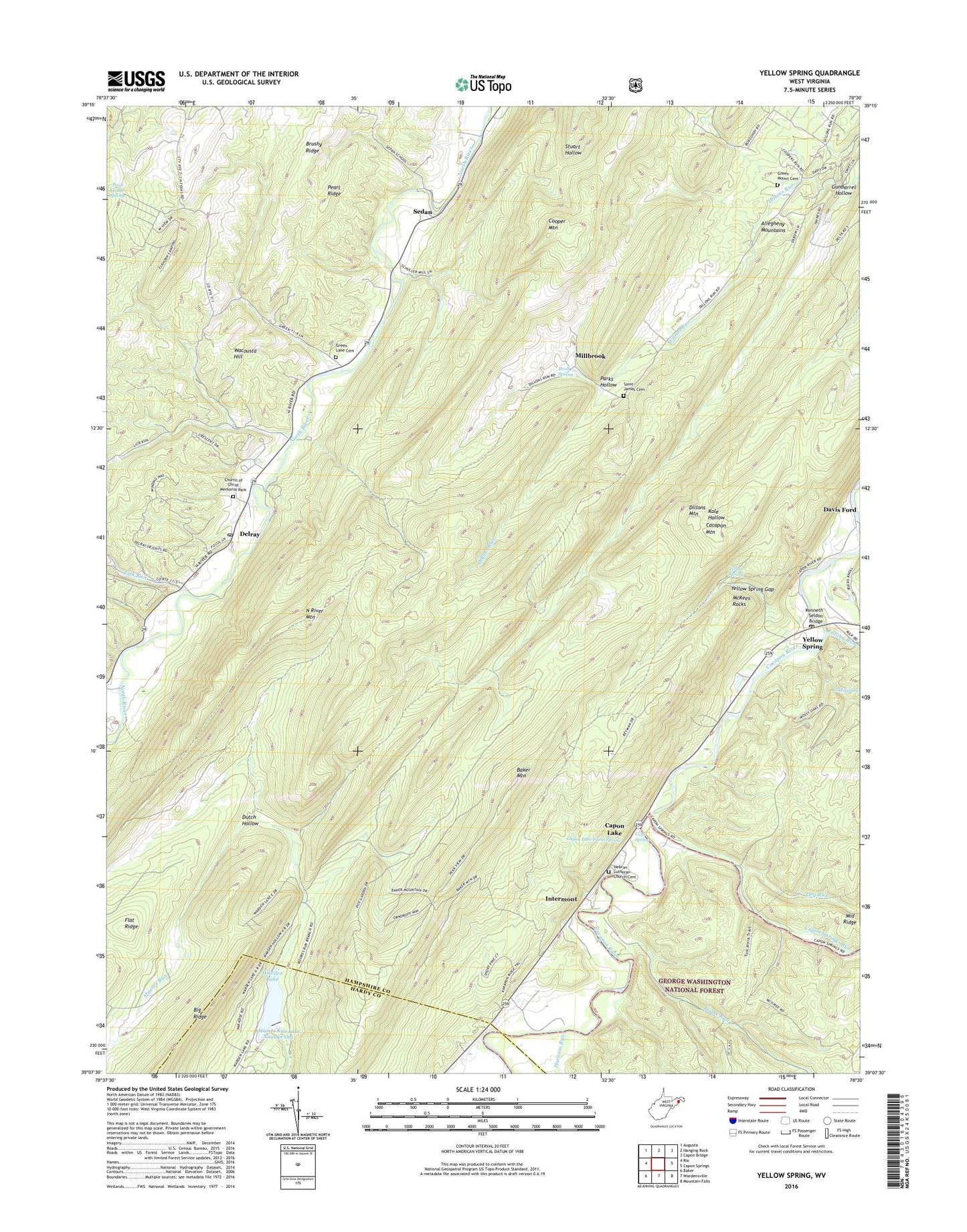
Yellow Spring West Virginia US Topo Map
Couldn't load pickup availability
Also explore the Yellow Spring Forest Service Topo of this same quad for updated USFS data
2023 topographic map quadrangle Yellow Spring in the state of West Virginia. Scale: 1:24000. Based on the newly updated USGS 7.5' US Topo map series, this map is in the following counties: Hampshire, Hardy. The map contains contour data, water features, and other items you are used to seeing on USGS maps, but also has updated roads and other features. This is the next generation of topographic maps. Printed on high-quality waterproof paper with UV fade-resistant inks.
Quads adjacent to this one:
West: Rio
Northwest: Augusta
North: Hanging Rock
Northeast: Capon Bridge
East: Capon Springs
Southeast: Mountain Falls
South: Wardensville
Southwest: Baker
This map covers the same area as the classic USGS quad with code o39078b5.
Contains the following named places: Baker Mountain, Beall Spring, Brushy Ridge, Capon District, Capon Lake, Capon Lake Farm Spring, Capon Springs Run, Capon Springs Station, Church of Christ Memorial Park, Cold Spring, Davis Ford, Delray, Delray Post Office, Dillons Mountain, Dillons Run, Dry Run, Elkhorn Lake Dam, Elkhorn Run, Falling Run, Green Lane Cemetery, Green Mound Cemetery, Green Mountain Church, Gunbarrel Hollow, Harness Run, Hawk Run, Hebron Church, Hebron Lutheran Church Cemetery, Intermont, Kenneth Seldon Bridge, Lick Run, McKees Rocks, Mick Run School, Millbrook, Moores Run Lake Number One, North River Mountain, North Texas School, Parks Hollow, Paul Keister Spring, Pearl Ridge, Saint James Cemetery, Sedan, Union Church, Wacousta Hill, Warden Lake, Warden Lake Dam, Warden Lake Wildlife Management Area, Yellow Spring, Yellow Spring Gap, Yellow Spring Post Office, ZIP Code: 26865