MyTopo
Elk Creek Lake Wisconsin US Topo Map
Couldn't load pickup availability
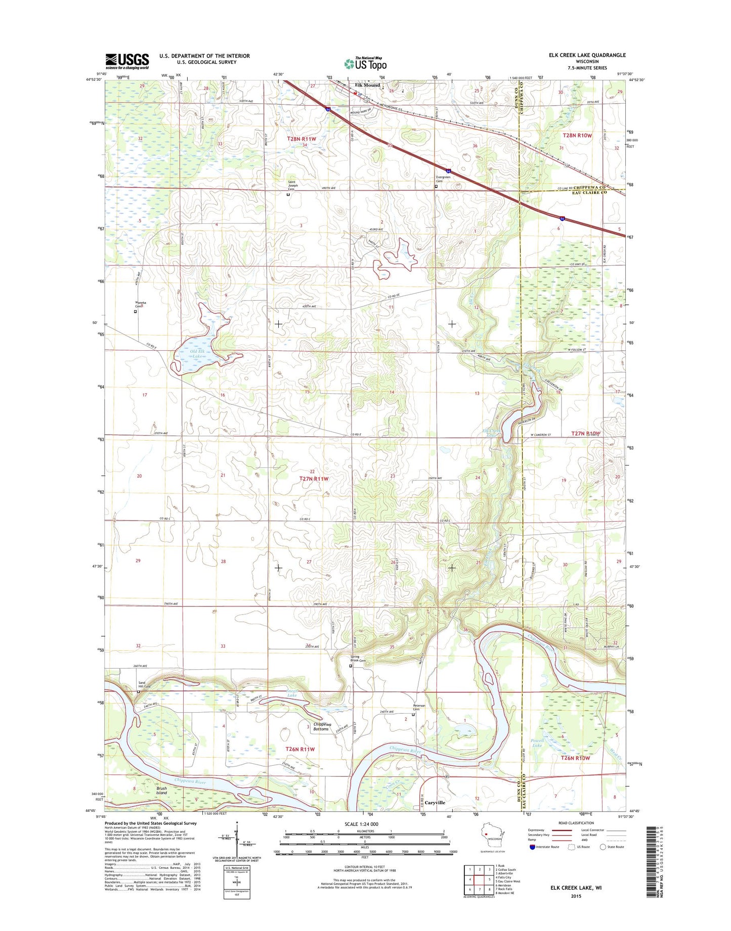
2022 topographic map quadrangle Elk Creek Lake in the state of Wisconsin. Scale: 1:24000. Based on the newly updated USGS 7.5' US Topo map series, this map is in the following counties: Dunn, Eau Claire, Chippewa. The map contains contour data, water features, and other items you are used to seeing on USGS maps, but also has updated roads and other features. This is the next generation of topographic maps. Printed on high-quality waterproof paper with UV fade-resistant inks.
Quads adjacent to this one:
West: Falls City
Northwest: Rusk
North: Colfax South
Northeast: Albertville
East: Eau Claire West
Southeast: Mondovi NE
South: Rock Falls
Southwest: Meridean
This map covers the same area as the classic USGS quad with code o44091g6.
Contains the following named places: Amey School, Amy Chapel, Brush Island, Caryville, Caryville Savanna State Natural Area, Chippewa Bottoms, Elk Creek, Elk Creek Lake, Elk Creek State Public Fishing Area, Elk Creek WP247 Dam, Elk Mound, Elk Mound Fire Department, Elk Mound High School, Elk Mound Police Department, Elk Mound Post Office, Evergreen Cemetery, Faith Church, Fishermans Park, Fosbroke School, Mound View Elementary School, Oakland School, Old Elk Lake, Old Meridean Ferry, Peterson Cemetery, Powell Lake, Prairie Center School, Saint Joseph Cemetery, Sand Hill Cemetery, Sneen Lake, Springbrook Lutheran Cemetery, Town of Spring Brook, Village of Elk Mound, Waneka Cemetery, Waneka School, West Creek, ZIP Code: 54739