MyTopo
Arkdale NW Wisconsin US Topo Map
Couldn't load pickup availability
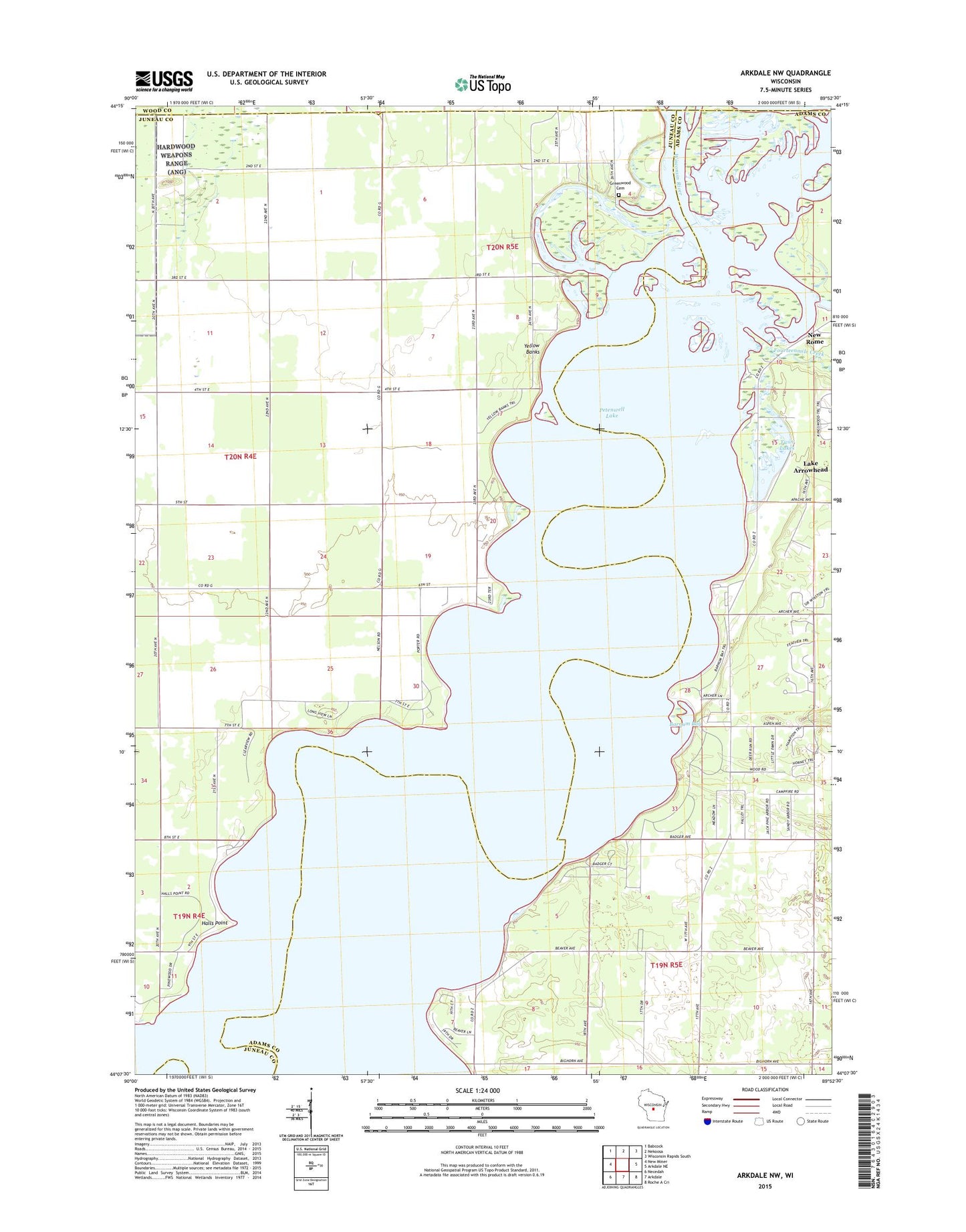
2022 topographic map quadrangle Arkdale NW in the state of Wisconsin. Scale: 1:24000. Based on the newly updated USGS 7.5' US Topo map series, this map is in the following counties: Juneau, Adams, Wood. The map contains contour data, water features, and other items you are used to seeing on USGS maps, but also has updated roads and other features. This is the next generation of topographic maps. Printed on high-quality waterproof paper with UV fade-resistant inks.
Quads adjacent to this one:
West: New Miner
Northwest: Babcock
North: Nekoosa
Northeast: Wisconsin Rapids South
East: Arkdale NE
Southeast: Roche A Cri
South: Arkdale
Southwest: Necedah
This map covers the same area as the classic USGS quad with code o44089b8.
Contains the following named places: Barnum Bay, Chester Creek, Cranberry Rock Lookout Tower, Fourteenmile Creek, Greenwood Cemetery, Halls Point, Monroe Park, New Rome, New Rome Church, Petenwell Lake, Petenwell Wilderness Park, Twin Lakes, Violet Lawn School, Yellow Banks, ZIP Code: 54457