MyTopo
Ashland East Wisconsin US Topo Map
Couldn't load pickup availability
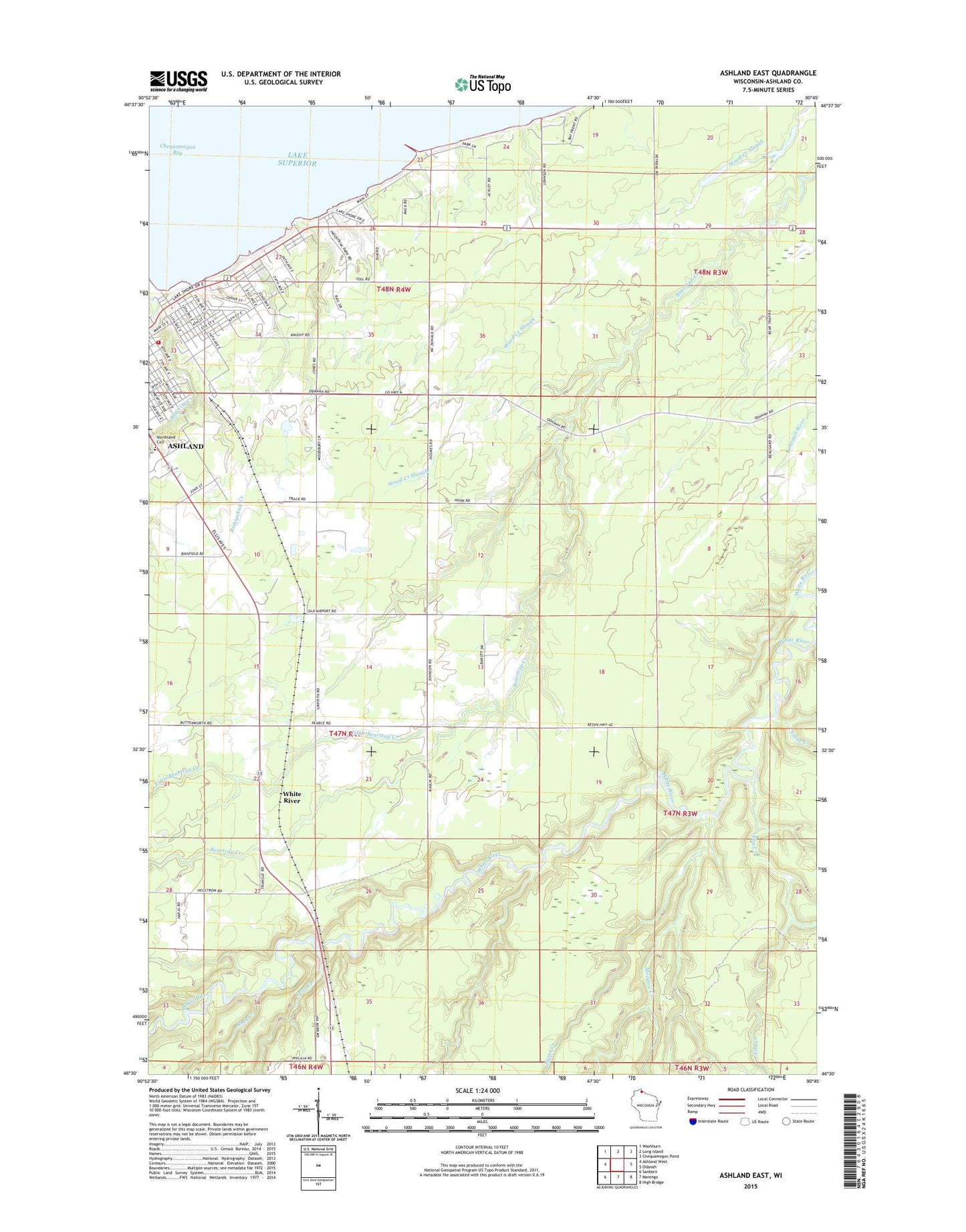
2022 topographic map quadrangle Ashland East in the state of Wisconsin. Scale: 1:24000. Based on the newly updated USGS 7.5' US Topo map series, this map is in the following counties: Ashland. The map contains contour data, water features, and other items you are used to seeing on USGS maps, but also has updated roads and other features. This is the next generation of topographic maps. Printed on high-quality waterproof paper with UV fade-resistant inks.
Quads adjacent to this one:
West: Ashland West
Northwest: Washburn
North: Long Island
Northeast: Chequamegon Point
East: Odanah
Southeast: High Bridge
South: Marengo
Southwest: Sanborn
This map covers the same area as the classic USGS quad with code o46090e7.
Contains the following named places: Ashland County Teachers College, Ashland Wastewater Treatment Plant, Bay City School, Bayfront Census Designated Place, Bishigokwe Creek, City of Ashland, Deer Creek, Ellis Park, Ellis School, Elm Creek, Hodgkins Park, Hyms Creek, Lake Park, Lake Shore School, Little Beartrap Creek, Meadow Creek, Memorial Hall, Memorial Library, Northland College, Rock Creek, Silver Creek, Thornapple Creek, Town of Gingles, WATW Radio Tower (Sturgeon Bay), WATW-AM (Ashland), Wheeler Hall, White River, WJJH-FM (Ashland), ZIP Code: 54806