MyTopo
Barneveld Wisconsin US Topo Map
Couldn't load pickup availability
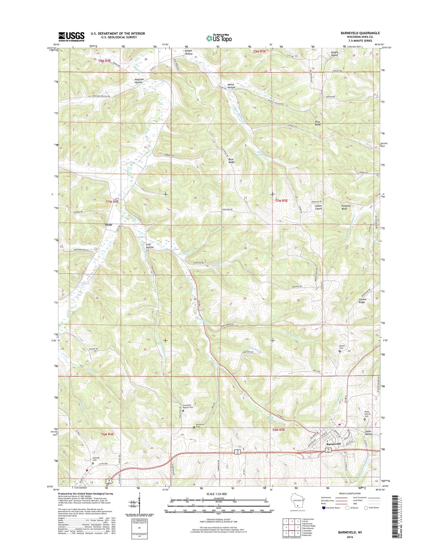
2022 topographic map quadrangle Barneveld in the state of Wisconsin. Scale: 1:24000. Based on the newly updated USGS 7.5' US Topo map series, this map is in the following counties: Iowa. The map contains contour data, water features, and other items you are used to seeing on USGS maps, but also has updated roads and other features. This is the next generation of topographic maps. Printed on high-quality waterproof paper with UV fade-resistant inks.
Quads adjacent to this one:
West: Pleasant Ridge
Northwest: Spring Green
North: Arena
Northeast: Mazomanie
East: Blue Mounds
Southeast: Daleyville
South: Hollandale
Southwest: Jonesdale
This map covers the same area as the classic USGS quad with code o43089a8.
Contains the following named places: 2.02 Reservoir, 2.25 Reservoir, 53582, 9 Reservoir, Amacher Hollow, Arneson Creek, Barneveld, Barneveld - Brigham Volunteer Fire Department, Barneveld Area Rescue Squad, Barneveld Elementary School, Barneveld High School, Barneveld Police Department, Barneveld Post Office, Barnveld Quarry, Bethel Cemetery, Birch Lake 1.5, Blue Ridge, Coulee Ridge, Duesler Creek, Eastside Cemetery, Forseth Field, Hyde, Hyde Church, Indian Castle, Irish Hollow, Irish Hollow Creek, Jenneton Baptist Cemetery, Jenneton Cemetery, Kittleson Krest Airport, Klusendorf Branch, Knight Hollow, Knudson Branch, Pine Knob, Pinnacle Bluff, Ridgeway, Ridgeway Fire Department, Ridgeway Pine Relict State Natural Area, Trout Creek, Twin Parks 10 D9400 Dam, Twin Parks 7 Dam, Twin Parks 8 2WP1781 Dam, Twin Parks 9 D9400 Dam, Village of Barneveld, White Church Cemetery, White Hollow, White Hollow Creek