MyTopo
Belmont Wisconsin US Topo Map
Couldn't load pickup availability
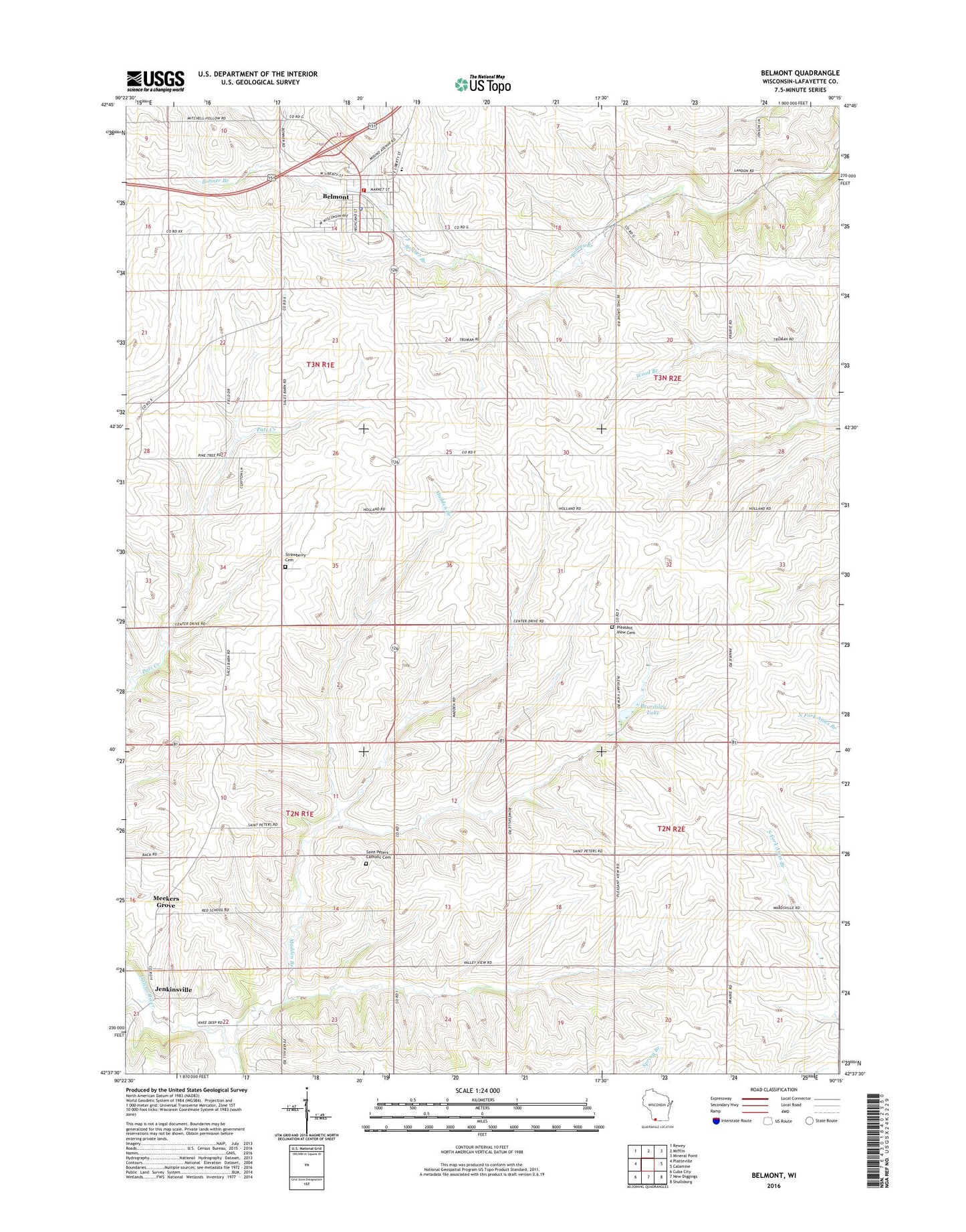
2018 topographic map quadrangle Belmont in the state of Wisconsin. Scale: 1:24000. Based on the newly updated USGS 7.5' US Topo map series, this map is in the following counties: Lafayette. The map contains contour data, water features, and other items you are used to seeing on USGS maps, but also has updated roads and other features. This is the next generation of topographic maps. Printed on high-quality waterproof paper with UV fade-resistant inks.
Quads adjacent to this one:
West: Platteville
Northwest: Rewey
North: Mifflin
Northeast: Mineral Point
East: Calamine
Southeast: Shullsburg
South: New Diggings
Southwest: Cuba City
Contains the following named places: Bachford School, Beardsley Lake, Belmont, Belmont - Whig United Methodist Church, Belmont Elementary School, Belmont Fire Department, Belmont Middle and High School, Belmont Police Department, Belmont Post Office, Belmont Prairie State Natural Area, Belmont Quarry, Belmont Wastewater Treatment Facility, Bethel Grove School, Darlington Ridge Farms, Huggins Quarry, Jenkinsville, Leo V Mine, Liberty Mine, Madden Branch, Meekers Grove, New Dall Mine, Peace Lutheran Church, Pleasant View Cemetery, Pleasant View Church, Pleasant View School, Roseville Church, Saint Peters Cemetery, Saint Peters School, Seymour Central School, Strawberry Cemetery, Strawberry School, Town of Elk Grove, Vickers School, Village of Belmont, Wolters Farm, ZIP Code: 53510