MyTopo
Mineral Point Wisconsin US Topo Map
Couldn't load pickup availability
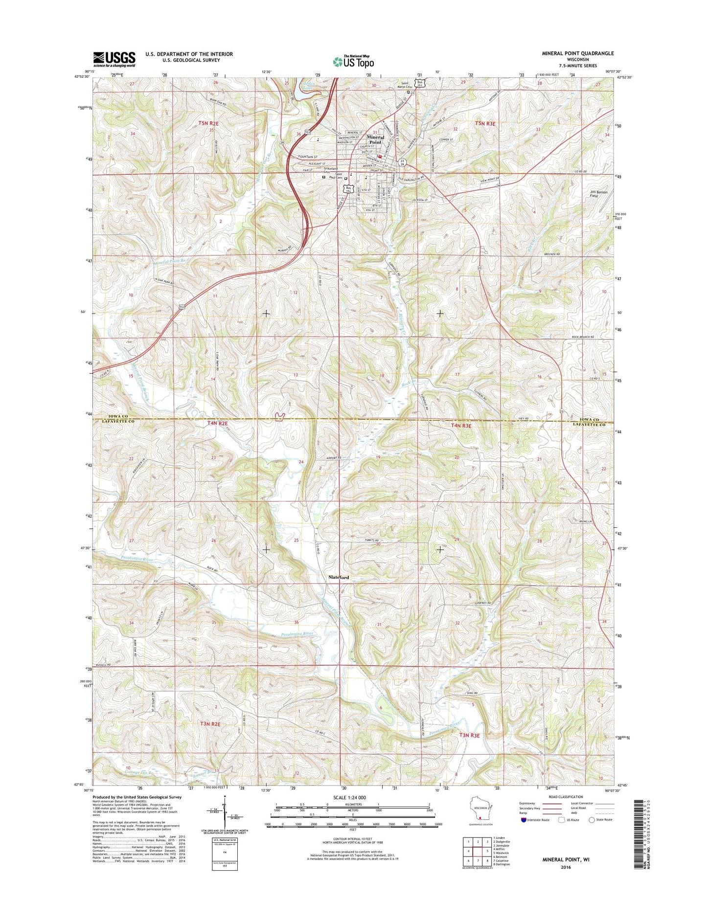
2022 topographic map quadrangle Mineral Point in the state of Wisconsin. Scale: 1:24000. Based on the newly updated USGS 7.5' US Topo map series, this map is in the following counties: Lafayette, Iowa. The map contains contour data, water features, and other items you are used to seeing on USGS maps, but also has updated roads and other features. This is the next generation of topographic maps. Printed on high-quality waterproof paper with UV fade-resistant inks.
Quads adjacent to this one:
West: Mifflin
Northwest: Linden
North: Dodgeville
Northeast: Jonesdale
East: Waldwick
Southeast: Darlington
South: Calamine
Southwest: Belmont
This map covers the same area as the classic USGS quad with code o42090g2.
Contains the following named places: Brewery Creek, Burr Oak School, City of Mineral Point, Cottage Inn Branch, First United Methodist Church, Furnace Creek, Graceland Cemetery, Hutchinson Dam, Jim Benson Field, Ludden Lake 2WP1659 Dam, Mineral Point, Mineral Point Branch, Mineral Point Elementary School, Mineral Point Fire Department, Mineral Point High School, Mineral Point Middle School, Mineral Point Police Department, Mineral Point Post Office, Mineral Point Rescue Squad, Mineral Point Wastewater Treatment Facility, Oak Park School, Options in Education Program, Parkinson School, Rock Branch, Saint Mary's Cemetery, Saint Paul Cemetery, Seven Oaks School, Slateford, Soldiers Memorial Park, Sudan Branch, Sweet Clover School, Town of Kendall, Town of Mineral Point, Town of Willow Springs, Trinity Episcopal Church, Willow Springs Church, ZIP Code: 53565