MyTopo
New Diggings Wisconsin US Topo Map
Couldn't load pickup availability
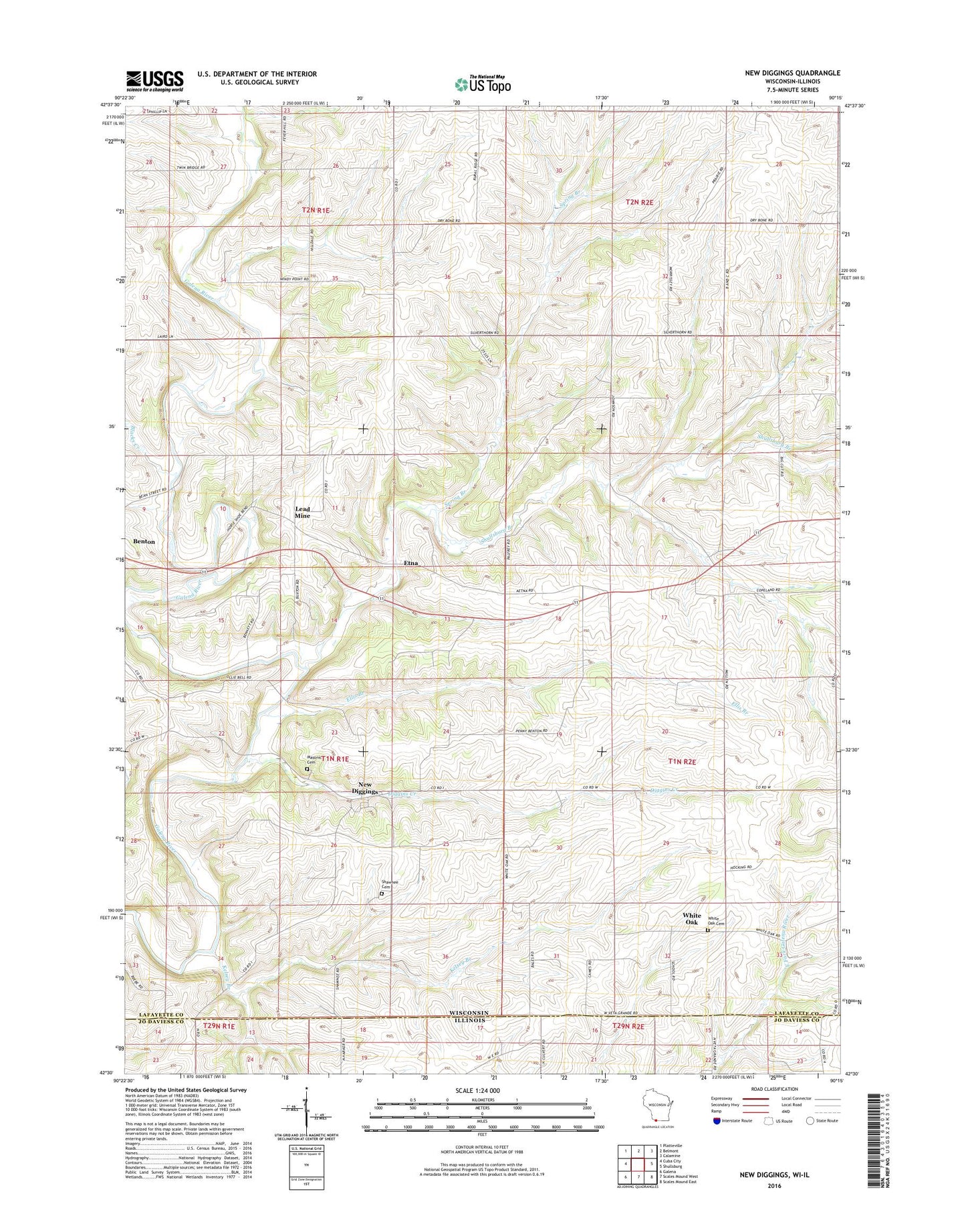
2022 topographic map quadrangle New Diggings in the states of Wisconsin, Illinois. Scale: 1:24000. Based on the newly updated USGS 7.5' US Topo map series, this map is in the following counties: Lafayette, Jo Daviess. The map contains contour data, water features, and other items you are used to seeing on USGS maps, but also has updated roads and other features. This is the next generation of topographic maps. Printed on high-quality waterproof paper with UV fade-resistant inks.
Quads adjacent to this one:
West: Cuba City
Northwest: Platteville
North: Belmont
Northeast: Calamine
East: Shullsburg
Southeast: Scales Mound East
South: Scales Mound West
Southwest: Galena
This map covers the same area as the classic USGS quad with code o42090e3.
Contains the following named places: Blacks Creek, Blackstone Mine, Diggins Creek, Ellis Branch, Etna, Gleason Farm, Kelsey Branch, Lead Mine, Lead Mine Church, Lead Mine School, Masonic Cemetery, Mulcahy Mine, Mullen School, New Diggings, O'Brien School, Old White Oak Springs Village Cemetery, O'Toole School, Race Track School, Redfearn Farms, Shawnee Cemetery, Shullsburg Branch, Silverthorne School, Spring Branch, Sullivan School, Town of New Diggings, Town of White Oak Springs, Twin Ridge Farm, Veda Grand School, Weiskircher Dairy, White Oak, Windy Acres, ZIP Code: 53803