MyTopo
Calamine Wisconsin US Topo Map
Couldn't load pickup availability
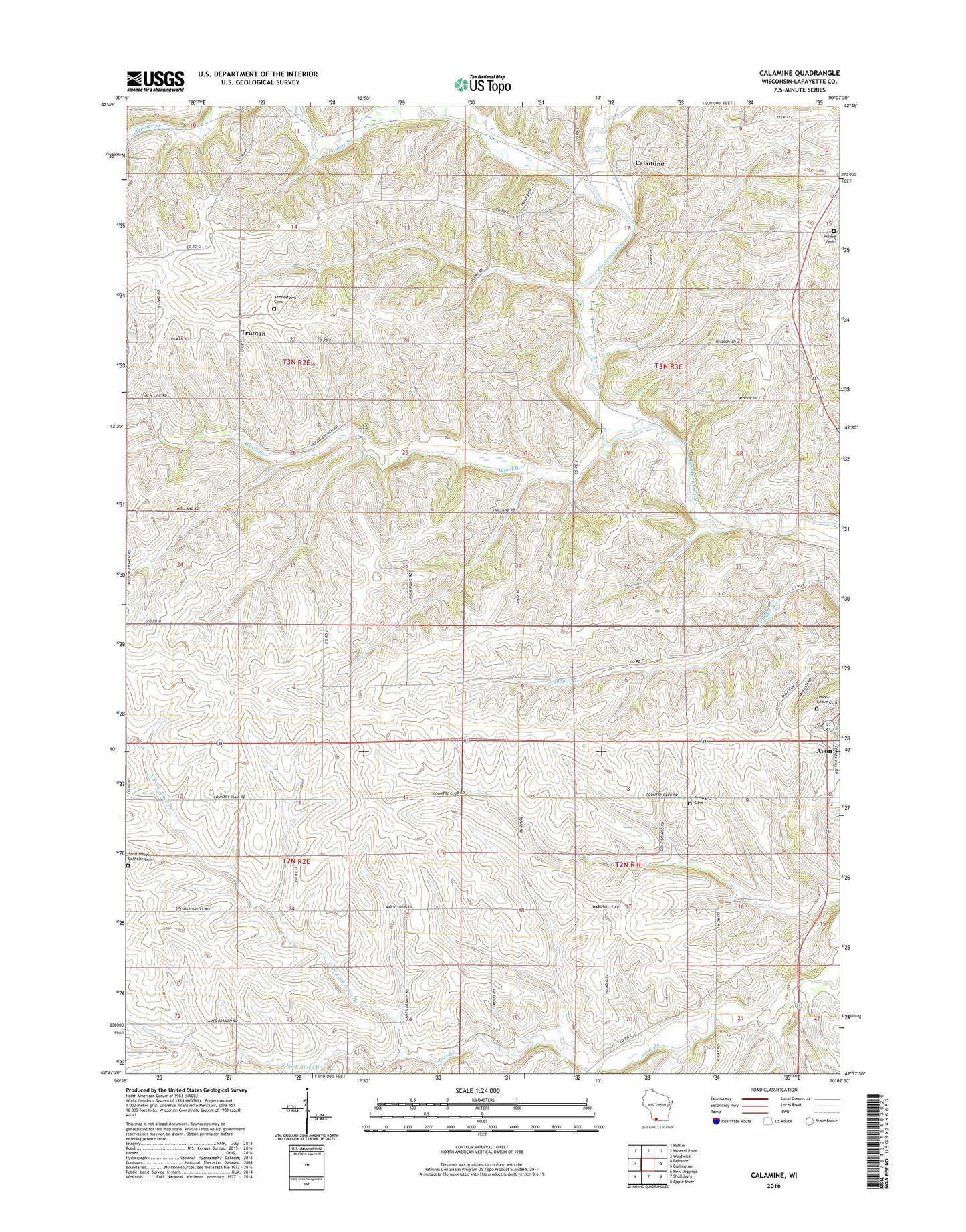
2022 topographic map quadrangle Calamine in the state of Wisconsin. Scale: 1:24000. Based on the newly updated USGS 7.5' US Topo map series, this map is in the following counties: Lafayette. The map contains contour data, water features, and other items you are used to seeing on USGS maps, but also has updated roads and other features. This is the next generation of topographic maps. Printed on high-quality waterproof paper with UV fade-resistant inks.
Quads adjacent to this one:
West: Belmont
Northwest: Mifflin
North: Mineral Point
Northeast: Waldwick
East: Darlington
Southeast: Apple River
South: Shullsburg
Southwest: New Diggings
This map covers the same area as the classic USGS quad with code o42090f2.
Contains the following named places: Avon, Big Valley Farm, Bonner Branch, Calamine, Center School, Cornerstone Christian School, Forked Deer Creek, Hamestreet School, Hazel Valley School, High Point Pork Farms, Highway Dairy Farms, Holland School, Hovey School, Immaculate Conception Cemetery, Lafayette County, Lattin Farms, Meylor School, North Fork Ames Branch, Our Lady of Hope Cemetery, Quad Town Dairy Farm, Ray - Pilling Cemetery, Saint Marys Church, Schwartz Cemetery, Seymour Corners, South Fork Ames Branch, Town of Seymour, Truman, Truman School, Union Grove Cemetery, Wardsville School, Willow Branch School, Wood Branch, Wood Branch School