MyTopo
Shullsburg Wisconsin US Topo Map
Couldn't load pickup availability
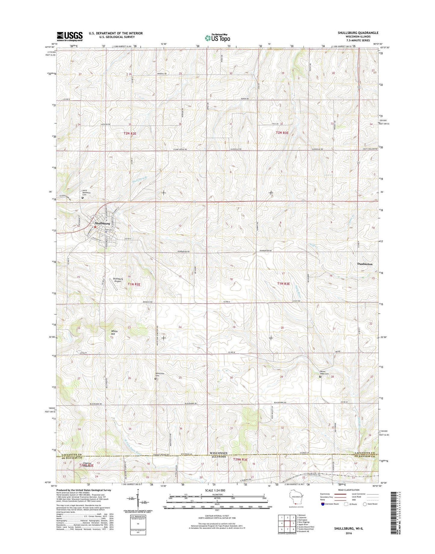
2022 topographic map quadrangle Shullsburg in the states of Wisconsin, Illinois. Scale: 1:24000. Based on the newly updated USGS 7.5' US Topo map series, this map is in the following counties: Lafayette, Jo Daviess. The map contains contour data, water features, and other items you are used to seeing on USGS maps, but also has updated roads and other features. This is the next generation of topographic maps. Printed on high-quality waterproof paper with UV fade-resistant inks.
Quads adjacent to this one:
West: New Diggings
Northwest: Belmont
North: Calamine
Northeast: Darlington
East: Apple River
Southeast: Elizabeth NE
South: Scales Mound East
Southwest: Scales Mound West
This map covers the same area as the classic USGS quad with code o42090e2.
Contains the following named places: Baxter Farm, Calumet and Hecla Mine, Charles Mound, City of Shullsburg, Dunbarton, Dunbarton School, Glenville School, Mount Hope Cemetery, Rowe School, Saint Matthews New Catholic Cemetery, Shullsburg, Shullsburg Airport, Shullsburg Ambulance Service, Shullsburg Elementary School, Shullsburg Fire District, Shullsburg Junior High School, Shullsburg Police Department, Shullsburg Post Office, Shullsburg School District, Summit School, Teutschmann Farm, Town of Monticello, Town of Shullsburg, Upmann Farm, White Hill, White Oak Springs Cemetery, White Thorne School, Youle School, ZIP Code: 53586