MyTopo
Arnott Wisconsin US Topo Map
Couldn't load pickup availability
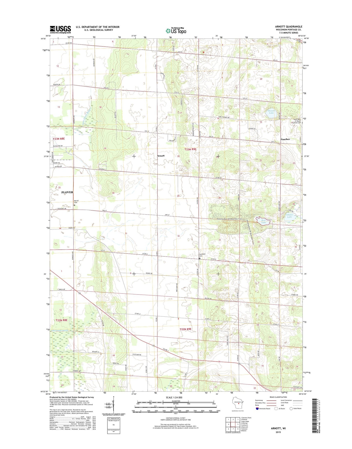
2022 topographic map quadrangle Arnott in the state of Wisconsin. Scale: 1:24000. Based on the newly updated USGS 7.5' US Topo map series, this map is in the following counties: Portage. The map contains contour data, water features, and other items you are used to seeing on USGS maps, but also has updated roads and other features. This is the next generation of topographic maps. Printed on high-quality waterproof paper with UV fade-resistant inks.
Quads adjacent to this one:
West: Whiting
Northwest: Stevens Point
North: Polonia
Northeast: New Hope
East: Amherst
Southeast: Blaine
South: Almond
Southwest: Bancroft
This map covers the same area as the classic USGS quad with code o44089d4.
Contains the following named places: Adams Lake, Arnott, Arnott School, Bear Lake, Buena Vista Church, Fancher, Lombard Cemetery, Morrill Cemetery, Morrill School, Pleasant Valley School, Prairie School, Saint Mary of Mount Carmel Church, Somers Gravel Pit, Standing Rock Park, Stockton Fire Department, Thomas Lake, Town Hall School, Town of Stockton